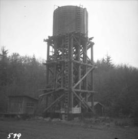
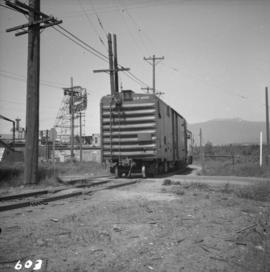
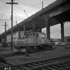
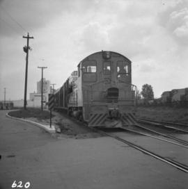
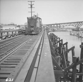
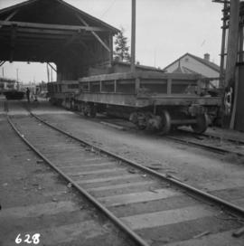
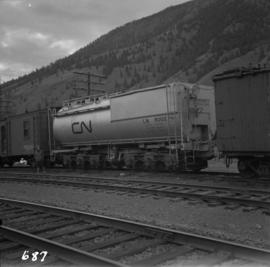
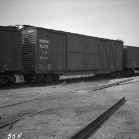
Photograph depicts a boxcar at the C.P.R. Coquitlam yards. Note the frame construction.
Photograph depicts the C.P.R. wharf at Kaslo on Kootenay Lake. The wharf is used to load/unload cars from vehicles or lake scows. The ferry slip itself is beyond the tank cars, at the center middle distance of the photo.
Photograph depicts the C.P.R. train station at Kaslo. At one time the line ran between Kaslo and Nakusp, via New Denver. It was lifted in 1915-1920. The trackage now consists of Kootenay Lake slip and about 1 mile of sidings. It is used mainly for oil (incoming) and lumber (outgoing).
Photograph depicts CPR buildings near Shawnigan Lake depot on Vancouver Island. The buildings in the centre are a section house (left) and a speeder or tool shed (right). They sit inside a wye track. Spur on the left is all that is left of "Y" turning center. The view is looking south. The Shawnigan Lake station (not depicted) is located at mile post 27.8 approximately 1/2 mile to the railway south of these buildings which are to the south of the photographer.
Photograph depicts sheds and repair center of the C.P.R. at Victoria, near Lime Bay. The rail-liner just came in from the daily run to Courtenay.
Photograph depicts the Malahat Station on the Esquimalt and Nanaimo Railway on Vancouver Island. The view is looking south towards Victoria.
Photograph depicts the C.P.R. Michel Station between Crow's Nest and Fernie. The view is looking west towards the only working colliery left in the district. The station is disused but in good repair.
Photograph depicts a C.P.R. rail car slip at Slocan City, on the south end of Slocan Lake, on the line between Slocan and South Slocan. The view is looking north.
Photograph depicts a typical section shed scene anywhere in B.C. It was taken on the C.P.R. track near Flat Creek or Illecillewaet, between Rogers Pass and Revelstoke. The April 25, 1965 CPR Employee timetable lists the mileage at Illecillewaet as 98.2.
Photograph depicts a water tower.
Photograph depicts a velocipede north of C.P.R. track and immediately west of Port Hammond in the Fraser Valley. These three-wheeled hand/foot powered track vehicles were mostly used by track patrolmen.
Photograph depicts the C.P.R. yards in Vancouver, just west of railway station in the downtown area. The view is looking east from Burrard St.
Photograph depicts the west side of the C.P.R. engineering shops at Revelstoke. The building appeared to house a machine shop and had no cars or locomotives inside.
Photograph depicts the C.P.R. yards just west of downtown passenger station and in front of Pier B, owned by the C.P.R. The view is looking northwest from Burrard St.
Photograph depicts a B.C. Electric Railway locomotive #902 and boxcar entering the Kitsilano yards and crossing 2nd Ave., near Fir St. in Vancouver.
Photograph depicts ten ballast cars of the B.C. Electric Railway on newly laid industrial spur on the northeast side of the Langley depot.
Photograph depicts the B.C. Electric Railway crossing at Serpentine Creek, 2 miles west of Cloverdale. The view is looking north.
Photograph depicts the B.C. Electric Railway trackage at Kerrisdale in Vancouver. The photo was taken from 49th Ave. and West Boulevard, looking north. The second track used to lie to the right of the existing one.
Photograph depicts the former B.C. Electric Railway spur running westwards along Bridgeport Rd., leading from the former main trackage. It was not in use for many years and was lifted in 1965, except for road crossings. The photo is taken from the intersection with Sexsmith Rd., looking east. The former main trackage is sited about 300 yards in the background and at right angles to the track in the foreground.
Photograph depicts a B.C. Electric Railway trolley electric locomotive #960, in freight yard below the Georgia Viaduct in Vancouver.
Photograph depicts an auto special at New Westminster, travelling west to McPherson Ave. industrial estate in south Burnaby.
Photograph depicts a B.C. Electric Railway locomotive #902 crossing the False Creek trestle, travelling north.
Photograph depicts a ballast wagon awaiting demolition at repair shed of the B.C. Electric Railway in New Westminster. The car was built in 1948.
Photograph depicts a machine for cleaning the track of weeds with loose roots. It belongs to the B.C. Electric Railway and is located at Langley.
Photograph depicts a depot and derelict electricity substation at Coghlan, 9 rail miles east of Langley, looking west.
Photograph depicts the Canadian National Railway (CN) Port Mann depot.
Photograph depicts the Canadian National Railway (CN) main line from the Vancouver depot. The view is looking east, down from the bridge carrying Clark Dr.
Photograph depicts the Canadian National Railway (CN) trestle leading to the swing bridge across the north arm of the Fraser River. The view is taken from Lulu Island, looking northeast. Stumps under the trestle indicate this is the second trestle on the site.
Photograph depicts the Canadian National Railway (CN) track on Lulu Island, about 4 miles west of the eastern tip of the island. The track to the right runs along the northern edge of the island and the left-hand track goes to the Lafarge Cement Plant on the south bank of Lulu Island.
Photograph depicts the Canadian National Railway (CN) switcher #7218 and caboose on Lulu Island about to cross the New Westminster Highway, travelling northward on a spur. It came southwards as a loaded freight with 3 boxcars for a small spur behind the photo, and 3 empty cement tank cars for the Lafarge Cement Plant on the south bank of Lulu Island, half a miles distant behind the caboose.
Photograph depicts a piece of abandoned track leading to the peat plant at #8 road on Lulu Island on the Westminster Highway. The track runs parallel to the Westminster Highway, which is at the left beyond the photo. The rail is undated and marked, "Rlymney Steel" (South Wales). The photo is looking west and the Canadian National Railway (CN) spur lies a quarter mile behind the camera.
Photograph depicts the Canadian National Railway (CN) Kaptara depot site at the northwest corner of Shawnigan Lake on Vancouver Island. The siding removed in the last 6 months and the materials are still on site.
Photograph depicts a freshly painted Canadian National Railway (CN) caboose at Kamloops Junction depot.
Photograph depicts the Canadian National Railway (CN) yards at Port Mann. A wrecking crane, without a jib, and water tanker are behind.
Photograph depicts an ex-locomotive tender, now a mobile water tank at the Canadian National Railway (CN) depot at Spences Bridge. The mobile water tank holds 11, 600 gallons.
Photograph depicts a disused Canadian National Railway (CN) water tower at Spuzzum, 25 miles north of Hope. The view is looking east across the Fraser Canyon.
Photograph depicts Tilbury dock on the Delta shore of the Fraser River. The stern of the Canadian National Railway (CN) onboard railcar carrier SS "Canora" is about 10ft away, and showing tidal and moving a piece of dock leading to shore.
Photograph depicts the Canadian National Railway (CN) line crossing the south Thompson River. Kamloops Junction and Kamloops city are joined by a 2 mile spur, which crosses the river as shown. The view in the photo is looking north from the site of the former fort.
Photograph depicts the Canadian National Railway (CN) Tilbury dock at Delta on the lower Fraser River. The view is looking east, upstream.
Photograph depicts the notice on the outer door of the Great Northern Railway depot in Vancouver.
File consists of indexes to the Canadian Railroad Historical Association's periodical, "Canadian Rail". Includes indexes for 1962 issues, 1973 issues, and a complete index to issues #1 to #455 (1937-1996).
File consists of original copies of B.C. Rail Guides, published by the Canadian Railroad Historical Association Pacific Branch. Includes B.C. Rail Guide No. 6 "A Selected Bibliography on Railways in British Columbia: Part I" by Ron Meyer; B.C. Rail Guide No. 7 (Part II of the same); and an unnumbered B.C. Rail Guide "List of Railway Archival Material Held by Pacific Coast Branch, Canadian Railroad Historical Association" by A.J. Rimmington.
File consists of various glossaries and definitions of railway terms excerpted from books and periodicals.
File consists of railway related statistics for British Columbia, which predominantly consist of photocopy reproductions from books and clippings from periodicals. Includes statistics for PGE, BC Rail, Vancouver Island logging railroads, CNR, short lines, and others. Also includes research by Davies on the chronology of BC railway history, railway statistics of BC, and rail distances in BC. Some of this research was produced in his B.C. Rail Guide No. 5, "Statistics for the B.C. Railway Historian", which is also included.
File consists of a pamphlet published by the City of Vancouver Archives commemorating the arrival of the first trans-Canada train from Montreal to Vancouver.
File consists of the 1982 edition of a guidebook by Bill Coo entitled "Scenic Rail Guide to Western Canada with Connecting Road Routes".
Series consists of province-wide and regional maps of British Columbia that show railway trackage or otherwise relate to railways. Includes plans of railway structures, trackage, and buildings built in British Columbia by railway companies. Contains maps that depict the Canadian Pacific Railway, the Canadian National Railway, the Pacific Great Eastern Railway, BC Rail, the Great Northern Railway, and various Vancouver Island railways.
File consists of maps of the Canadian Pacific Railway (CPR) trackage in British Columbia, which consist of photocopy reproductions and hand drawn works by Davies. Includes maps of CPR track in various B.C. cities (Armstrong, Cranbrook, Greenwood, Grand Forks, Penticton, Vancouver, Princeton, Kaslo, Creston, Kamloops, Salmon Arm, Summerland, Revelstoke, Enderby, Nelson, Trail, and Golden); maps of CPR track at various times (1909, 1985); maps of the Kettle Valley Railway (KVR); maps of the Esquimalt & Nanaimo Railway (E&N); and a hand drawn map of the railways in south-eastern British Columbia.
File consists of maps of the Canadian National Railway (CNR) trackage in British Columbia, which consist of photocopy reproductions and hand drawn works by Davies. Includes maps of CNR track in various B.C. cities (Kamloops, Smithers, Lytton, Terrace, Hope, Kelowna, Prince George, Vernon, Prince Rupert); maps of CNR track at various times (1910, 1919, 1930, 1962, 2003); and maps of the Grand Trunk Pacific Railway (GTPR).
File consists of maps of the Great Northern Railway (GNR) trackage in British Columbia, which consist of photocopy reproductions and hand drawn works by Davies. Includes maps of GNR track in various B.C. cities (Grand Forks); maps of GNR track at various times (1914, 1928); and a map of railways in northern Washington in 1928.