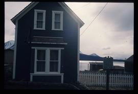
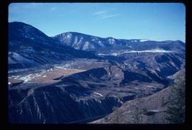
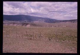
Image depicts a view of some farm land in Chetwynd, B.C.
Image depicts the Peace River and visible layers of sediment deposits in the surrounding cliffs.
Image depicts a view of Fort St. John, B.C.
Image depicts the Peace River, possibly somewhere near Fort St. John, B.C.
Image depicts a view of Pine Pass on the border between Alberta and British Columbia in the Rocky Mountains.
Image depicts an old abandoned cabin at an uncertain location.
File contains slides depicting places in Saskatchewan.
Image depicts the small town of Fraser, B.C. Located on the Klondike Highway.
Image depicts half of a ship, which is named the Tutshi, in Carcross, Y.T.
Image depicts the Caribou Hotel and the Matthew Watson General Store in Carcross, Y.T.
Image depicts a building which once served as the residence for two nurses in Atlin, B.C. A sign in front of the house reads: "Grateful Atlinites built this house in 1902 for their first missionary nurses, Helen Bone and Elizabeth Mitchell, who came here in 1899 and lived in a crude shack while valiantly and humanely caring for sick and dying pioneers."
File consists of letters relating to the Regional District of Fraser-Fort George geographical authority and heritage inventory. Includes: "Valemount Train Station" typed letter from Russell J. Irvine, the director of the Regional District of Fraser-Fort George, to Kent Sedgwick regarding the Valemount train station and ranch buildings at Mount Robson and applications for heritage trust (27 July 1982); "Heritage in Mackenzie" typed letter from the District of Mackenzie to Mr. Trimmer, the secretary of the Heritage Advisory Committee regarding heritage sites in Mackenzie (17 Apr. 1979); "Regional District" typescript document that is a list of heritage sites in the Regional District of Fraser-Fort George area; and "Fraser-Fort George Regional District" pamphlet depicting a map of the regional districts geographic area and list of authority districts.
File consists of notes, clippings, and reproductions relating to flooding in Prince George. Includes: "RE: Ice Jams in Nechako River at Prince George" typescript letter from Peter Campbell to Graham Farstad (30 May 1984) and "Floods" typed document by Kent Sedgwick (1 Feb. 1996). Also includes photographs depicting low water and flooding in Prince George (1937 and 2006).
Subseries consists of material collected and created by Kent Sedgwick for research regarding parks and outdoor recreation in Prince George. Material on parks includes Fort George Park (renamed to Lheidli T’enneh Memorial Park in 2015); Cottonwood Island Park; Connaught Hill; Moore's Meadow; L.C. Gunn Park; the Nechako Cutbanks; Paddlewheel Park; Monkman Provincial Park; Fraser Canyon Park; and Carp Lake. Also includes information on the creation of plaques and monuments, including the Alexander Mackenzie monument; the “Arrival of Steel” CN railway plaque; heritage interpretative signs for the Grand Trunk Pacific Railway; the Millar addition; and flooding and rivers. The files consists of various pamphlets and correspondence regarding the development of parks and the creation of interpretive materials.
File consists of notes, reproductions, and letters relating to L.C. Gunn Park in Prince George. Includes: "Signage for Gunn Park" letter from Kent Sedgwick to the Mayor and Council (21 Dec. 1989); "L.C. Gunn viewpoint a proposal" documents within a duotang (1987); and "Donation to the City of Prince George" typescript letter from Graham Farstad to the Administration Committee ( 1 June 1988). Includes photographs depicting the opening of L.C. Gunn Park and the sign unveiling (3 Oct. 1988).
Image depicts the house of the owner of Gang Ranch.
Image depicts the Fraser River in the upper Fraser Canyon.
Image depicts an unknown woman taking pictures. Nearby are the skeletal remains of an unknown animal. The location is somewhere near the upper Fraser Canyon.
Image depicts an unknown woman with a camera. Nearby are the skeletal remains of an unknown animal. The location is the upper Fraser Canyon.
Image depicts a view of the upper Fraser Canyon. The Fraser River is visible on the left side of the image.
Image depicts a view of the upper Fraser Canyon.
Image depicts a road somewhere in the Upper Fraser Canyon, and a view of the hills and trees.
Image depicts the Upper Fraser Canyon.
Image depicts the Alkali Lake Ranch in Alkali Lake, B.C.
Image depicts a view of the Fraser River in Lillooet, B.C.
Image depicts a view of the mountains surrounding Lillooet, B.C.
Image depicts some farmland in Lillooet, B.C.
Image depicts the Bridge River near Lillooet, B.C.
Image depicts the Fraser River running through the Moran Canyon near Lillooet, B.C.
Image depicts the Moran Canyon near Lillooet, B.C.
Image depicts what is possibly the Fraser River running through the Moran Canyon near Lillooet, B.C.
Image depicts a view of Seton Lake, located near Lillooet, B.C.
Image depicts the road to Pavilion Mountain.
Image depicts a view of Kelly Lake Valley from Pavilion Mountain.
Image depicts an old church located somewhere in Lillooet, B.C.
Image depicts a view of Lillooet, B.C.
Image depicts two bridges over the Fraser River, located somewhere in Lillooet, B.C.
Image depicts the Moran Canyon; the Fraser River is visible near the bottom.
Image depicts the start of Joffre Creek Road, most likely somewhere in the Joffre Lakes Provincial Park.
Image depicts a road leading into a First Nations' Reserve at the head of Harrison Lake.
Image depicts the Lillooet River delta at the head of Lillooet Lake.
Image depicts the Duffey Lake Provincial Park.
Image depicts the Britannia Mine, which closed in 1974 and is now a museum. "Anaconda" was the last operating owner.
Image depicts numerous power lines and a road somewhere north of Squamish.
Image depicts the Nairn Falls in Nairn Falls Provincial Park south of Pemberton, B.C.