Showing 4134 results

Archival description
3619 results with digital objects Show results with digital objects
Maps, plans, and drawings
2023.5.1 · Series · 1976-2020
Part of UNBC School of Planning and Sustainability fonds

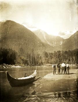
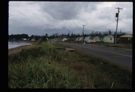
Series consists of maps, plans, and drawings collected by faculty in the UNBC School of Planning and Sustainability. The majority of these maps reflect the planning history of the City of Prince George and include large format, hand-drawn plans created by the City Planning Department from the 1970s and 1980s. Maps from City of Prince George Official Community Plans are also included.

2009.7.1.073 · Item · [ca 1876 - ca. 1890]
Part of Archdeacon W. H. Collison fonds

Handwritten annotations read: "At rest, after a rough passage of two days and a night from Massett, Queen Charlotte's Islands by canoe - W.H. Collison and Mrs. Collison with Indians from Masset"; "Archdeacon Collison Indian Canoe & Crew. Return from Queen Charlotte's Islands, Haida & Tsimshian Crew [...?]" Archdeacon and Mrs. Collison sit in centre of canoe.

2009.7.1.017 · Item · [ca. 1910]
Part of Archdeacon W. H. Collison fonds

Photograph depicts Archdeacon William Henry Collison to left of wife Marion, who stands bent over garden on right. Church steeple visible behind wood fence in background. Hills can be seen in distance.

Handwritten annotation on verso reads: "Grandad & Grannie in garden at Kincolith".

2009.7.1.016 · Item · [ca. 1910]
Part of Archdeacon W. H. Collison fonds

Photograph depicts Marion and William Henry Collison standing on left with shovel, Bertha Collison on right, and young Muriel and Katherine Collison in centre with shovel (eldest daughters of W.E. Collison). Wood buildings cross midground, trees and hills visible in background.

Handwritten annotation on verso reads: "Garden at Kincolith / Grandad, Grannie / Mimi, Katie / Mother".

2009.7.1.003 · Item · [between 1873 and 1919]
Part of Archdeacon W. H. Collison fonds

Group of five unidentified men stand on shore to right of large dugout canoe, handling their rifles. Forest and snow-capped mountains stand on opposite shore in background.

Handwritten annotation on verso reads: "Mrs Collison (wife of Arch. Collison in Canoe en route to Hazelton B.C."

McBride - Church
2012.13.1.85.62 · Item · [2004?]
Part of J. Kent Sedgwick fonds

Image depicts a church somewhere in McBride, B.C. The sign in front possibly reads "St. Patrick's Church."

McBride - Yellowhead
2012.13.1.085 · Subseries · [between 1970 and 2004]
Part of J. Kent Sedgwick fonds

File contains slides depicting places in and between McBride and the Yellowhead Pass via the Yellowhead Highway.

McBride and Dunster
2012.13.2.17.31 · File · 1983, 2005
Part of J. Kent Sedgwick fonds

File consists of notes, clippings, and reproductions relating to Mcbride and Dunster. Includes photographs depicting the Croyden cemetery and the Dunster ferry site (2005).

McBride, BC in 1914
2009.5.3.57 · Item · 1914
Part of Taylor-Baxter Family Photograph Collection

Photograph depicts street in McBride, wood buildings and tent buildings on either side. Small businesses and restaurants line the left side of the street. Forest slash stands in newly cleared area in foreground. Railway tracks cross right foreground, hills visible in background. Annotation on verso of photograph reads: "MC.Bride, B.C.", handwritten on recto: "1914 [Bourchier?]"

McGregor Canyon?
2012.13.1.63.14 · Item · Aug 1989
Part of J. Kent Sedgwick fonds

Image depicts a view of the Herrick River in what is possibly McGregor Canyon; the slide is simply labelled "McG above Canyon."

McGregor Canyon?
2012.13.1.63.13 · Item · Aug 1989
Part of J. Kent Sedgwick fonds

Image depicts a view of the Herrick River in what is possibly McGregor Canyon; the slide is simply labelled "McG Canyon."

McGregor Canyon?
2012.13.1.63.12 · Item · Aug 1989
Part of J. Kent Sedgwick fonds

Image depicts a view of the Herrick River in what is possibly McGregor Canyon; the slide is simply labelled "McG Canyon."

McGregor Canyon?
2012.13.1.63.15 · Item · Aug 1989
Part of J. Kent Sedgwick fonds

Image depicts a view of the Herrick River in what is possibly McGregor Canyon; the slide is simply labelled "McG above Canyon."

McGregor River - Bridge
2012.13.1.72.34 · Item · July 1981
Part of J. Kent Sedgwick fonds

Image depicts a bridge over the McGregor River. A sign in the image reads: "Danger. The river is not navigable for any type of boat. Down stream falls and rapids impassible!"

McGregor Valley - Dam Site
2012.13.1.72.04 · Item · Sep. 1976
Part of J. Kent Sedgwick fonds

Image depicts a red vehicle parked on the side of the road with a view of the McGregor Valley behind it. The slide is labelled "dam site."