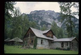
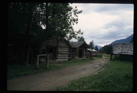
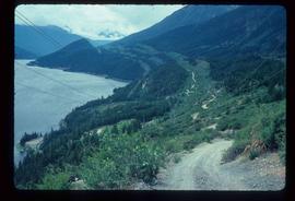
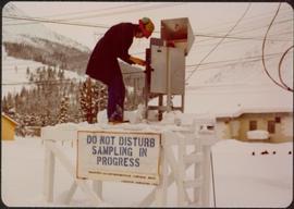
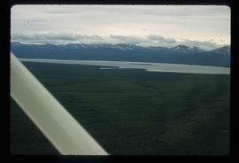
Image depicts the Bridge River No. 1 hydroelectric station on the shore of Seton Lake (rear side of powerhouse).
Image depicts the Lajoie Dam on the Bridge River, upstream side, showing part of Downton Lake and, in the foreground, the spillway intake.
Image depicts a view of the land surrounding Bralorne, B.C.
Image depicts a fence in the Blackwater River area in the Chilcotin.
Image depicts Mount Robson while en route to Mount Robson Ranch in B.C.
Image depicts the Mount Robson Ranch.
File contains slides depicting Nanaimo and the Pacific Rim.
Image depicts a view of Prince Rupert, B.C.
Image depicts a small stream running through a cluster of trees somewhere in or around Seton Portage, B.C.
Image depicts a church on a hill somewhere in Seton Portage, B.C.
Image depicts a steep mountain road somewhere in the area of Seton Portage, B.C.
Image depicts power lines running alongside Anderson Lake near Seton Portage, B.C.
Image depicts numerous houses and a tractor in Seton Portage, B.C.
Image depicts Wells, B.C.
Image depicts an aerial view of South Tweedsmuir Provincial Park.
Image depicts an aerial view of Glacier Mountain in South Tweedsmuir Provincial Park.
Image depicts a view of South Tweedsmuir Provincial Park.
Image depicts a lake in South Tweedsmuir Provincial Park.
Image depicts a lake in South Tweedsmuir Provincial Park. There is an unknown individual present in a canoe with the camera-man.
Image depicts a river in South Tweedsmuir Provincial Park. There is an unknown individual present in a canoe with the camera-man.
Image depicts Kent Sedgwick standing beside a wrecked plane somewhere in South Tweedsmuir Provincial Park.
Image depicts a view of a river from the Cottonwood Bridge.
Image depicts a sawmill somewhere in Quesnel, B.C.
Image depicts numerous wood piles near the sawmill somewhere in Quesnel, B.C.
Image depicts a sawmill somewhere in Quesnel, B.C.
Image depicts what appears to be a farm at an uncertain location.
Image depicts a river, possibly the Fraser, at an uncertain location.
Image depicts an unknown individual standing near what is most likely a slump slide at an uncertain location.
Image depicts an area of disturbed ground, most likely due to a landslide, at an unknown location.
Image depicts two unknown individuals standing near what is most likely a slump slide at an uncertain location.
Image depicts an area of placer mining at Hixon Creek in Hixon, B.C.
Image depicts several people standing near the Hixon Falls in Hixon, B.C.
File consists of records and textual material related to wildlife population collected by Grant Hazelwood. Includes journal reprints, reports, and leaflets. Highlights include:
- John G. Stockner, "Phytoplankton heterogeneity and paleolimnology of Babine Lake, British Columbia, Canada", Nov. 1975 (journal reprint)
- Western Guides and Outfitters Association, "Aims, Objectives and Policies", Oct. 1980 (reproduction)
- Information summary sheet leaflets for threatened and endangered Canadian wildlife including the white pelican, sea otter, Vancouver Island marmot, and wood bison, 1979
- D. Blower, "Population estimates for April 1977 caribou map", June 1977
Also includes a map:
- B.C. Fish and Wildlife Branch, "Wildlife Distribution Mapping - Big Game Series: Black Bear", 1978
Photograph depicts a Chevrolet pickup truck on highway to right of Mud Lake, at Km 632 on the Stewart-Cassiar Highway. Forest on hillside in background.
Photograph depicts palletizer machinery, where bags of asbestos fibre were shrink-wrapped and made ready for shipping pallets. Palletizer was located near shipping (believed to be in mill building). Unidentified man visible in machinery on far left.
Photograph depicts Joseph wearing safety gear while standing at testing equipment on raised sampling station. Sign below Joseph reads "DO NOT DISTURB / SAMPLING IN PROGRESS / PROPERTY OF ENVIRONMENTAL CONTROL DEPT. / CASSIAR ASBESTOS LTD." Helen Joseph took air quality tests in the working areas and town (see item 2000.1.1.3.19.135). Power lines, unidentified building, and mountain base visible in background. Photo was taken during winter.
Collection consists of 1 document on lichens entitled "Common Lichen of the Prince George Area and Their Importance to Caribou," prepared by Susan Stevenson for Northwood Pulp and Timber Limited, British Columbia Fish and Wildlife Branch.
Sem títuloImage depicts Giscome with the school on the left, the remnants of the town site in the middle and the church on the right. Map coordinates 54°03'58.2"N 122°22'04.8"W
Image depicts an old tomb stone at an uncertain location, possibly Fort St. James, B.C.
Image depicts a lake with numerous buildings along the shore. The location is uncertain.
Image depicts Blackwater River.
File contains slides depicting birds and wildlife at unknown locations.
Image depicts an aerial view of what is likely Turner Lake in South Tweedsmuir Provincial Park.