Item
Part of Cassiar Asbestos Corporation Ltd. fonds
File contains 20 slides date stamped between July and August 1976 and annotated “TRAILER SERVICE SUMMER 1976", depicting the construction and renovation of a mobile home, excavations, and structures believed to be wells or water boxes. File also contains 9 additional slides with no annotations, depicting mobile home and houses in winter. These 9 images are associated with materials dated Nov. – Dec. 1976 and it is likely that these photographs were taken in the winter of 1975-1976.
File contains 6 slide presentations depicting training material for the operation of a P&H excavator published by the Harnischfeger Institute. The presentations depict an introduction to excavator controls and techniques for proper hoist motion, proper swing motion, concerning haulage units, proper propel motion, and proper crowd motion.


Photograph depicts large swath of dark waste down mountainside to right of valley. The waste dump is believed to be visible at top of swath on right of image. Bench mining visible on the North and South peak in background. Handwritten annotation on recto of photograph: "Oct. 25 / 65 4:25 PM."
Photograph depicts the Cassiar valley. Handwritten annotation on verso of photograph: "1958 [1961 crossed through]", on recto: "Cassiar Asbestos Corporation Limited. Cassiar B.C. Townsite in foreground mill and ore storage in left middle ground," "Toronto set". It is believed that this photograph was made into a post card.
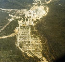
Photograph depicts the Cassiar plantsite including the mill, dry rock storage building, tailings pile, and many other buildings. A portion of the townsite can be seen on left.
Photograph depicts the Cassiar valley: town in foreground, plant and tailings pile in background. Mountain range visible in distance. Photograph was taken from above, facing east.
Photograph depicts the town of Cassiar, mountain base in background. Mine road visible in top right of image.
Photograph depicts the Cassiar mine, switchback road in foreground, mountain range in background. Pit is visible behind the West peak. The new mine garage can be seen on West peak just above "#7 switchback" in centre of image.
Photograph depicts the Cassiar mine, switchback road in foreground, mountain range in background. Pit is visible behind the West peak. The new mine garage can be seen on West peak just above "#7 switchback" in centre of image. Photograph was taken from the air, portion of plane visible in top left of image.
Photograph depicts the Cassiar mine, switchback road in foreground, mountain range in background. Pit is visible behind the West peak. The new mine garage can be seen on West peak just above "#7 switchback" in centre of image.
Photograph depicts the Cassiar mine, switchback road in foreground, mountain range in background. Pit is visible to right of West peak. The new mine garage can be seen on West peak just above "#7 switchback" in centre of image.
Photograph depicts the Cassiar mine in left area of mountain range. The new mine garage can be seen on West peak on far left.
Photograph depicts the Cassiar mine above valley, north mountain range in background. Tramline station and crushing plant visible to west of pit. Photograph was taken from the air, portion of plane visible in top left of image.
Photograph depicts the West peak of the Cassiar mine, pit partially visible below. Drill visible in left foreground at highest elevation of mine, north west mountain range in background.
Photograph depicts the Cassiar mine, pit partially visible behind West peak in right centre of image. South west mountain range in background.
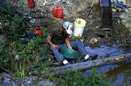
Photograph depicts exposed asbestos fibre in talus, shovel in left foreground.
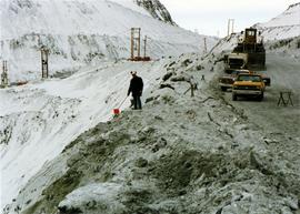
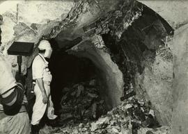
Photograph depicts two men standing on mining bench in mountainside, three boxes and what appears to be a long hose to the left. Third man and tractor plow can be seen in distance at end of bench. Photo caption next to printed copy of image in 1953 Annual Report: "Benches being prepared for mining."
Photograph depicts two unidentified men at high elevation on mountain. Trucks and tanks visible in background, hose (possibly of air track drill) in right foreground. Mountain range in background.
Photograph depicts unknown man driving bulldozer on edge of mine area at high elevation. The dozer is an International model TD24 (manufactured between 1947 and 1955). A second man stands on edge of cliff, directing driver. Mountain range in background.
Photograph depicts unknown men driving bulldozers on edge of mine area at high elevation. Dozers are Internationals, model TD24 (manufactured between 1947 and 1955). Mountain range in background.
Photograph depicts unknown man driving bulldozer near edge of mine area at high elevation. Dozer is an International model TD24 (manufactured between 1947 and 1955). Valley and mountain range in background.
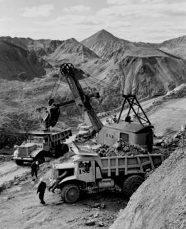
Photograph depicts cable-operated shovel loading Kenworth haul truck on road in mine area at high elevation. Pickup truck in background, four unidentified men are gathered around second Kenworth truck in foreground. Valley and mountain range in distance.

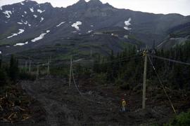
Photograph depicts tramline in a strip cleared of trees on McDame Mountain, bucket in foreground. Handwritten annotation on recto of photograph: "#2 SECTION LOOKING NORTH". Photograph was glued to cardboard backing with the annotation: "1962".
This file contains operations at the plantsite:
Below is synopsis of the item level descriptions (see each item for further description)
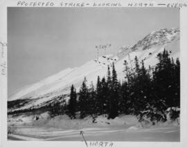
Photograph depicts the projected mining area of Asbestos Mountain, taken during the expedition of George Edzerza's party and their exploration of the future mine at Cassiar.
Handwritten annotations on verso in blue ink describing sections of photograph which have been pointed to or outlined in blue ink: "PROJECTED STRIKE - LOOKING NORTH - OVER -->" "<500'>" "NORTH".
Handwritten annotations in black ink on verso also outline areas and mark areas with "x".
Handwritten annotation on recto in blue ink: "No. 2. This is the continuation of the ore zone, over the top of the mountain, away from the 'fluff'' deposit."
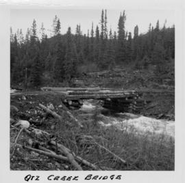
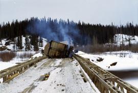
Photograph depicts a log bridge across Quartz Creek taken from shore. Trees in background on opposite shore, snow capped mountains barely visible behind trees.
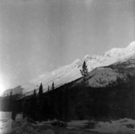
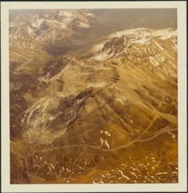
Photograph depicts McDame Mountain from view of the early construction campsite at Cassiar. Trees in foreground.
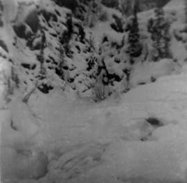
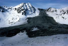
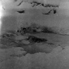
Photograph depicts glacier on McDame Creek road, 1.5 miles from the mine at Cassiar. Snow-covered trees in background.
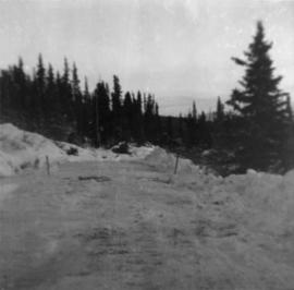
Photograph depicts McDame Creek Road, snow-covered and taken from center of road 1.5 miles from the early construction camp at Cassiar. Two stakes in foreground, one on either side of road. Glacier is believed to be crossing road between two stakes. Trees on either side of road, trees and hills in background.
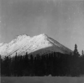
Photograph depicts snow-covered mountain north of townsite, partially covered in shadow. Photo taken with sun at highest point in the sky. Plant site clearing in foreground, trees behind clearing.
Photograph depicts weir on Troutline Creek, snow in foreground and background.
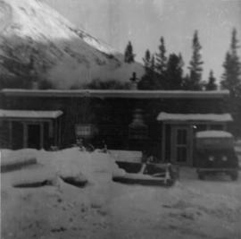
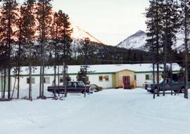
Photograph depicts cookery building with truck on right, in front of door. Snow-covered lumber piles and machinery in foreground, trees and mountain in background.