File consists of notes and reproductions relating to the land surveys conducted between 1871 and 1876 to find a route across British Columbia for the Canadian Pacific Railway. File contains material regarding surveyor Charles Horetzky; surveyor Sir Sandford Fleming; surveyor Joseph Hunter and the Pine Pass; and the proposed routes for the Canadian Pacific Railway in British Columbia.
Collection includes approximately 940 slides taken during the construction of the Tumbler Ridge Electric Railway during the early 1980s. Locations include the Anzac siding, the BC Rail Stuart subdivision, the Chetwynd subdivision, the Parsnip River area, Quintette, the Table River area, railway pipeline crossings, and the Wolverine River area, among others.
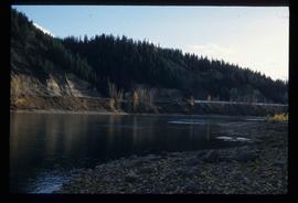
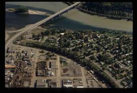
Image depicts the Fraser River at Paddlewheel park, with a train on the other side of the river, in Prince George B.C.
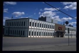
Image depicts the CN Building in Prince George, B.C.
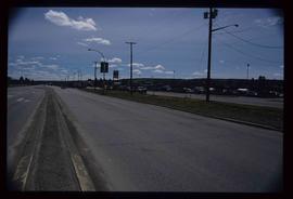
Image depicts a view along Highway 97 in Prince George, B.C.
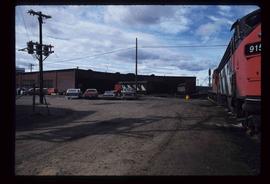
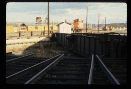
Image depicts trains at the Grand Trunk Pacific railway roundhouse in Prince George, B.C.
Image depicts the Grand Trunk Pacific railway roundhouse in Prince George, B.C.
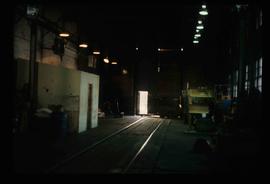
Image depicts the interior of the GTP roundhouse in Prince George, B.C.
Image depicts Ash Street and Patricia Boulevard in Prince George, B.C.
File contains slides depicting the remains of the old Miworth Ferry in Miworth, B.C.
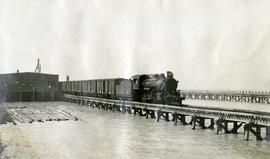
Photograph depicts a Pacific Great Eastern Railway train at the Squamish dock.
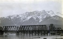
Photograph depicts the the Lillooet River Bridge north of Pemberton, BC. Mt. Currie is visible in the background.
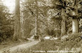
Photograph depicts the stagecoach road between Squamish (Newport) and Brackendale.
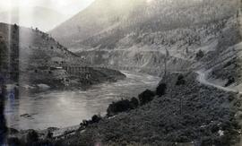
Photograph depicts the Pacific Great Eastern Railway bridge when the railway operated on the east side of the Fraser River.
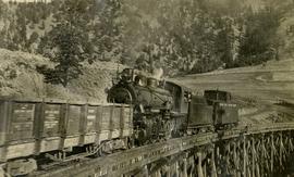
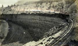
Photograph depicts a Pacific Great Eastern Railway train on Pavilion Creek trestle at Mile 20.3. The train includes Locomotive #56, built by Canadian Locomotive Company of Kingston, Ontario, in August 1914, together with caboose C2, built by National Steel Car of Hamilton, Ontario in 1914 and a “Hart Convertible Car” #140 stencilled with indeterminable initials. These cars were convertible gondolas which were used as ballast cars with the ability to dump ballast either between or outside the rails depending on whether the centre floor doors or the side doors were opened. This particular car, which was scrapped in 1949, was part of a group of 15 cars remaining in number series 131 - 195 (not all numbers used) known on the PGE as “Red Harts” to distinguish them from a somewhat more modern version in number series 201 - 240 (again, not all numbers used) known as “Black Harts”.
The ca. 1921-1927 “PGE Bridge List” from the notebook of William H. Hewlett (1914-1968) references a 389.4 foot long, 34 ft. high, framed trestle with 26 spans of 14.8 feet at Mile 20.3 carrying the line over Pavilion Creek. There was a water tank at Pavilion located between the North end of the siding and the South end of the trestle. A track profile chart confirms that the track at this point is on a 12 degree curve.
"Canadian Railway and Marine World" reported in their January 1916 issue (p. 11, c.1), that track had been laid to within ½ mile of Clinton (Mile 45.0) on Dec. 14, 1915. If a constant rate of construction had been maintained from Mile 14, reached on July 30, 1915 as previously discussed, to Clinton, the approximate date of completion to Pavilion would be around the end of August, 1915 which is probably the earliest possible date for this photograph.
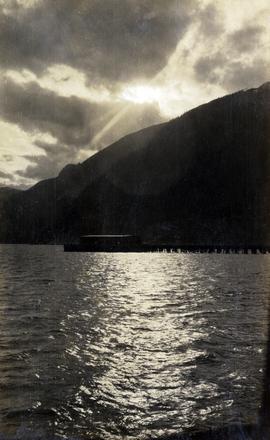
Photograph depicts the Squamish dock in late afternoon sunshine.
Photograph depicts a Pacific Great Eastern Railway work train on a trestle located near Sallus Creek in the area around Lillooet, Fountain, and Pavilion. The work train appears to be carrying railway ties. Railway workers work on the track behind the train with piles of unused rail ties nearby.
Photographs 2020.08.68, 2020.08.69, and 2020.08.70 are three views of track laying on the Sallus Creek trestle. These form a sequence: 2020.08.68, 2020.08.70, 2020.08.69 in order as track laying proceeds from the South end of the trestle toward the North end. The piece of equipment at the North end of the train in all three images is a track laying machine that lifted a piece of rail and delivered it to the workmen ahead of the machine. "Canadian Railway and Marine World" reported that track had been laid to 14 miles North of Lillooet by July 30, 1915 (CR&MW , Sept 1915, p341, c2). 14 miles North of Lillooet is approximately 20 rail lengths beyond the North end of this trestle, leading to a "best estimate" of late July 1915 as the date for this photograph.
The ca. 1921-1927 “PGE Bridge List” from the notebook of William H. Hewlett (1914-1968) references a Mile 13.7, 14 Mile Creek, frame trestle, 905 ft. long, 182 ft. high, 61 spans of 14.8 feet in the Lillooet Subdivision. A “PGE Track Profile” drawing shows this trestle was on a 1.55% grade and a 12 degree left hand curve. While the drawing had been revised at least twice (with an unknown date for the most recent revision), the pre-“Lillooet Diversion of 1931" mileage figures confirm that the 1915 “Mile 13.7" was in agreement with a more recent hand written note “Sallus Creek”. The trestle appears to have gone by the names "14 Mile" trestle, "13.7 Mile Trestle", and "Sallus Creek" trestle.
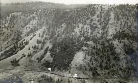
Photograph depicts a view of a train on the Pacific Great Eastern Railway line approximately 2 miles south of the Pavilion station.
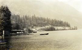
Photograph depicts a couple in a row boat (likely the same couple depicted in image 2020.08.59) near Alta Lake shore docks and buildings. A rail line and a railway water tower are visible in the background. The water tank is a typical PGE 25,000 gallon water tank. The station would be a little over 400 feet south of the tank and is hidden by the stand of trees.
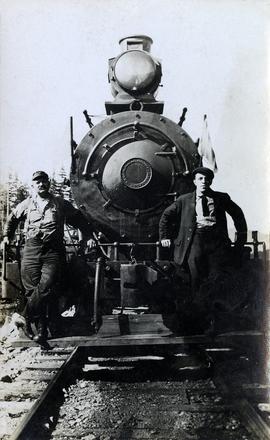
Photograph depicts the Pacific Great Eastern Railway #3 locomotive from the Davenport Locomotive Works. Two railway workers lean against the front of the locomotive for a posed portrait. The individual at left may be Angus McRae, a PGE locomotive engineer.
More information about the locomotive, Pacific Great Eastern #3:
The locomotive was built by Davenport Locomotive Works in Davenport, Iowa in February 1914, serial number 1477, for Patrick Welch, one of the developers (Foley, Welch & Stewart) of the PGE railway. Most of the early equipment, although lettered with the Pacific Great Eastern name, was owned by Patrick Welch. The Provincial Archives in Victoria holds a document showing that Welch sold all the equipment to the newly incorporated Pacific Great Eastern Equipment Company, of which he was also a director, on 14 June 1916 in exchange for 6000 shares in the company. Much, if not all, of the equipment had PGEEC "ownership plates" applied during the 1916-1918 period. It was not until the Provincial Government acquired the railway (and the Equipment Company) in 1918 that the equipment actually became the property of the railway. Pacific Great Eastern #3 was a switching locomotive with an 0-6-0 wheel arrangement and eight-wheel tender built to a standard Davenport design.
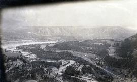
Photograph depicts the confluence of the Cayoosh Creek outflow into the Fraser River in Lillooet, BC. Seton River is visible in the foreground. This area is Cayoose Creek Band (Sekw'el'wás First Nation) territory and includes land currently encompassed within Cayoosh Creek Indian Reserve 1. The Pacific Great Eastern Railway bridge over the Fraser River is also visible in the background.
This clip of original film footage depicts Pacific Great Eastern Railway (PGE) track inspection with a V-8 vehicle.
Clip description with timing reference to scenes:
- 0.01 The Fraser River above Marble Canyon near Moran
- 0.22 At the Tunnel at mile 168.9 between Fountain and Glenfraser
- 0.25 Scenes at Moran mile 181
- 0.37 Inspecting the 2 tunnels at mile 186.5
- 0.44 Water tank just north of Kelly Lake and south of the wye at Kelly Lake Mile Mile 191.5
- 1.04 Wood Trestle at 51 mile creek Mile 206
- 1.15 Lac La Hache station and section house in the background
- 1.30 Williams Lake station
- 1.43 Lone Butte Water tower
- 1.46 The Lone Butte rock formation
- 2.01 Alta Lake station right and Water tower in distance
- 2.06 Outside the east side of the Squamish roundhouse. Track ahead of car leads to yard. Water tower to right
- 2.15 A shot of the back side of the Squamish roundhouse looking south. 563 has had its trucks converted from 6 wheel to 4 wheel and is looking real clean. This must be late 1954. Steam locomotive 163 in final months of service and was cut up for scrap in July 1956
- 2.20 Cheakamus
- 2.24 Garibaldi Mile 59.5. Line to the left goes to the sawmill there
- 2.27 Inspecting the bridge at mile 55.6 in the Cheakamus canyon. Looking south from the south end of the bridge. Telegraph wires in the right of clip
- 2.31 Same bridge looking north
- 2.37 Bridge at mile 56.5 in the Cheakamus Canyon
- 2.42 Stopped at the water tank at the place called Watertank mile 62.5. Section house to the right of tracks.
- 2.58 Heading north around Pinecrest Mile 64 or 65
- 3.07 Stopped at the mill at Parkhurst around mile 80 on the east side of Green lake
- 3.23 Watching a south bound train pass at Tisdall
- 3.32 Diesel hauled train coming to Tisdall at the old location of the north switch. Locomotives still with their 6 wheel trucks so before 1954. Note locomotives spread out in the train so all the weight was not on small bridges at one time
- 3.50 In the canyon north of Lillooet; man in brown suit and fedora is W.H. (Harry) Nichols
- 3.58 Along Alta Lake
- 4.12 Scenes along Anderson Lake north of Darcy
- 4.35 Royal Engineers bridge at Lillooet
- 4.42 GE diesel with either steam ditcher or steam crane just north of Lillooet
- 4.47 General Store at Pavillion Mile 178.2
- 4.52 Quesnel Station
- 5.04 Unknown Location
- 5.20 Gang working with tamping machine?
- 5.31 Cottonwood River Bridge. New just before the line to Prince George opened in 1952. Also scenes around the Cottonwood River
- 5.57 Ahbau Creek Bridge Mile 406.1 Prince George Subdivision. The last spike to complete the line to Prince George was driven at the north end of this bridge. Ahbau Creek was named after a local Chinese prospector and trapper
- 6.16 At the CN Prince George shops near to where the Correctional Facility is today. CN Bridge across the Fraser River in distance
- 6.37 Construction of the PGE crossing of the Fraser River at Prince George
- 6.59 PGE middle yard at Prince George
- 7.10 Heading back south to the main yard. CN Fraser River bridge in shot
- 7.22 Marguerite station
- 7.35 Hawks Creek or Deep Creek Bridge mile 329.9. One of the worlds highest railroad bridges at 312 feet high
Note: The miles in the notes are the current mileages. At the time of the filming the line to North Vancouver had not been completed. The mileages at that time would have read 40 miles less in the mile boards.
Postcard depicts "Canadian Pacific's all Stainless Stel Scenic Dome Streamliner-"The Canadian"-in the Canadian Rockies."
Postcard depicts a CPR train en route through the Canadian Rockies, which the postcard deemed to be "The Switzerland of America."
File consists of postcards collected by David Davies of Rogers Pass and Glacier, BC.
Postcard depicts Glacier House and Great Glacier House built in 1886 as one of three similar hotels, the other two being Mt. Stephen House in Field, and Fraser Canyon Hotel in North Bend. Business fell off rapidly in 1916 when tracks were relocated into a new tunnel. Buildings were demolished in 1930.
Postcard depicts a train oustide a snowshed in Glacier, BC. It was thought the view was looking south with Glacier Hotel in the middle distance at the head of the 180 degree loop. Outside trackage was built alongside sheds in the summit area of Rogers Pass.
Postcard depicts the entrance to the east end of the Connaught Tunnel.
Postcard depicts Illecillewaet Glacier from the Railway. "One of the chief attractions for tourists is the Illecillewaet Glacier, and, while not the largest in the Canadian Rockies, it is the most accessible and in every way representative of these most interesting natural phenomena. A trip across its face leaves a lasting impression on one's memory. The Illecillewaet River takes its rise from the great glacier of the Selkirks."
Postcard depicts the crossing of "The Loop."
Postcard depicts the CPR station at Albert Canyon, BC, circa 1900.
Postcard depicts the east portal of the Connaught Tunnel and Mount Macdonald.
Postcard depicts the Revelstoke Railway Museum. "Take a run down the track of Canadian History at the Revelstoke Railway Museum, located in the beautiful Columbia Valley. Museum exhibits trace the pople and events involved in the development of the CPR. Highlights include Steam Locomotive 5468 and a unique gift shop."
Postcard depicts the "general view of the town facing west with the railway station in the foreground. Revelstoke became a divisional centre of the railway in 1889 and has increased in importance with the growth of the railway and the Trans-Canada Highway."
Postcard depicts Sicamous Station and Hotel, circa 1910. "Sicamous became a favorite statring point for fishermen to the Shuswap Lake and junction for the fruit growing Okanagan Valley. The first station in Sicamous, built in 1890, burned down in 1900. A new one was built, modernized in 1908, and torn down in the 1960s."
Postcard depicts a view of the west-bound VIA Rail passenger train passing the Craigellachie Last Spike monument.
Postcard depicts Main Street (Victoria West) Kamloops in 1910.
Postcard depicts the Kamloops CPR depot and gardens.
Postcard depicts a "quartet pf GP9 locomotives headed by 8621 skirts Kamloops Lake, BCwith a merchandise freight. A beautiful day in 1965."
Postcard depicts "VIA Rail Canada Nos. 6456 and 6454 hauling Train No. 1, "The Canadian" between Spences Bridge and Drynoch, British Columbia, on Canadian Pacific's Thompson Subdivision, having been delayed by the need to detour, from its usual route, on Canadian National's Ashcroft Subdivision, seen here across the Thompson River. May 14, 1993."
Postcard depicts Spences Bridge "overlooking the scenic beauty of the Thompson River as it flows past the entrance to the Nicola River and Valley, downstream from Kamloops-the Heart of Funland."
Postcard depicts the Thompson River, 6 miles north of Spences Bridge, on the Okanagan Trail.
Postcard depicts the CPR crossing Skuzzy River, Fraser Canyon, BC
Postcard depicts Fraser River Canyon, near North Bend, BC
Postcard depicts the Four Tunnels on the CPR line through the Rocky Mountains.
