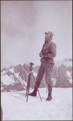
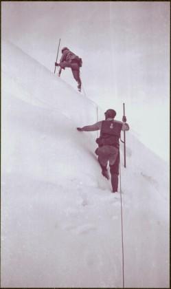
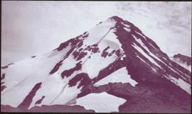
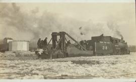
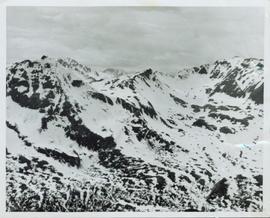
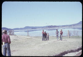
Photograph depicts snowy area.
Handwritten annotation on verso reads: “with Peter Jones".
White rapids visible below.
Handwritten annotation on verso reads: “summer tour 77, Morricetown Canyon in Skeena”.
Photograph depicts man seated by campfire, duck in hand. Tent buildings can be seen in background. Handwritten annotation on negative: "Billy Pulling ducks".
Image is one of 65 photos documenting a survey of the Canada-Alaska Boundary, Taku River area, May 23 to Oct. 15, 1906.
This particular photo is one of 13 found in original enclosure with the following handwritten annotation: "Kopoka River - river scenes Aug 29 to Oct. 9 [19]06". See also items 2006.20.3.1 - 2006.20.3.13.
Photograph depicts small structure barely visible in forest. Handwritten annotation on negative: "Trappers hut near Kopoka Glacier".
Image is one of 65 photos documenting a survey of the Canada-Alaska Boundary, Taku River area, May 23 to Oct. 15, 1906.
This particular photo is one of 13 found in original enclosure with the following handwritten annotation: "Kopoka River - river scenes Aug 29 to Oct. 9 [19]06". See also items 2006.20.3.1 - 2006.20.3.13.
Photograph depicts white rapids, shore visible on either side of river. Handwritten annotation on negative: "Rough water at [Kopoka?] River".
Image is one of 65 photos documenting a survey of the Canada-Alaska Boundary, Taku River area, May 23 to Oct. 15, 1906.
This particular photo is one of 13 found in original enclosure with the following handwritten annotation: "Kopoka River - river scenes Aug 29 to Oct. 9 [19]06". See also items 2006.20.3.1 - 2006.20.3.13.
Photograph depicts river water in foreground, mountains in background. Handwritten annotation on negative: "Looking down Kopoka River from main camp."
Image is one of 65 photos documenting a survey of the Canada-Alaska Boundary, Taku River area, May 23 to Oct. 15, 1906.
This particular photo is one of 13 found in original enclosure with the following handwritten annotation: "Kopoka River - river scenes Aug 29 to Oct. 9 [19]06". See also items 2006.20.3.1 - 2006.20.3.13.
Photograph depicts two unknown men walking on rocky shore with canoe over their heads. Water and forest in background. Handwritten annotation visible on negative: "[?] portaging canoe".
Image is one of 65 photos documenting a survey of the Canada-Alaska Boundary, Taku River area, May 23 to Oct. 15, 1906.
This particular photo is one of 8 found in original enclosure with the following handwritten annotation: "From main camp up Kopoka River. Scenes with persons in." See also items 2006.20.3.14 - 2006.20.3.21.
Photograph depicts unknown man standing in snowy area beside camera on tripod, mountains in background. Handwritten annotation visible on negative: "[?] Camera Sta No.2"
Image is one of 65 photos documenting a survey of the Canada-Alaska Boundary, Taku River area, May 23 to Oct. 15, 1906.
This particular photo is one of 8 found in original enclosure with the following handwritten annotation: "From main camp up Kopoka River. Scenes with persons in." See also items 2006.20.3.14 - 2006.20.3.21.
Photograph depicts two men paddling in canoe, shore in background. Handwritten annotation visible on negative reads: "Stughes & B_ Lake behind Main Camp Taku River".
Image is one of 65 photos documenting a survey of the Canada-Alaska Boundary, Taku River area, May 23 to Oct. 15, 1906.
This particular photo is one of 13 found in original enclosure with the following handwritten annotation: "SOME OTHERS." See also items 2006.20.3.22 - 2006.20.3.34.
Photograph depicts two men climbing up snowy area with walking poles and other gear. Handwritten annotation visible on negative: "Nellis & Gilroy Snow [?] - No.3."
Image is one of 65 photos documenting a survey of the Canada-Alaska Boundary, Taku River area, May 23 to Oct. 15, 1906.
This particular photo is one of 13 found in original enclosure with the following handwritten annotation: "SOME OTHERS." See also items 2006.20.3.22 - 2006.20.3.33.
Water spans foreground, opposite shore crosses midground, mountains stand in background.
Image is one of 65 photos documenting a survey of the Canada-Alaska Boundary, Taku River area, May 23 to Oct. 15, 1906. This particular photo is one of 7 found in original enclosure with the following handwritten annotation: "Around River Taku and main camp on same." See also items 2006.20.3.35 - 2006.20.3.41.
Photograph features white water rapids in rocky area of river, trees on shore in background.
Image is one of 65 photos documenting a survey of the Canada-Alaska Boundary, Taku River area, May 23 to Oct. 15, 1906. This particular photo is one of 7 found in original enclosure with the following handwritten annotation: "Around River Taku and main camp on same." See also items 2006.20.3.35 - 2006.20.3.41.
Image is one of 65 photos documenting a survey of the Canada-Alaska Boundary, Taku River area, May 23 to Oct. 15, 1906. This particular photo is one of 10 found in original enclosure with the following handwritten annotation: "From [Wahut?]-Azmuth and Koshu.” See also items 2006.20.3.47 - 2006.20.3.56.
Photograph depicts sternwheeler passing through rapids of the Fraser River, B.C. Printed annotation on recto reads: “The B.C. Express Passing through the Grand Canyon B.C.”, handwritten in red ink: “1913”.
Postcard photograph depicts sternwheeler, men visible on deck, hills on opposite shore in background.
Printed annotation on recto reads: “B.C. Express Steamer, Fraser River.” Handwritten annotation in pencil on verso reads: “BC Express Fraser River BC”.
Rocks and trees on either shore.
Printed annotation on recto reads: “Steamer B.X. Monarch of New B.C. Soda Creek, Quesnel and Fort George”
Postcard photograph depicts lofty view of sternwheeler in river, snow capped mountains in background.
Printed annotation on recto reads: “R.M.S. B.C. Express in Upper Canyon Fraser River.”
Handwritten annotation in pencil on verso reads: “Prince George to Tete Jaune” Hand written message in ink on verso is addressed to “Mademoiselle Elisabeth Joliet, Terrguy – Les Dijore Cote a Or France”.
View of a sternwheeler in the distance making its way down Fort George Canyon. Printed annotation on recto reads: "Fort George Canyon."
Front view of several men working on Grand Trunk Pacific train 218 in the winter. Handwritten annotation in pencil on verso of postcard reads: “Prince George, B.C., Dec. 1921 yard & main line.”
Photograph depicts a street scent at the corner of Laselle and Second St. in Fort George. A wagon is visible in the dirt road and wooden buildings cross the mid ground. Three unidentified men sit on the boardwalk outside Rigg's Restaurant while one man stands in the doorway of The White Laundry.
Overview of a snow covered mountain tops of the Cassiar Mountains. Handwritten annotation on verso in pen reads: “Cassiar mtns.”
Postcard overview of several identifiable storefronts built amongst the rocky outcrops of Prince Rupert. Printed annotation on recto reads: "Prince Rupert BC."
Postcard overview of the Bulkley River running closely past the village of Telkwa. Handwritten annotation in pen on verso reads: "Don Choracy [?] Prince Rupert, B.C. c/o Wrathall's Photo Shop. Aug. 9 Lake Kaetlyn. We had to drive all the way to Telkwa the other nite for postcards, imagine. We were sure glad and surprised to see Jack & Dick drive in at 7 to-nite. Just like being home. We are having so much fun. The boys are out on Lake to-nite, went to visit Dr. Macdonald's me thinks. I have bad head cold so have to stay home first nite at home I've since we came, Dieks is taking me on Lake tomorrow I hope, Love Bea-P."
Photograph features a sign in the middle of a field at the Royal Canadian Air Force base in Whitehorse, YT that reads: "Taking Photographs Prohibited". Handwritten photo album caption below this photo reads: "Our Authority". See also items 2006.20.12.39 & 2006.20.12.43.
Royal Canadian Air ForceHandwritten photo album caption below this photo reads: "Waiting for the Plane at 'Watson'" Photograph depicts unidentified man standing on ice and holding a fish. The ice in the area behind him has been broken, creating a small pond in the frozen lake. Second man sitting behind pond area. Trees on opposite shore in background.
Royal Canadian Air ForceHandwritten photo album caption below this photo reads: "Above the Rockies at 12 000 feet." Photograph depicts the Rocky Mountains from a distance. As the photograph was taken from the inside of an airplane, the plane's wing tip can be seen on the far right of the image. A sun circle is also visible in the top center.
Royal Canadian Air ForceView of ripples in lake. Forest on opposite shore is reflected in water. It is believed this photograph was taken at Summit Lake, B.C.
Handwritten caption above this photo reads: "Plane on Sumit Lake." Logs can be seen floating on water in foreground, as well as trees on opposite shore in background. The seaplane has the letters "CF-ATF" on its side.
Photograph depicts the steep slope of man-made embankment, forest in background at bottom of slope. Small twigs and pant leg of unidentified individual in foreground.
Photograph depicts the steep slope of man-made embankment. Forest in background, level excavated ground in foreground.
Typed annotation on recto: "Rainbow Trout fishing (Fly fishing) Tachi River - Stuart Lake, B.C." Two men fishing in a canoe with rope tied to another object, and one fish caught in net. Trees on shore in background.
Typed annotation on recto: "Fishing action - Stuart Lake, B.C." Two men fishing in a canoe, with one fish caught in net. Hillside in background. It is speculated that the seated man with fish may be Vivian Grey.
Photograph depicts a game of horseshoes in foreground. Fence crosses midground in front of water, and hills can be seen on opposite shore in background. Handwritten annotation on recto of mounted slide reads: "Playing horse [shoes?] in Legac".
Photograph depicts two boys standing on platform extending into lake. Buildings and fenced areas can be seen on shore in background. Handwritten annotation on recto of mounted slide reads: "boys playing on the lake / Legac".
Photograph depicts dog seated on grass in foreground. Unidentified individuals visible below with fishing nets in waterfall area at Moricetown Canyon.
Photograph depicts two white buildings, one with the sign "Nisga'a Government Administration building". Road in foreground, vehicles and hills in background.
Photograph depicts water in foreground, bayside village in background.
Photograph depicts sign in foreground outlining rules and restrictions for behaviour at Moricetown Canyon. Traditional fishing territory visible behind sign at waterfall in the Bulkley River, B.C. Highway and buildings can be seen in background.
Photograph depicts an unidentified individual standing on cliff above waterfall at Bulkley River, B.C. Fishing territory visible below; highway, buildings, and hills visible in background.
Photograph depicts fishing territory at waterfall rapids in Bulkley River, B.C. Highway and buildings on opposite shore in background.
Photograph depicts one unidentified man surveying a landscape from a snowy mountain peak with other mountain ranges in the background.
Photograph depicts the main street of Rolla with a dirt street and wooden sidewalks, tethered horses, and the storefront of H.G. Atkinson General Merchants. Three people are visible walking through the streets.
Regional map depicting communities, parks, customs posts, airports, radio stations, hatcheries, bodies of water, transport routes, communication lines, elevation points, and lines of batholith contacts. Includes an inset of St. Elias Mountains. Includes “Special Note on the Mineralization of this Map Area” from Bureau of Mines, Victoria, B.C.
Large crowd is gathered around main building in a harbor. Many boats visible in foreground. Smoke from tugboat partially obscures the scene. Annotation on recto reads: "Prince Rupert BC. Photo by MCrae Bros."
Photograph of the SS Camosun arriving in a harbour in Prince Rupert. A blurry man is in the lower right corner of the foreground. Another large vessel can be seen behind the Camosun. Annotation on recto reads: "SS 'Camosun' at Prince Rupert Allen Photo May 23[?]09."
Photograph of a small vessel on the ocean with a dock and harbour buildings in the foreground. Tents and piles of lumber can be seen among the buildings. Annotation on recto reads: "The Wharf, Prince Rupert, BC. 1657." Printed annotation on verso reads "The Wharf, Prince Rupert, BC J. Howard A. Chapman, Victoria. BC. 1657."
Wide angle photograph of many buildings scattered in a clear cut area. Foreground shows several businesses, including "Kelly Carruther's Supply" and "Prince Rupert Hardware and Supply Co." Some remaining forest is visible in the background. Annotation on recto reads: "Prince Rupert, BC 1659."
Photograph of several buildings down the street in Prince Rupert, including the church. Lumber pallets are littered around the buildings. Annotation on recto reads: "Prince Rupert, BC. 20.10.07."