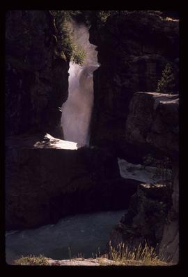
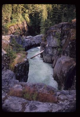
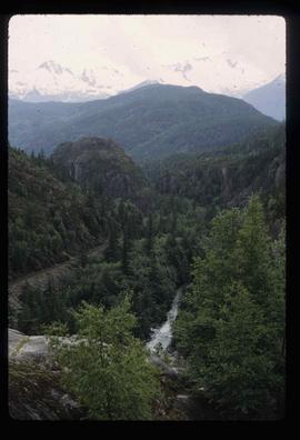
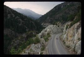
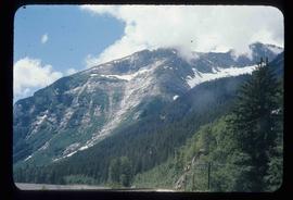
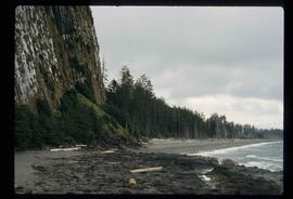
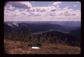
Image depicts a view of Howe Sound from the Stawamus Chief Nature Trail to the Stawamus Chief Mountain, which is often incorrectly referred to as "Squamish" Chief.
Image depicts Highway 99 north of Squamish and near Pemberton, B.C.
Image depicts the Nairn Falls in Nairn Falls Provincial Park south of Pemberton, B.C.
Image depicts a view of the scenery near Lillooet, B.C.
Image depicts the condominiums in the "Pemberton Valley Estates" in Pemberton, B.C.
Image depicts two trucks on a road at an uncertain location.
Image depicts a view of Nairn Falls Provincial Park.
Image depicts Nairn Falls.
Image depicts the canoe group portaging to Indianpoint Lake.
Image depicts Indianpoint Lake.
Image depicts the foot of Indianpoint Lake.
Image depicts the sunset over Isaac Lake from the Betty Wendle campsite.
Image depicts a camp at the foot of Isaac Lake.
Image depicts the Cariboo Falls.
Image depicts the lower end of the river channel leading to the Spectacle Lakes.
Image depicts a few unknown individuals canoeing in a slough area while on approach to Bowron Lake.
Image depicts a slough area while on approach to Bowron Lake.
Image depicts the river channel leading to the Spectacle Lakes.
Image depicts Spectacle Lake.
Image depicts two unknown individuals canoeing on the lower part of Spectacle Lake.
Image depicts a faded First Nations' rock painting.
Image depicts a mountain range located somewhere along the Skeena River.
Image depicts a road leading to Prince Rupert, B.C.
Image depicts the Skeena River.
Image depicts the Skeena River, as well as a stretch of highway that appears to be under construction.
File contains slides depicting places in and around Prince Rupert, B.C.
Image depicts numerous houses on the cliff-sides in Prince Rupert, B.C.
Image depicts a boat docked inside what appears to be a type of boathouse, possibly located in Metlakatla near Prince Rupert, B.C.
Image depicts the Hecate Strait near Prince Rupert, B.C.
Image depicts a dock in Prince Rupert, B.C.
Image depicts a large building with numerous vehicles in the foreground.
Image depicts numerous buildings and a small dock somewhere in Prince Rupert, B.C. One of the buildings is labelled "Fishermen's Supply."
Image depicts a view of Prince Rupert, B.C.
Image depicts the coastal forests on the shores of Haida Gwaii, B.C.
Image depicts Kent Sedgwick standing on a beach in Haida Gwaii, B.C. He is holding seaweed.
Image depicts the coastline of Haida Gwaii, B.C.
Image depicts an individual standing on a trail in the coastal forest on Haida Gwaii, B.C.
Image depicts an individual crouching in an old cemetery located somewhere in the coastal forest on Haida Gwaii, B.C.
Image depicts several individuals seated on a ferry as it possibly departs from a dock somewhere in Prince Rupert, B.C. It is most likely headed for Haida Gwaii, B.C.
Image depicts numerous buildings and a dock on the shore of Haida Gwaii, B.C..
Image depicts a building surrounded by a tall, circular enclosure somewhere on Haida Gwaii, B.C.
Image depicts an oddly shaped tree branch that appears to have grown downwards, and is covered in green, mossy growths. Located somewhere on Haida Gwaii.
Image depicts an individual walking on a a log bridge in a forest somewhere on Haida Gwaii.
Image depicts Kent Sedgwick crouching and holding a stick; the slug on the end is barely visible. Located somewhere on Haida Gwaii.
Image depicts a view of the Sugarbowl Grizzly Den Protected Area from Raven Peak.
Image depicts several individuals walking on a trail somewhere near Raven Peak.
Image depicts a view of a valley; the slide itself labels the image in two places, "central basin" on the left side of the image, and "Pat's Pass" on the top of the image between the two mountains.