Pièce
Fait partie de Cassiar Asbestos Corporation Ltd. fonds
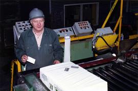
Photograph depicts mill production worker Tony Mlikovic.
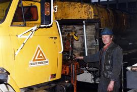
Photograph depicts mechanic Wally Drzimotta standing beside a Cassiar Mining Corporation truck.
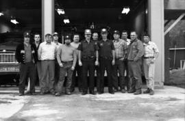
Photograph depicts Cassiar employees and two firemen wearing Justice Institute of British Columbia hats standing in front of an open garage with fire trucks in Vancouver.
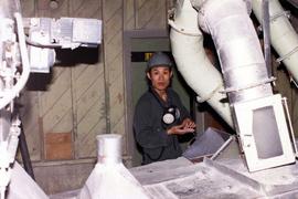
Photograph depicts mill production worker Stephen Le.
Photograph depicts carpenter Florian Osorio.
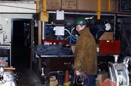
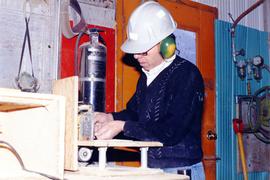
Photograph depicts plumber John Wilcox.
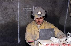
Photograph depicts underground miner Randy Joporowski.
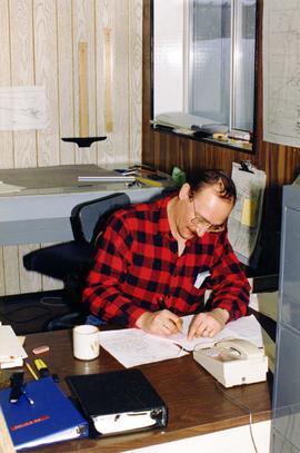
Photograph depicts senior mine engineer Ron Sobie writing at a desk.
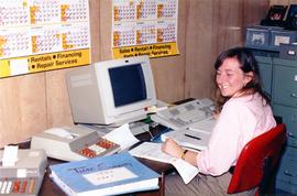
Photograph depicts temporary payroll clerk Mary Comper.
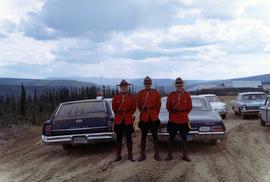
Photograph depicts three unknown RCMP constables standing in red serge uniform.
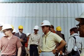
Photograph depicts Trudeau wearing a white hardhat and standing with a group of men and women.
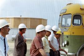
Photograph depicts Trudeau walking with men in white hardhats by a bus.
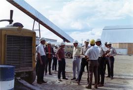
Photograph depicts Trudeau speaking with men white hardhats while standing by mine machinery.
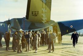
Photograph depicts a party of ambassadors standing outside a Canadian military airplane at Clinton Creek.
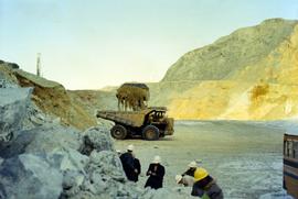
Photograph depicts a party of ambassadors standing outdoors near a dumptruck that is being loaded with dirt at Clinton Creek.
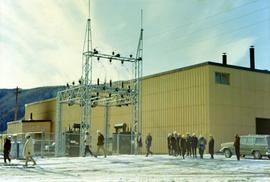
Photograph depicts a party of ambassadors wearing hardhats and walking outdoors past a building at Clinton Creek.
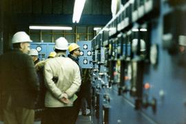
Photograph depicts a party of ambassadors wearing hardhats while inspecting the inside of the mine at Clinton Creek.
Photograph depicts Danny Demitr speaking with an unknown man.
Typed annotation on caption adhered to recto of photograph: "Presentation of Open Pit Mines and Quarries Annual Safety Award by W.K. Kiernan, Minister of Mines, British Columbia to J.G. Berry, General Superintendent, Cassiar Asbestos Corporation. Cassiar Asbestos Corporation won the trophy for the year 1962 with a compensable accident frequency of 7.19." Photograph depicts J.G. Berry shaking hands with Mr. Kiernan as he accepts a plaque from the "DEPARTMENT OF MINES AND PETROLEUM RESOURCES." A man and woman are partially visible at table behind them. Curtains on wall in background.
Photograph depicts group of eleven men standing in line in the Cassiar valley. Left to right: Jack Christian, Charles Rainforth Elliot, John Drybrough, John E. Kennedy, Fred Martin Connell, W. Harold Connell, Ken A. Creery, George Washington Smith, Tam Zimmermann, [Fred Murray]?, Nick Gritzuk. Creery looks through his own camera, appearing to photograph the photographer. Power lines and mountains in background. Most men featured in photo are believed to be members of Cassiar's Board of Directors.
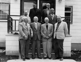
Photograph depicts group of eight men standing on front steps of Cassiar's Main Office building. Top, left to right: Ken A. Creery, John Drybrough. Middle, left to right: John E. Kennedy, Tam Zimmermann. Bottom, left to right: Fred Martin Connell, George Washington Smith, W. Harold Connell, Charles Rainforth Elliot. Windows and doors to office in background, flowers in bottom right foreground. Photo believed to have been taken on the same day as items 2000.1.1.4.3.4 - 2000.1.1.4.3.6.
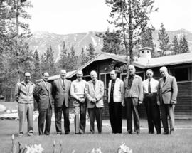
Photograph depicts group of nine men standing on lawn in front of building known as "House 130" or "Director's Lodge". Left to right: Andre Beguin, unknown, Charles Rainforth Elliot, Jack Christian, W. Harold Connell, Plato Malezemoff (from Newmont Mining), Tam Zimmermann, Ken A. Creery, Fred Martin Connell. Daffodils and tulips planted in foreground, trees and mountains in background. Most men featured in photo are believed to be members of Cassiar's Board of Directors; Beguin was a General Superintendent.
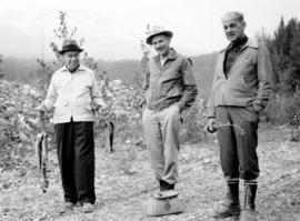
Photograph depicts three men with fishing gear. Trees and mountains in background. Left to right: Plato Malezemoff (holding fish), Jack Christian, Tam Zimmermann.
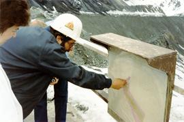
Photograph depicts a man wearing a Brinco Mining hardhat and pointing at a map.
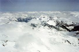
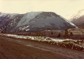
Photograph depicts a view of snow-capped mountains among clouds taken from the air.
This blueprint depicts the general layout of the recreational centre. Top-down, side and front perspectives are used. The ground floor, second floor, outside walls and stage layouts are shown.
This blueprint depicts the outside layout of the recreation centre and includes its north, south, east and west elevations. Details are included regarding the materials to be used for construction.
This blueprint depicts the overall framing structure of the recreational centre. Details include a cross section layout of the recreational centre with relevant framing dimensions, the locations and instructions for assembly as well as types of framing materials to be used.
This blueprint depicts the detailed plans for the recreational centre's entrance hall. There are details pertaining to the elevation of entrance doors, the overall plan of the entrance hall, the upper level staiwell as well as handrailing details. Annotations in gold pen and pencil regarding clarification and changes to certain details are included. Numerical annotation at the bottom right hand of plan imposed new numbering system (3002/09/08).
This blueprint depicts the overall layout of the heating and ventilating units to be used for the first and second floor of the recreational centre. Details include the locations of fans, boilers, ducts and exhausts as well as typical heating connector connections and the plumbing layout. Annotations in gold pen and pencil regarding clarification and changes to certain details are included. Numerical annotation at the bottom right hand of plan imposed new numbering system (3002/09/11).
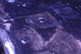
This map depicts the generalized pit layout and estimated waste extraction areas for benches 5840 and 5870. Annotated details include numerical bench markers as well as extraction dates. The hand drawn plan consists of solid and dotted lines drawn with green and red pencil.
This map depicts the pit layout and estimated waste extraction areas for 5840 bench for the end of September to November. Extraction dates, approximate extraction tonnages and ore, waste and talus locations are included throughout the plan. Annotated details include numerical bench markers, extraction dates, approximate total tonnages as well as waste and ore tonnage calculations for October. The hand drawn plan consists of solid and broken lines drawn with red, blue, orange and lead pencils as well as black ink.
This map depicts the pit layout and estimated waste extraction areas for 5870 bench for the end of August to November. Extraction dates, approximate extraction tonnages and ore, waste and talus locations are included throughout the plan. Annotated details include numerical bench markers, extraction dates, approximate extraction tonnages, ore, waste and talus locations as well as waste, ore, talus and total tonnage calculations for October. The hand drawn plan consists of solid and broken lines drawn with red, blue, orange and lead pencils as well as black ink.