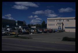
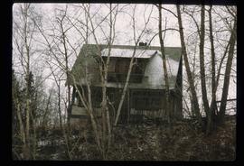
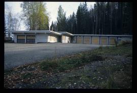
Showing 2245 results

Archival description
950 results with digital objects Show results with digital objects
Beehive Burner
2012.13.1.3.089 · Item · 12 Oct. 1989
Part of J. Kent Sedgwick fonds

Image depicts a Beehive Burner along the Nechako on River Road. Map coordinates 53°55'34.1"N 122°44'58.0"W.

Nechako Cutbanks Trail
2012.13.1.3.091 · Item · 12 Oct. 1989
Part of J. Kent Sedgwick fonds

Image depicts the cutbanks on the other side of the Nechako, taken from the nature trail at Island Cache. Map coordinates 53°55'34.6"N 122°45'52.4"W

2012.13.1.3.108 · Item · 12 Oct. 1989
Part of J. Kent Sedgwick fonds

Image depicts 4th Ave at Quebec St, showing the following businesses: The Yarn Barn, Golden Chalice Jewellers, Dandy Lines, Ultrasport, and Saveco. Map coordinates 53°54'58.6"N 122°44'47.5"W

CN Train Yard
2012.13.1.3.121 · Item · 12 Oct. 1989
Part of J. Kent Sedgwick fonds

Image depicts a number of trains in the CNR train yard taken from River Road in Prince George, B.C. Map coordinates 53°54'51.5"N 122°43'29.6"W

Prince George
2012.13.1.3.134 · Item · 12 Oct. 1989
Part of J. Kent Sedgwick fonds

Image depicts Prince George, possibly with the Northwood Pulpmill in the background.

2012.13.1.3.148 · Item · Apr. 1999
Part of J. Kent Sedgwick fonds

Image depicts two snow sculptures near a wooden bridge on an ice rink, possibly during the Winter City Conference, in Prince George, B.C. Taken at the Prince George Civic Center. Map coordinates 53°54'45.6"N 122°44'59.6"W

Prince George Sawmill
2012.13.1.3.159 · Item · Nov. 2000
Part of J. Kent Sedgwick fonds

Image depicts Prince George Sawmill taken from across the Nechako River looking southwest. Map coordinates 53°56'00.0"N 122°44'29.7"W

Third Avenue
2012.13.1.3.161 · Item · May 2001
Part of J. Kent Sedgwick fonds

Image depicts 3rd Ave in Prince George, B.C. Map coordinates 53°55'01.9"N 122°44'48.7"W

Highway 97
2012.13.1.3.164 · Item · May 2001
Part of J. Kent Sedgwick fonds

Image depicts a section of Highway 97 looking south. Map coordinates 53°55'10.3"N 122°46'54.9"W

2012.13.1.3.168 · Item · Mar. 2003
Part of J. Kent Sedgwick fonds

Image depicts an aerial view of a Prince George residential section between Highway 97, Carney Street and 10th Ave looking north. Map coordinates 53°54'54.0"N 122°46'00.4"W

PGE Grade
2012.13.1.041 · Subseries · [between 1980 and 2003]
Part of J. Kent Sedgwick fonds

File contains slides depicting the grade for what was formerly the Pacific Great Eastern, and is now known as British Columbia Railway.

Paddlewheel Park
2012.13.1.7.201 · Item · Nov. 2000
Part of J. Kent Sedgwick fonds

Image depicts the Fraser River at Paddlewheel park, with a train on the other side of the river, in Prince George B.C.

King George V School
2012.13.1.7.213 · Item · May 2001
Part of J. Kent Sedgwick fonds

Image depicts the King George V School in Prince George, which was demolished sometime around 2006 and Duchess Park Secondary School was built in its place.