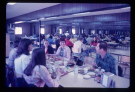
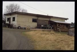
Image depicts a large group of people sitting and eating near a bridge at an uncertain location, though possibly near Hudson's Hope, B.C.
Image depicts a crowded cafeteria, most likely somewhere in Hudson's Hope, B.C. The slide is labelled "Camp at H.H."
Image depicts a view of Chetwynd, possibly from Highway 97.
Image depicts an unidentified individual standing near a drop-off in the Pine Pass between Alberta and British Columbia. The sign behind the individual reads: "Pine Pass - 2,868 FT. Here the great barrier of the Rock Mountains is breached by the lowest highway pass. Once the remote route of the trapper, it now links the commerce of the north and markets of the south. The John Hart Highway was completed in 1952 and followed by the P.G.E. in 1958. Gas and oil lines also take advantage of this convenient natural feature."
Image depicts a truck on a bridge, possibly crossing over the Peace River.
Image depicts a street with a building which is labelled "MacKeigan Enterprises Ltd." in Hudson's Hope, B.C.
Image depicts a street in Hudson's Hope, B.C.
Image depicts what appears to be a Fire Hall in Hudson's Hope, B.C.
Image depicts two houses in Hudson's Hope, B.C.
Image depicts what appears to be a Fire Hall in Hudson's Hope, B.C.
Image depicts a road and numerous buildings in Hudson's Hope, B.C.
Image depicts what appears to be a motel in Hudson's Hope, B.C. The slide is labelled "camp HH."
Image depicts a cabin and several other buildings, possibly located in Hudson's Hope, B.C.
Image depicts a street of shops at an uncertain location somewhere in the Peace River Regional District. A pink and blue building, possibly a theatre, is labelled "Lux."
Image depicts two unidentified individuals speaking to each other in the doorway of what appears to be a mobile home. The location is uncertain.
Image depicts a cookhouse at an uncertain location.
Image depicts two small sheds at an uncertain location. The slide labels them as "Giscome bldgs in Blackburn."
Image depicts a cookhouse at an uncertain location.
Image depicts a barn full of hay and several cows, possibly near Newlands, B.C.
Image depicts an old shack buried in snow, possibly in Newlands, B.C.
Image depicts an old building that was possibly once a gas station in the community of Newlands, B.C.
Image depicts what is possibly the community of Newlands, B.C.
Image depicts a house with torn-up siding. The slide is labelled: "Mellos house relocated from Penny." The location is uncertain.
Image depicts the community hall in Penny, B.C.
Image depicts two signs for hiking trails in Penny, B.C. One reads: "Hiking trail to Red Mt. Lake (Grizzly Bear Mt.) expect to meet wild animals."
Image depicts the post office in Penny, B.C.
Image depicts a beehive burner somewhere in or near Penny, B.C.
Image depicts Sue Sedgwick standing in front of an old, run-down house somewhere in or near Penny, B.C.
Image depicts a railway crossing sign with peeling and cracked paint somewhere in or near Penny, B.C.
Image depicts Kent Sedgwick sitting on the bank of a river. An old beehive burner is visible in the background. Located somewhere in or near Penny, B.C.
Image depicts an old, abandoned cabin with ivy growing up the side. The location is uncertain.
Image depicts numerous piles of wood in Longworth, B.C.
Image depicts an old cabin in the woods at an uncertain location.
Image depicts a dirt road and a possibly abandoned building at an uncertain location.
Image depicts a cabin at an uncertain location.
Image depicts what appears to be a teepee at an uncertain location.
Image depicts a group of people observing splintered wooden boards at an uncertain location.
Image depicts the post office in Longworth, B.C.
Image depicts a log cabin and an orange truck somewhere in or near Longworth, B.C.
Image depicts two unidentified individuals standing next to the train station, and two railway tracks running through Longworth, B.C.
Image depicts a house surrounded by trees and a mountain in the background; it is most likely located somewhere in or near Longworth, B.C.
Image depicts several old shacks and some railway tracks running through Longworth, B.C.
Image depicts two old shacks and a mountain in the background. Possibly located in or near Longworth, B.C.
Image depicts an old house missing windows and doors at an uncertain location.
Image depicts two old houses surrounded by numerous trees at an uncertain location.
Image depicts several old buildings. The location is uncertain.
Image depicts a snow-covered road with vehicle tracks, and several houses. The location is uncertain.
Image depicts railway tracks on the right side of the image, and several old houses alongside it. The location is uncertain.