2009.5.2.47
·
Item
·
[ca. 1910?]
Parte de Taylor-Baxter Family Photograph Collection
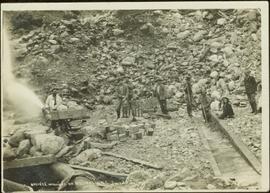
Photograph depicts an unidentified man mining in rocky area, trees and hills in background. Handwritten annotations on verso of photograph: "PLACER MINER WSHING FOR GOLD FINDLAY RIVER BC", "PHOTO WWW".