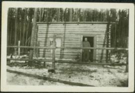
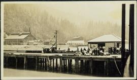
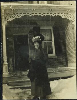
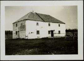
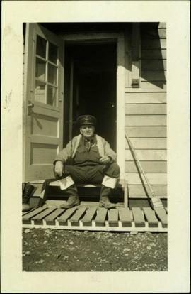
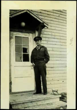
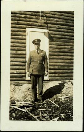
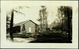
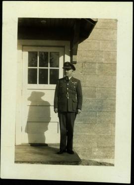
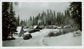
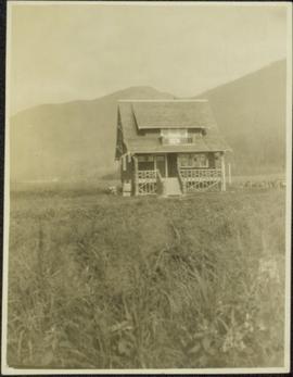
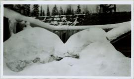
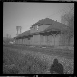
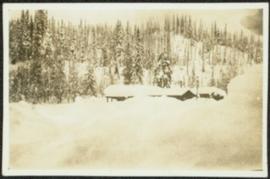
Photograph depicts an unidentified building in snowy area, trees on hill in background.
Photograph depicts a man standing in doorway of small log building in forest clearing. Fence crosses foreground.
Photograph depicts bridge construction approaching unidentified river on opposite shore, unfinished pier in foreground. Steep riverbank in background.
Photograph depicts town buildings and church on shore to right of river winding through hills. Metal bar speculated to be part of a bridge crosses foreground.
Photograph depicts a group of unidentified buildings in what appears to be an industrial area on opposite shore. River or lake in foreground, tree-covered hills in background.
Photograph depicts men walking and standing on pier over water in unidentified area. A large pile of bundles can be seen on pier. Large buildings stand on shore, and trees cover hillside in background. Portion of a boat or ship tethered to shore is partially visible in right foreground.
Photograph depicts a large group of men standing on what appears to be a wood pier. Forest on shore in background.
Photograph depicts crane visible behind large metal structures, building materials in foreground.
Photograph depicts two large metal structures on flatbed trailer. Trees visible in background.
Photograph depicts sluice trunk in mining area, men on tall structure in background.
Woman stands in walkway cleared of snow in front of tall brick home with a detailed porch, believed to be in Victoria, B.C. Woman wears long winter coat, fur hand-warmer, and large hat. It is believed this woman may be a cousin to Sarah Glassey's family, possibly through the Taylor line.
Woman speculated to be mother of H.F. Glassey stands in open doorway of porch, leaning her head against the sill.
Unidentified house with veranda stands in field, hills in background.
Greenhouses stand in front of house in field, hills in background.
Young woman believed to be Sarah Glassey stands in farm yard holding unidentified object. A small dog stands at her feet. Fence, supplies, and unidentified building stand in background. It is also possible that this woman may Violet (nee Taylor) Baxter, niece to Sarah Glassey.
Two women sit at small table in front yard of large house, woman on right believed to be Sarah Glassey. Pillows, chairs, and plants on porch in background. Handwritten annotation on recto: "Mrs. Bradbury, Myself taken when I was sick. Her house in Saanich."
Front view of an abandoned log building. The door is open or missing, the front window glass is broken, the area in front of the building is littered with antlers, boxes and wood. The tree next to the building has grown too close the building and roof. Handwritten annotation on verso in pen reads: “Laketon, Dease Lake, BC. Court house & jail June ‘62”
Photograph depicts silhouette of unknown man standing in front of tent, trees in background. Poor image quality.
Image is one of 65 photos documenting a survey of the Canada-Alaska Boundary, Taku River area, May 23 to Oct. 15, 1906.
This particular photo is one of 13 found in original enclosure with the following handwritten annotation: "SOME OTHERS." See also items 2006.20.3.22 - 2006.20.3.34.
Photograph depicts miscellaneous items and supplies in front of white tent. Unknown man stands in foreground and a second man can be seen sitting in tent. Stand of trees in background. Handwritten annotation visible on negative: "[?] Oct 13".
Image is one of 65 photos documenting a survey of the Canada-Alaska Boundary, Taku River area, May 23 to Oct. 15, 1906. This particular photo is one of 9 found in original enclosure with the following handwritten annotation: "Pictures of different members of ‘our’ party.” See also items 2006.20.3.57 - 2006.20.3.65.
Handwritten annotation on recto of postcard reads: “Were there’s a will there’s a way, 5th Street, Prince Rupert, B.C., F. Button photo Pr. Rupert. No. 514.” Handwritten annotation in pen on verso of postcard reads: “Miss Belding, 33 Marlbro Avenue, Hull Yorkshire, England. S.S. Prince George. Dec. 1918. Dear Bertha, This is a street in the centre of the town Prince Rupert. There is a capacity list of passengers on board. The boat is registered to hold 384. We left at midnight and exped to arrive in Vancouver tomorrow at 3:30 pm. Love from Edie.”
Man driving a two horse cart in front of beehive burner, cart is full of bark presumably sawed off the logs.
Handwritten annotation in pencil on verso: "Mill Burner".
Photograph depicts a large two story building in fenced area. Field spans foreground, stand of trees in background. Handwritten photo caption below photograph reads: "The old warehouse." It is believed that this photograph may have been taken at Fort St. James, BC.
Photograph depicts group of working men and 6 dogs standing outside wood building. Hill in background.
Handwritten photo album caption beside and below this photo reads: "F/S. I[?].M. McLean, Ft. S. John. C.D. #2 Unit. N.W.S.R. 'Just as you see him'." Photograph depicts the Sergeant in sergeant's hat and rubber boots, sitting in open doorway of Officers' Quarters [see item 2006.20.12.15]. There is a broom on right, boots on far left, and wood slat sidewalk in foreground.
Sem títuloHandwritten photo album caption beside this photo reads: "S/L. A.C. Heaven. C.D. #3 Unit, N.W.S.R. Fort Nelson." Photograph depicts man in uniform standing on steps in front of doorway to unidentified building. Wings medallion on left breast.
Sem títuloHandwritten photo album caption below this photo reads: "S/L. Geo Du Temple. #4 Unit N.W.S.R. Watson Lake." Photograph depicts man in uniform (wings medallion on left breast) standing in front of white doorway of log building. Ground in foreground covered with sticks and sawdust.
Sem títuloHandwritten photo album caption below this photo reads: "Barracks at Watson Lake". Photograph depicts three long log buildings connected in a U shape. The barracks are in a forest, surrounded with trees. The area around the building is strewn with wood debris and log piles. Dirt road in foreground.
Sem títuloHandwritten photo album caption beside and below this photo reads: "F/S. J. Hone. C.D. #5 Unit. N.W.S.R. Whitehorse. A 100% soldier." Photograph depicts the Sergeant standing in uniform (wings medallion on left breast) in front of white doorway to unidentified building. A reflection of trees can be seen in door window.
Sem títuloHandwritten photo album caption below this photo reads: "Ordinary 'Nose-Hanger'." Photograph depicts airplane hangar with large circles in a darker fabric to accommodate the nose and engines of plane. Large truck and stacks of unidentified packages in foreground on right. Unidentified vehicle to left of hangar. It is believed that photograph was taken at Whitehorse, YT.
Sem títuloPhotograph depicts large group of men gathered outside large building with the sign "WHITEHORSE GRILL".
Handwritten photo album caption below this photo reads: "Dawson Creek BC / 1943 Beer Ration Day".
Handwritten caption beside this photo reads: "Cookhouse in Winter". Photograph depicts top of building semi-visible behind large snow pile. Treetops can be seen in background.
Photograph depicts a numerous variety of buildings in snowy clearing of forest. A car is parked in foreground on road leading into the camp. Handwritten caption beside this photo reads: "Sumit Lake Camp". It is speculated that this may be the Campbell Construction Co. road camp.
Typed annotation on recto: "Old Hudson Bay Company storhouse [sic] at Fort St. James, B.C." Cow grazing in front of a large, white, two-story building with a ladder on its roof. Wood fence, smaller second building, and forest hillside can be seen in background.
Typed annotation on recto: "Fishing Bungalows at Douglas Lodge Stuart Lake, B.C." Man stands in forest on dirt road in front of log bungalows.
Photograph depicts a derelict locomotive shed at Union Bay on Vancouver Island. It is a Canadian Colliery Resources Ltd. shed, last used 15 Aug. 1960. Operations finished that day and disposal of all the equipment followed.
Photograph depicts small buildings sited on the north side of the tracks and just west of the Mission City CPR depot. They are all in use and well cared for.
Photograph depicts the CPR depot at Chase, which is no longer in use.
Photograph depicts the CPR line at Notch Hill in the Shuswap. At one time this was a busy place, as helper engines were stationed here to push heavy trains over the hill. This spur is on the north side of the depot and has rails from 1902. The view is looking west, depicting the mainline to the left and just in view.
Photograph depicts the CPR Mission Bridge on the Huntingdon branch. The photo was taken from the open swing span looking downstream, with a tug and derrick (Fraser River Pile Driving Co.) fast disappearing downstream. The new road bridge in the background is about to be opened in late June 1973.
Photograph depicts the CPR Mission Bride on the Huntingdon branch. The photo was taken from the open swing, and shows a tug and derrick passing swiftly downstream in the north channel of the opening. The span opens about every 2 or 3 days for river traffic.
Photograph depicts the CPR Mission Bridge on the Huntingdon branch. The span opened to allow downstream passage of a tug and derrick, which passed at about 6 to 8 knots because of the freshet. Tow started at federal wharf at Mission City. The span opens for river traffic every 2 or 3 days. The view is looking east and upstream.
Photograph depicts the CPR Mission Bridge on the Huntingdon branch. The swing span is in an open position and the view is looking west and downstream. A new road bridge to be opened within the month is in the background. The bridge cabin holds a gas engine that turns the span in about 60 seconds.
Photograph depicts the West Summerland CPR station in the Okanagan. The station often was used but not permanently manned. It was located at mile 9.5 from Penticton. The view is looking south.
Photograph depicts the Penticton CPR depot. The view is looking northwest.
Photograph depicts the CPR Faulder depot on the Kettle Valley Railway. It is located at mile 15.5 from Penticton, on the Princeton Subdivision.
Photograph depicts the CPR line at Arawana, 5 miles northeast of Penticton and at mile 125.7 on the Carmi Subdivision. The photo shows the ruins of the station house and Okanagan Lake in the background. The passing loop in the foreground has been disconnected and partially dismantled. The rear track was used once or twice weekly by the way freight train between Penticton and Midway. The view is looking west.
Photograph depicts an abandoned ranch house, southeast of Rock Creek, north of an abandoned GNR grade, and about a mile north of an international boundary.
Photograph depicts a house that had been pushed on its side by a bulldozer.
Photograph depicts a house that provided an example of the few surviving homes left on Beach Ave.
Photograph depicts one of the surviving houses on Beach Ave, Vancouver, between Gilford and Chilco.