Showing 2440 results

Archival description
2097 results with digital objects Show results with digital objects
East Line slide lists
2012.13.2.17.05 · File · 2000-2002
Part of J. Kent Sedgwick fonds

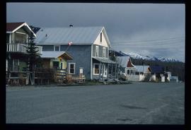
File consists of lists and printed emails relating to slides and photographs depicting the East Line. Includes a CD that contains slides and photographs depicting the East Line (2000).

Northwood Pulpmill
2012.13.1.3.160 · Item · Nov. 2000
Part of J. Kent Sedgwick fonds

Image depicts the Northwood Pulpmill in Prince George, B.C. taken from above the Nechako River looking east. Map coordinates 53°56'00.0"N 122°44'29.7"W

Prince George Sawmill
2012.13.1.3.158 · Item · Nov. 2000
Part of J. Kent Sedgwick fonds

Image depicts Prince George Sawmill taken from across the Nechako River looking southwest. Map coordinates 53°56'00.0"N 122°44'29.7"W

Prince George Sawmill
2012.13.1.3.159 · Item · Nov. 2000
Part of J. Kent Sedgwick fonds

Image depicts Prince George Sawmill taken from across the Nechako River looking southwest. Map coordinates 53°56'00.0"N 122°44'29.7"W

Paddlewheel Park
2012.13.1.7.201 · Item · Nov. 2000
Part of J. Kent Sedgwick fonds

Image depicts the Fraser River at Paddlewheel park, with a train on the other side of the river, in Prince George B.C.

Atlin Lake?
2012.13.1.98.46 · Item · 1999
Part of J. Kent Sedgwick fonds

Image depicts what is possibly Atlin Lake, with numerous mountains in the distance and Atlin Mountain visible on the right of the image.

Miles Canyon - A River
2012.13.1.98.65 · Item · 1999
Part of J. Kent Sedgwick fonds

Image depicts a river in the Miles Canyon near Whitehorse Y.T. The Robert Lowe Bridge, built in 1922, can be seen over the canyon.

A Bear
2012.13.1.98.71 · Item · 1999
Part of J. Kent Sedgwick fonds

Image depicts a bear, possibly a grizzly. The location is uncertain.

Railway - Near Summit
2012.13.1.100.19 · Item · 1999
Part of J. Kent Sedgwick fonds

Image depicts two merging railway tracks, and what appears to be a frozen river, somewhere near the summit of a mountain.

2012.13.1.89.136 · Item · 1999
Part of J. Kent Sedgwick fonds

Image depicts four individuals sitting on a log, possibly somewhere near the Hansard Bridge, B.C. The individuals are UNBC faculty members Gail Fondahl, Tracey Summerville, Greg Halseth and an unidentified individual. The slide is labelled: "Hansard Bridge UNBC." Map coordinates 54°04'37.7"N 121°50'39.9"W

East Line photos
2012.13.2.17.06 · File · [between 1999 and 2005]
Part of J. Kent Sedgwick fonds

File consists of notes and printed photographs relating to the East Line. The file includes photographs that depict various areas on the Upper Fraser and within the communities, including Dome Creek; Sinclair Mills; Penny; Grand Canyon; and Crescent Spur (between 1999 and 2005).

Fraser River Big Bend
2012.13.2.17.11 · File · [between 1999 and 2005]
Part of J. Kent Sedgwick fonds

File consists of aeriel photographs depicting the Fraser River Big Bend, where the Fraser River changes direction from westbound to southbound at its "Big Bend" near the Huble Homestead Historic Site, 45 km north of Prince George, British Columbia.

Road to Skagway
2012.13.1.98.01 · Item · 1999
Part of J. Kent Sedgwick fonds

Image depicts the road to Skagway, Alaska. Possibly located on the Klondike Highway in British Columbia with Tutshi Lake on the left.

Railway Bridge
2012.13.1.98.03 · Item · 1999
Part of J. Kent Sedgwick fonds

Image depicts a railway bridge, possibly in the small town of Fraser, located on the Klondike Highway in B.C.

Atlin Lake
2012.13.1.98.14 · Item · 1999
Part of J. Kent Sedgwick fonds

Image depicts Atlin Lake as well as a small section of Atlin, B.C. The mountain is possibly Atlin Mountain.