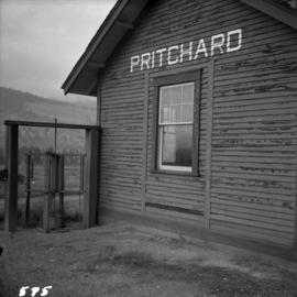
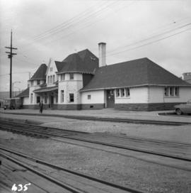
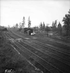
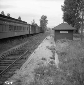
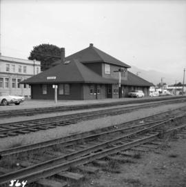
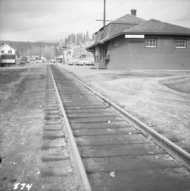
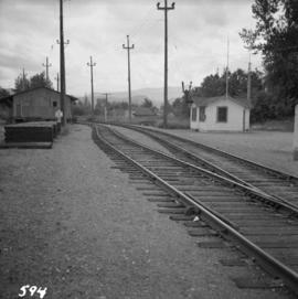
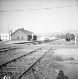
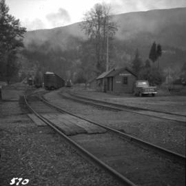
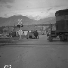
Photograph depicts the C.P.R. station at Invermere in the Kootenays. There is a trolley off the track on the road and the way freight switching at the station. Golden is to the left, Cranbrook is to the right, and the station building is at the immediate left.
Photograph depicts Sirdar station belonging to the C.P.R. It is at the south end of Kootenay Lake and 11 miles north of Creston. There is a little used turntable behind the depot. The view is looking south.
Photograph depicts Koksilah depot of the Esquimalt and Nanaimo Railway on Vancouver Island. It is 2 miles south of Duncan and the view is looking north.
Photograph depicts the C.P.R. depot at Duncan on Vancouver Island, with a view looking northeast.
Photograph depicts the C.P.R. depot at Kimberley. It is in the center of the town, looking up towards the Kimberley mine which is 1 mile away. The last passenger service (1 coach) between Kimberley and Cranbrook ran about 1955.
Photograph depicts the C.P.R. Pritchard depot, 25 miles east of Kamloops. The passenger turnstile is unusual though found elsewhere in this area. The depot is long unused for passengers and is now used by a permanent way gang.
Photograph depicts the C.P.R. summit of the southern transcontinental C.P. line at Crowsnest Pass on the Alberta-B.C. border. The roundhouse is disused. Four men are working on the turntable; it is unclear whether they are rebuilding its eastern face or demolishing it by breaking down one wall to get at the table. The site is 4,453 ft. above sea level and the view is looking south.
Photograph depicts the B.C. Electric Railway depot at Huntingdon and Sumas, about 20 ft from the U.S.-Canadian border. The view is looking southeast.
Photograph depicts the electricity station at Coghlan on the B.C. Electric Railway, which is 9 rail miles east of Langley in the Fraser Valley. The view is looking east.
Photograph depicts the Canadian National Railway (CN) Kamloops Junction depot, facing east. The single line spur to Kamloops is about two miles long.
Photograph depicts the Sumas depot of the Northern Pacific Railway in the U.S. The Canadian border is at the grade crossing in the middle distance.
Photograph depicts a Lutheran Church on River Rd. in north Surrey, opposite from Annacis Island.
Photograph depicts an old building at 119 Water St. in Vancouver, B.C.
Photograph depicts the headquarters and general offices of the National Harbours Board in Vancouver, B.C., located at the foot of Dunlery St.
Photograph depicts a home at 1310 Comox St. in Vancouver, B.C. View is of the east side of the house, facing Jervis St.
Photograph depicts the post office, store, and gas pump in Clayburn, north of Abbotsford, B.C.
Photograph depicts the Buckingham Apartments at 925 Cardero St.and Barclay St. in Vancouver, B.C.
Photograph depicts a girls' school, Strathcona Lodge, at Shawnigan Lake.
Photograph depicts a former store on main street in Pitt Meadows in the Fraser Valley.
Photograph depicts a former service station on the main street of Pitt Meadows in the Fraser Valley.
Photograph depicts the catholic church at Cobble Hill on Shawnigan Lake.
Photograph depicts a west end fire hall in Vancouver on Nelson and Nicola St.
Photograph depicts a church on a reservation at Mosquito Creek in North Vancouver, B.C.
Photograph depicts the fire hall in Moyie, 20 miles south of Cranbrook. When the photo was taken there were 2 hose reel carts inside, a hose, and huge log stove under the hose drying tower (partially seen through window). Moyie was a prosperous village about 1900-1910.
Photograph depicts a courthouse at Revelstoke, B.C. that was built in 1912-1913.
Photograph depicts a possibly derelict hotel in Slocan City, 25 miles northwest of Nelson. Slocan City was once famous for its silver, lead etc. mines.
Photograph depicts an abandoned log cabin in the Kettle Valley between Rock Creek and Westbridge, on the east side of the road approximately 5 miles from Rock Creek.
Photograph depicts a derelict shop on what was the Main St. of Slocan City.
Photograph depicts one of the earlier brick buildings beside the river, sited opposite the sternwheeler landing pier. It is called Commercial Block and was built in 1897.
Photograph depicts the Buckingham Apartments at 925 Cardero St. in Vancouver, B.C. after a snowfall. The view is looking south and depicts Barclay St. crossing in the foreground.
Photograph depicts houses being demolished on Beach Ave, West End, Vancouver.
Photograph depicts a house on 10th Ave., Vancouver.
Photograph depicts a dredge working on the shoreline of a new apartment site on the south side of Coal Harbour, Vancouver, B.C. Photograph taken from Stanley Park, looking east. The Bayshore Inn Hotel is shown in the rear center.
Photograph depicts a general view of the upper and south shore section of Coal Harbour in Vancouver, B.C.
Photograph depicts a general view of the last 300 yards of the upper neck of Coal Harbour in Vancouver, B.C. The view is looking west and taken from the south side.
Photograph depicts the west end of Coal Harbour looking south to West Georgia St. and Chilco-Gilford block beyond. The old pilings exposed at low tide.
Photograph depicts Simon Fraser University in Burnaby, B.C. The view is looking northeast towards the northwest corner of the Academic Quadrangle.
Photograph depicts Simon Fraser University in Burnaby, B.C. The view is looking northwest from the science complex towards the gymnasium.
Photograph depicts a horse drawn hay rack in a field on the north slopes of Vedder Mountain, near Yarrow.
Photograph depicts Craigellachie station, a famous spot on the C.P.R. line. The trans-continental line was joined here on November 7, 1885, about 250 yards down the track just beyond the right hand colour aspect signal. The depot house is not manned, used by the line side crews to store equipment. In former days it was a passing point, but there are very few houses in the area now.
Photograph depicts the C.P.R. depot at Princeton, looking east.
Photograph depicts the C.P.R. freight depot at Spences Bridge. It also shows caboose #436581, built in 1913. The view is facing east towards Merritt.
Photograph depicts a view looking east from the end of the C.P.R. track at Coal Harbour in Vancouver, B.C.
Photograph depicts the C.P.R. Cowichan depot on Vancouver Island. The view is looking south.
Photograph depicts the C.P.R. depot at Slocan City. At the left beyond the photo is the ferry slip on Slocan Lake.
Photograph depicts the B.C. Electric Railway workshops at the south end of the Burrard bridge in Vancouver. The view is looking west and depicts caboose A10 in the background.
Photograph depicts the C.P.R. depot at New Westminster.
Photograph depicts a former car barn of the B.C. Electric Railway at New Westminster. Newly aligned track to doors (from left) #3 and #5.
Photograph depicts the rear and side view of the abandoned Sumas electrical substation on the B.C. Electric Railway at Vedder Mountain.
Photograph depicts the derelict electricity station of the B.C. Electric Railway at Cloverdale.