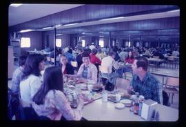
Image depicts a crowded cafeteria, most likely somewhere in Hudson's Hope, B.C. The slide is labelled "Camp at H.H."
Image depicts a view of Chetwynd, possibly from Highway 97.
Image depicts a truck on a bridge, possibly crossing over the Peace River.
Image depicts a wall of rock with visible sediment layers at an uncertain location in the Peace River Region, possibly near Hudson's Hope.
Image depicts what is either the Peace or Kiskatinaw River in Pine Valley, B.C.
Image depicts an unidentified individual standing in front of a rock face with visible sediment layers. Located somewhere in the Peace River Region, possibly near Hudson's Hope.
Image depicts the Peace River, possibly near Hudson's Hope, B.C.
Image depicts a street with a building which is labelled "MacKeigan Enterprises Ltd." in Hudson's Hope, B.C.
Image depicts a street in Hudson's Hope, B.C.
Image depicts what appears to be a Fire Hall in Hudson's Hope, B.C.
Image depicts two houses in Hudson's Hope, B.C.
Image depicts what appears to be a Fire Hall in Hudson's Hope, B.C.
Image depicts a road and numerous buildings in Hudson's Hope, B.C.
Image depicts what appears to be a motel in Hudson's Hope, B.C. The slide is labelled "camp HH."
Image depicts a cabin and several other buildings, possibly located in Hudson's Hope, B.C.
Image depicts the Peace River, possibly near Clayhurst or Hudson's Hope, B.C.
Image depicts the Clayhurst Ferry on the Peace River.
Image depicts grass burning at an uncertain location in the Peace River Region.
Image depicts a street of shops at an uncertain location somewhere in the Peace River Regional District. A pink and blue building, possibly a theatre, is labelled "Lux."
Image depicts a stretch of highway, possibly Highway 29 or 97.
Image depicts what is possibly the Peace River running parallel to a road, possibly Highway 29.
Image depicts a section of forest located somewhere in the Peace River Regional District of B.C.
Image depicts an area of forests and fields somewhere near Fort St. John, B.C.
Image depicts a section of the Peace River blocked off by the W.A.C. Bennett Dam. The dam itself is not visible in the image.
Image depicts a road with a guardrail and open fields somewhere near Dawson Creek, B.C.
Series consists of photographs relating to Ray Williston's life from childhood to recent times, air photographs of Prince George, photographs of Bangladesh, and a listing of photographs slated for use in Mr. Williston's biography "Forests, power and policy: the legacy of Ray Williston" written by Eileen Williston and Betty Keller.