2013.6.36.1.001.98
·
Pièce
·
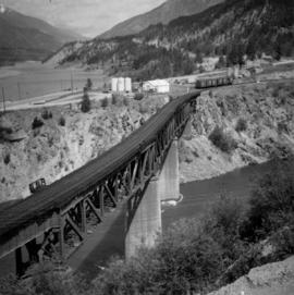
[May 1966}
Fait partie de David Davies Railway Collection
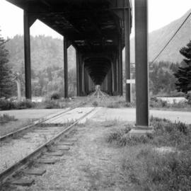
Photograph depicts a double-use bridge across the Fraser River at Hope, BCon the north side of the village. The upper deck carries road traffic and the lower deck the C.P.R. rail line leading to the Kettle Valley Line. View looking north.