Showing 849 results

Archival description
762 results with digital objects Show results with digital objects
2023.2.2.11.2 · File · 1995-1997
Part of Dr. Paul Sanborn fonds

This 3.5" floppy contains the following EP 1148 .TXT data sets from 1995-1997:

  • sbsapc.txt "Long-term soil productivity study, Sub-Boreal Spruce" Intact soil cores
  • sbsbd.txt "Long-term soil productivity study, Sub-Boreal Spruce" Bulk density mineral soil 0-20cm
  • sbsffc.txt "Long-term Soil Productivity Study, Sub-boreal Spruce" SBS forest floor bulk density and mass3
  • sbsfc.txt "Long-term Soil Productivity Study, Sub-boreal spruce" SBS forest floor chemistry
  • sbsmc.txt "Long-term Soil Productivity Study, Sub-boreal Spruce sites" SBS mineral soil chemistry
  • sbskgff.txt "Long-term soil productivity study, Sub-boreal spruce zone" SBS forest floor nutrient mass in kg/ha
  • sbskgmm.txt "Long-term soil productivity study, Sub-boreal spruce" SBS mineral nutrient mass in kg/ha
  • sbsom.txt "Long-term Soil Productivity Study, SBS" "SBS bole-only treatment, slash levels"
  • sbscr.txt "Long-term soil productivity study, Sub-boreal spruce zone" Timber cruise of initial stands
  • sbshtcr.txt "Long-term soil productivity study, SBS" Age vs height curves - pretreatment data (mature stand)
  • sbssi.txt "Long-term soil productivity study, Sub-Boreal Spruce zone" Carmean estimates of site indices for initial stand
  • sbstr.txt "Long-term soil productivity study, Sub-Boreal Spruce" Tree measurements
2023.2.2.10.1 · Sub-subseries · 1997-1998
Part of Dr. Paul Sanborn fonds

EP 660 was a conventional silvicultural trial established in 1967 which involved single species plantings of lodgepole pine (Pl), white spruce (Sw), and Douglas-fir (Fd) at different spacings. Three installations were established in the Prince George - Vanderhoof area: Buckhorn Ridge, Bobtail Road, and Chilco Creek.

General details on EP 660 are given by:
Coopersmith, D., M. McLellan, and J. Stork. 1997a. Experimental Project 660 overview of three experimental installations – a 30-year progress report. B.C. Min. For., Prince George For. Reg., Res. Note #PG-12.

Details on the Buckhorn installation are given by:
Coopersmith, D., M. McLellan, and J. Stork. 1997b. Experimental Project 660 30-year progress report: Buckhorn Installation. B.C. Min. For., Prince George For. Reg., Res. Note #PG-12-1.

2023.2.2.10.1.5 · File · 1997-1998
Part of Dr. Paul Sanborn fonds

File contains the following data sets:

  • S300FINL.XLS [Ministry of Forests lab data report: non-woody forest floor components]
  • S301FINL.XLS [Ministry of Forests lab data report: woody forest floor components]
  • 660FF97.xls [non-woody and woody forest floor components: mass / unit area (corrected to oven-dry basis)]
  • BUCKLIST.xls [table showing internal sample numbers corresponding to lab sample numbers used in MoF lab reports]
2023.2.2.10.1.6 · File · Aug. 1997
Part of Dr. Paul Sanborn fonds

File contains 8 slides from 2 rolls, taken August 1997:
Roll 1 - Buckhorn Ridge:

  • Slide 31 – Fd (2 x 2 m) – stand view
  • Slide 32 – Fd (2 x 2 m) – forest floor view
  • Slide 33 – Pl (2x 2 m) – stand view
  • Slide 34 – Pl (2 x 2 m) – forest floor view
    Roll 2 – Bobtail Road:
  • Slide 20 – Pl (2 x 2 m) – east plot, stand view
  • Slide 21 – Pl (2 x 2 m) – east plot, stand view
  • Slide 22 – Fd (2 x 2 m) – east plot, stand view
  • Slide 23 – Sw (2 x 2 m) – stand view
Field trip guidebooks
2023.2.1.03 · File · 1987-2016
Part of Dr. Paul Sanborn fonds

File consists of guidebooks for trips – both in Canada and international – that Paul Sanborn attended. Also includes guidebooks that were given to him by colleagues. Most of these guidebooks relate to soil science, but some deal with Quaternary and bedrock geology.

Includes the following items:

4th International Workshop on Disturbance Dynamics in the Boreal Forest. 2002. A Naturally Disturbing Tour of the Central Interior of British Columbia. August 12, 2002.

18th Biennial Meeting of the American Quaternary Association. 2004. Guidebook for Field Trips. Compiled by Rolfe D. Mandel. June 25, 28-30, 2004.

19th World Congress of Soil Science. 2010. Excursion 2: Brisbane Bayside, 1 August 2010.

19th World Congress of Soil Science. 2010. New Zealand “Volcanoes to Ocean”, Pre-Conference North Island Guidebook, 26th – 30th July 2010.

ASA-CSSA-SSSA International Annual Meeting. 2011. SSSA Soils-Geomorphology Field Tour: Blackland Prairies, Edwards Plateau, and Texas Central Basin. October 20-21, 2011.

Canadian Geophysical Union. 2002. Rocky Mountain highlights and dirt: C.G.U. Field Trip. May 18, 2002. Prepared by: C. Henderson.

Canadian Geophysical Union. 2006. The Burgess Shale and Rocky Mountain Highlights: C.G.U. Field Trip. May 14, 2006. Compiled by C.J. Collom.

Canadian Society of Soil Science. 2014. Soils and Landscapes of the Front Ranges, Foothills, and Great Plains: Field Guide. Compiled by Dan and Lea Pennock. May 2014.

Friends of the Pleistocene – Rocky Mountain Cell. 1995. Late Pleistocene – Holocene Evolution of the Northeastern Yellowstone Landscape: Field conference guidebook. August 25-27, 1995. Compiled by Grant A. Meyer.

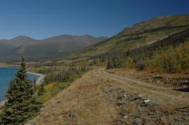
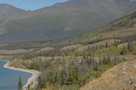
Froese, D., P. Matheus, and J. Rasic. 2003. Beringian environments and heritage of the Upper Yukon River: A field workshop from Dawson City, Yukon through Yukon Charley Rivers National Preserve, Alaska. May 30-June 3, 2003. [associated with International Mammoth Conference, Dawson]

Froese, D., R. Woywitka, L. Andriashek, D. Smith, and N. Atkinson. 2013. Field trip guide to the Quaternary geology and geoarchaeology of the Oil Sands region, NE Alberta: August 22-25, 2013. Canadian Quaternary Association.

Geological Association of Canada / Mineralogical Association of Canada. 2016. Veins to Valleys: the Klondike District. Field trip leaders: Jim Mortensen, Jeffrey Bond, Peter Tallman, Grant Zazula. May 28-31, 2016.

Luttmerding, H.A. 1992. Vertisolic soils field tour, British Columbia portion. August 19-23, 1992. BC Ministry of Environment, Lands and Parks.

Morison, S.R., C.A.S. Smith. 1987. XIIth INQUA Congress Field Excursions A20a and A20b: Research in Yukon. National Research Council of Canada, Ottawa.

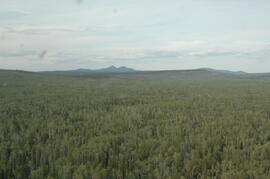
Northwest Forest Soils Council Field Trip. 2001. Boreal Forest Soils in a Changing Climate. July 9-11, 2001. Fairbanks, Alaska.
Tarnocai, C., C.A.S. Smith, and C.A. Fox. 1993. International Tour of Permafrost Affected Soils: the Yukon and Northwest Territories of Canada. Research Branch, Agriculture Canada, Ottawa. https://sis.agr.gc.ca/cansis/publications/surveys/yt/ytps/ytps_report.pdf

Sanborn, P. 1995. Watershed Restoration in the Olympic National Forest, Hood Canal Ranger District, Washington. September 17-18, 1995. International Conference of Society for Ecological Restoration.

2023.2.2.10.2.4 · Item · 1995
Part of Dr. Paul Sanborn fonds

This document is an unpublished 1995 UNBC co-op work term report by B. Roosdahl entitled "Forest Floor Development on Bladed Trails in the SBS: A retrospective study of the Archie Creek site". B. Roosdahl was a co-op student who was one of the student research assistants involved in the field work at the Archie Creek site in fall 1995.

Forest soil sulphur research
2023.2.2.1 · Subseries · 1988-2011
Part of Dr. Paul Sanborn fonds

Forest soil sulphur research was a continuing interest for Dr. Paul Sanborn for more than 30 years, beginning at UBC in the mid-1980s when he took a graduate course in Forest Soils from Dr. Tim Ballard. Among the things that he learned was that soils in much of BC were deficient in sulphur (S). Simultaneously, he became aware of the large amount of research on prescribed fire in BC forests, with broadcast burning being the main method of site preparation across much of the province at that time.

Sanborn undertook various projects in this area of research:

  1. UBC Postdoctoral Project on effects of prescribed fire on sulphur in forest soils (1988-90)
  2. Cluculz retrospective study (E.P. 886.10) with the BC Ministry of Forests and UNBC
  3. Sulphur stable isotope tracer study (E.P. 886.15) with the BC Ministry of Forests and UNBC
2023.2.2.7.4 · File · 2009
Part of Dr. Paul Sanborn fonds

In July 2009, Dr. Paul Sanborn undertook the first soils field research at the Fort Selkirk volcanic field in central Yukon, with helicopter support and funding from the Yukon Geological Survey. This file includes digital photographs of the 2009 field work at the Ft. Selkirk site. Some of the digital photographs have been annotated as PDFs.

  • Ft Selkirk 110114069.xls [particle size analysis data, CANTEST]
  • S1090final.xlsx [chemical analysis data, Ministry of Forests & Range, Analytical Chemistry Laboratory]
  • S1112final.xlsx [chemical analysis data, Ministry of Forests & Range, Analytical Chemistry Laboratory]
  • Ft Selkirk 2009 soils data (updated Sept 15, 2010 and April 10, 2023).xls [consolidated lab data for all 2009 samples]
2023.2.2.7.3 · File · 2009-2023, predominant 2009-2010
Part of Dr. Paul Sanborn fonds

In July 2009, Dr. Paul Sanborn undertook the first soils field research at the Fort Selkirk volcanic field in central Yukon, with helicopter support and funding from the Yukon Geological Survey. This file includes the following data sets gathered from the research:

  • Ft Selkirk 110114069.xls [particle size analysis data, CANTEST]
  • S1090final.xlsx [chemical analysis data, Ministry of Forests & Range, Analytical Chemistry Laboratory]
  • S1112final.xlsx [chemical analysis data, Ministry of Forests & Range, Analytical Chemistry Laboratory]
  • Ft Selkirk 2009 soils data (updated Sept 15, 2010 and April 10, 2023).xls [consolidated lab data for all 2009 samples]
2023.2.2.7 · Subseries · 2009-2010, 2023
Part of Dr. Paul Sanborn fonds

For July 1-7, 2009, Dr. Paul Sanborn did the first soils field research at the Fort Selkirk volcanic field in central Yukon, with helicopter support and funding from the Yukon Geological Survey.

Initial findings were published in the 2009 edition of Yukon Exploration and Geology, but this paper did not include most of the laboratory data:
Sanborn, P., 2010. Soil reconnaissance of the Fort Selkirk volcanic field, Yukon (115I/13 and 14). In: Yukon Exploration and Geology 2009, K.E. MacFarlane, L.H. Weston and L.R. Blackburn (eds.), Yukon Geological Survey, Whitehorse, Yukon. pp. 293-304. https://emrlibrary.gov.yk.ca/ygs/yeg/2009/2009_p293-304.pdf [Note that in Fig. 1, the labels for Camp 1 and Camp 2 on map are transposed; Camp 1 should be to the east of Camp 2.]

2023.2.2.13.2.68 · Item · 9 Jul. 2007
Part of Dr. Paul Sanborn fonds

This image is part of the return trip sequence of aerial images obtained on the helicopter flight leaving the Klutlan Glacier study site. On the return leg at the end of the day, the flight initially went upvalley to pick up another party. This image was taken after the helicopter turned north to return to base camp.

2023.2.2.13.2.69 · Item · 9 Jul. 2007
Part of Dr. Paul Sanborn fonds

This image is part of the return trip sequence of aerial images obtained on the helicopter flight leaving the Klutlan Glacier study site. On the return leg at the end of the day, the flight initially went upvalley to pick up another party. This image was taken after the helicopter turned north to return to base camp.

2023.2.2.13.2.70 · Item · 9 Jul. 2007
Part of Dr. Paul Sanborn fonds

This image is part of the return trip sequence of aerial images obtained on the helicopter flight leaving the Klutlan Glacier study site. On the return leg at the end of the day, the flight initially went upvalley to pick up another party. This image was taken after the helicopter turned north to return to base camp.