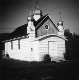
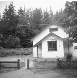
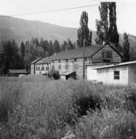
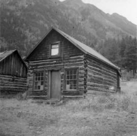
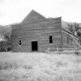
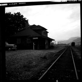
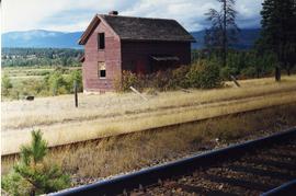
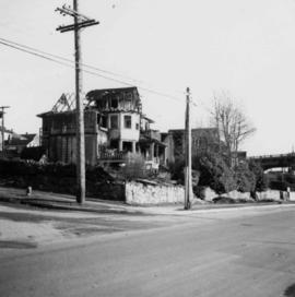
Showing 498 results

Archival description
2013.6.36.1.074.09 · Item · Sept. 1966
Part of David Davies Railway Collection

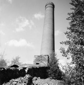
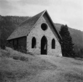
Photograph depicts "Butterchurch" that was built in 1870 under the direction of Father Rondeault of the Oblate Order for missionary work among the Comiakan Natives, a tribe of about 100. It was abandoned by about 1880 because of its location. It was recently restored as a historical shrine.

Hotel in Carmi
2013.6.36.1.075.06 · Item · [23 June 1979]
Part of David Davies Railway Collection

Photograph taken at Carmi, an old village between Rock Creek and Kelowna. Visible is an old hotel that was up for sale.

Meat Market store, Coalmont
2013.6.36.1.076.07 · Item · 12 Sept. 1971
Part of David Davies Railway Collection

Photograph taken in Coalmont, a ghost village that was livening up. Visible is the Meat Market store, the only surviving building on the frintage of this block, adjacent to the hotel.

Stave Falls School
2013.6.36.1.076.13 · Item · [June 1968]
Part of David Davies Railway Collection

Photograph depicts Stave Falls School, a type of rural school that was falling into disuse. This one was still in use and cared for.

2013.6.36.1.026.10 · Item · [22 June 1979]
Part of David Davies Railway Collection

Photograph depicts a section shanty at the CPR McCulloch depot located at mile 76.6 on the Carmi Subdivision. The rail here is Canada Algoma, 85 lbs. and dated to 1940. The view is looking southeast, with Hydraulic Lake in the background.

Midway CPR depot
2013.6.36.1.028.01 · Item · 17 Sept. 1970
Part of David Davies Railway Collection

Photograph depicts the Midway CPR depot located at the eastern terminus of Kettle Valley Railway. It was a subdivisional point with way freights originating at Nelson and Penticton, and running west and east respectively to Midway. There are two to 3 freights weekly from Nelson and 1 to 2 from Penticton. It lost its agency in June 1969 and all small freight [

CPR line at Greenwood
2013.6.36.1.028.03 · Item · 17 Sept. 1970
Part of David Davies Railway Collection

Photograph depicts the CPR line at Greenwood. There is no representative of the CPR in Greenwood now and the agency expired in June 1969. There appears to be 2 to 3 way freights per week from Nelson to Midway. The view is looking north and shows the depot house.

2013.6.36.1.028.11 · Item · 17 Sept. 1970
Part of David Davies Railway Collection

Photograph depicts the CPR line at Eholt, located at mile 108.7 from Nelson on the Boundary Subdivision. It was a formerly bustling junction with the left-hand spur leading to Phoenix. Nor it only has 3 way freight trains a week from Nelson to Midway. The view is looking west.

2013.6.36.1.028.28 · Item · 18 Sept. 1970
Part of David Davies Railway Collection

Photograph depicts a freight shed at the Nelson CPR depot. There is a terminal spur on the south side of the shed and road trucks on the north side. The road side of the main depot building can be seen in the left rear of the photo. The view is facing east.

Nelson CPR Depot
2013.6.36.1.028.41 · Item · 18 Sept. 1970
Part of David Davies Railway Collection

Photograph depicts the Nelson CPR depot . All the freight traffic work is handled at this office for a wide area. The view is looking west.

Replacement rail bridge
2013.6.36.1.091.02 · Item · Sept. 1998
Part of David Davies Railway Collection

Photograph depicts a replacement rail bridge. Forms sat on a temporary pile of dirt, which in turns sat on a road bed of a new highway that had just been cut.

New CN overpass
2013.6.36.1.091.08 · Item · Sept. 1998
Part of David Davies Railway Collection

Photograph depicts a new CN overpass in Campbell Creek. The grade crossing at the newly created service/business road was built on the south side of a road/rail complex.

Queensborough bridge
2013.6.36.1.156.03 · Item · [July 1994]
Part of David Davies Railway Collection

Photograph depicts railway track previously owned by BCER. It led onto the east end of Lulu Island and then to Annacis Island. Looking from the Naew West River Walk to the Queensborough bridge that was protected by signals and had a high chain link fence to deter pedestrians. It was likely that the rail was only used at night. Originally built by Canadian Northern Railway to reach Steveston, circa 1917.