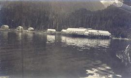
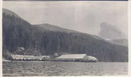
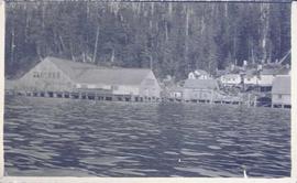
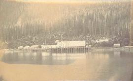
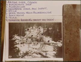
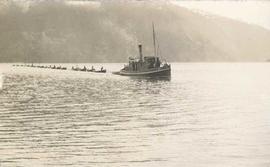
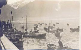
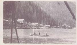
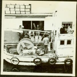
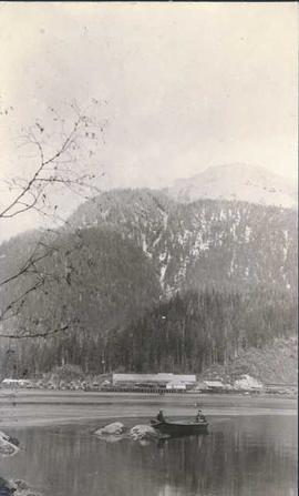
Photograph depicts a tug boat hauling a line of small fishing boats across the water with a mountain in the background. Annotation on verso of photograph states: "Tow of Cannery Fishing boats"
Photograph depicts several fishing boats on the water with a wooden dock in the foreground to the left of the image.
Photograph depicts two men seated in front of a row of hanging fish.
Photograph depicts three men standing behind salmon hung to dry on a wooden deck. Annotation on recto of photograph states: ""Spring Salmon" Rivers Inlet, B.C"
Photograph depicts a two men standing on piles of whale bones at a whaling station. Annotation on verso of photograph states: "Pile of whale bones, Whaling station, Vancouver Is."
Photograph depicts three men at a whaling station with debris on the ground and a large elevated tank in the background.
Photograph depicts three men fishing in a boat with a cannery and wooden buildings along the forested shoreline in the background.
Photograph depicts a building under construction with wood planks on the dock in the foreground and a forested area in the background.
Photograph depicts a cannery on wood pilings with several other buildings along a forested shoreline with a body of water and boat in the foreground.
Photograph depicts wood planks piled on a dock with wood buildings built along the shoreline of the background.
Photograph depicts cannery buildings on wooden pilings with a body of water in the foreground and a forested area in the background.
Photograph depicts a view of cannery buildings from the shoreline with mountains in the background.
Photograph depicts cannery buildings on pilings with a body of water in the foreground and a deforested area behind the shoreline.
Photograph depicts a distance perspective of several cannery buildings with a body of water in the foreground and a mountain range in the background.
Photograph depicts several cannery buildings on pilings with water in the foreground and a forested area in the background.
Photograph depicts cannery buildings on pilings with a body of water in the foreground and tree covered mountains in the background.
Photograph depicts a cannery on pilings with a body of water in the foreground and houses and trees in the background.
Photograph depicts a cannery on pilings with a body of water in the foreground with a forested area in the background.
Photograph depicts a cannery on pilings over the water with other cannery buildings in the background.
Photograph depicts a man standing on the deck of a sailboat with a view of a cannery along the shoreline of Ocean Falls with mountains in the background.
Photograph depicts piles of wood planks and log booms in the foreground with a waterfall in the background.
Photograph depicts several log booms on the water with a forested area in the foreground.
Photograph depicts a two men on small fishing boat, called a gillnetter, moored at a fish packer dock with six men at work. One man is transferring materials from crates into large bags while several others watch. Handwritten annotation in pen on verso reads: “Fish Packer”
Photograph depicts a wharf and buildings along the shore of an unidentified fishing community with a forested environment visible in the background.
Photograph depicts families at Dedrickson’s Camp at Drury Inlet standing on a wharf on baptism day.
Photograph depicts an unidentified man holding the lever of a piece of wharf machinery on a dock.
The images consists primarily of 130+ photographs taken by or belonging to Reverend R.W. Large, MD which depict communities on the Northwest Coast between approximately 1898 and 1920 including Bella Bella, Rivers Inlet, and Port Simpson, including native villages in which Reverend Large worked. Images show scenes of native fishing, canneries, mission hospitals, churches, girls schools, portraits of native families, and Northwest Coast totems. Other images include 25+ photographs and postcards from the Large family depicting ships and boats on the North Coast.
Consists of 165 black and white photographs depicting Northwest Coast communities including Bella Bella, Rivers Inlet, Port Simpson, and Prince Rupert between approximately 1900 and 1920. Also includes postcard images of ships and boats on the North Coast belonging to the Large family, from Reverend Large's son Dr. R.G. Large. Also includes 39 colour slides ca. 1960 of ship scenes and weather balloon launches from the Dr. R.G. Large family.
Sin títuloPhotograph depicts two unidentified men fishing in a boat in front of Namu Cannery with a forested mountain visible in the background.
Photograph depicts a wooden flume funneling water in a forested area. Photo is adhered to paper backing. Original annotations on verso of photo are covered by paper mounting. Typed annotation on recto of paper reads: “First wash for gold by Hixon Creek Cariboo Gold Co. Across Hixon from Quesnel Quartz up the hill. North side of creek 1930’s”
Photograph depicts a wooden flume funneling water in a forested area. Photo is adhered to paper backing, upon which handwritten annotation on recto reads: “First wash for gold by Hixon Creek Cariboo Gold Co. Across Hixon from Quesnel Quartz up the hill. North side of creek 1930’s”
Photograph depicts a dam and spillway obstructing a creek. Photo is adhered to paper backing, upon which handwritten annotation on recto reads: “This is the dam and spillway about nine miles up Hixon Creek belonging to the Hixon Creek Cariboo Gold Co., whose main camp on Hixon Creek was at the falls. A fellow Sterling or Bill Tordiffe & I took a contract to cut the logs for this dam in January 1934. The first few winters Quart [sic] Quesnel Quartz had to shut down for snow”
Photograph depicts two wooden buildings in a snow covered forest environment. Photo is adhered to paper backing, upon which handwritten annotation on recto reads: “Quesnelle Quartz mining Company Hixon, B.C. Taken in mid nineteen thirties. Powerhouse from rear. Present day (1973) logging road would run through powerhouse at immediate rear of it at which you are looking. Tom Marsh Box 156 Squamish BC V0N 3G0 December 1978”
Photograph depicts two wooden buildings in a snow covered forest environment. Photo is adhered to paper backing, upon which handwritten annotation on recto reads: “Quesnelle Quartz Mining Co. Hixon BCTaken in mid 1930ies. Power house from rear. Present day (1973) Logging road would run through powerhouse at immediate rear of it at which you are looking. Tom Marsh Box 150 Squamish BC 1978.12”
Photo is adhered to paper backing, upon which handwritten annotation on recto reads: “Placer mining Hixon B.C. Hungry 30ies. This picture taken on top of hill across from Quesnel Quartz Mine maybe 800 ft west of Quartz taken approx 45 yrs ago (1933) 1978.12.19”
Photograph depicts a snow-covered forest clearing with six structures and a truck. Buildings have been numbered 1-8 with pen. Original handwritten annotations on verso of photograph are signed by Tom Marsh. Photograph is taped to paper. Typed annotation on recto of paper reads: “1. Bridge over creek. 2. Blacksmith shop. 3. Powerhouse. 4. Headframe over 200’ shaft. 5. Office 6. Water tanks from powerhouse. 7. Bunkhouse. 8. Truck. 9. Cookhouse behind #6 cannot be seen. We were always able to find the cookhouse even though hidden in this picture. Taken about 1935 by Russell Ross, supt. Quesnel Quarts Mine. Tom Marsh, Box 156, Squamish B. C.”
Photograph depicts a dam and wooden spillway along a creek. Annotation on verso reads: "This is the dam and spillway about 9 miles up Hixon Creek belonging to the Hixon Creek Cariboo Gold Co. Original handwritten annotations on verso of photograph are signed by Tom Marsh and covered by mounting the photo on paper. Photograph is taped to paper. Typed annotation on recto of paper reads: “This is the dam and spillway about nine miles up Hixon Creek belonging to the Hixon Creek Cariboo Gold Co., whose main camp on Hixon Creek was at the falls. A fellow Sterling or (Bill) Tordiffe & I took a contract to cut the logs for this dam in January 1934. The first few winters Quesnel Quartz had to shut down for snow."
Annotated overview of the Quesnel Quartz Mine Camp, with buildings numbered and a corresponding legend provided. Annotation on recto of photograph states: "1. BRIDGE OVER CREEK 2. BLACKSMITH SHOP 3. POWEROUSE 4. HEADFRAME OVER 200' SHAFT 5. OFFICE 6. WATER TANKS FROM POWERHOUSE 7. BUNKHOUSE 8. TRUCK 9. COOKHOUSE BEHIND #6 CANNOT BE SEEN" Additional annotation associated with photograph states: "We were always able to find the cookhouse even though hidden in this picture. Taken about 1935 by Russell Ross Supt. Quesnel Quartz Mine"
Two men stand below a large upright hose that is spraying a powerful stream of water against the side of a rocky hillside. Annotation on verso of photograph states: "Placer Mining Hixon (Hungry Thirties) This picture taken on top off Hill Across from Ques. Qarts. Maybe 800 Ft. west of Quarty There pictures taken approx 45 years ago Your friend(?) Box 156 Squamish B.C. Dec. 19/78"
Film is a dramatization of the construction of the fourth generator at the Kemano hydro-electric power plant in Kitimat
Photograph depicts large trailer truck parked at what is believed to be the loading station on the Cassiar plant (possibly in mill building).
Photograph depicts large swath of dark waste down mountainside to right of valley. The waste dump is believed to be visible at top of swath on right of image. Bench mining visible on the North and South peak in background. Handwritten annotation on recto of photograph: "Oct. 25 / 65 4:25 PM."
Photograph depicts Cassiar mountain range, partially visible.
Photograph depicts construction work in plant site, mountains in background. Corresponding note on accompanying photo description page: "August 2nd: 1. Shop foundations in foreground. Mill in background."
Photograph depicts numerous illegible sign posts on dirt road.
Map depicts location of treasure hidden between Clearwater and Clemina, BC.
Map depicts the Shuswap Lakes, Rogers Pass, Kamloops, Yellowhead Pass, Thompson Valley, and the Nicola Valley. Also includes the first clues to a treasure hunt.
Six men visible on hillside and wood plank roadway, working together to roll cut logs down the hill and load them onto the truck.
Handwritten annotation in pencil on verso read: “logs up to 32 feet in length.”
Fonds consists of textual, photographic, cartographic, electronic and promotional films/video recordings related to the mining operations of Cassiar Asbestos Mining Corporation (CAMC) and creation of Cassiar townsite. CAMC records primarily consist of records related to mining operations including construction, engineering, daily mining operations, administration of CAMC, tallies of extractions, labour and union activities, corporate events and visits by dignitaries. Townsite records are primarily visual representations of townsite construction, including the creation of health, education and community services including Cassiar's private hospital, school, library, as well as townsite images. Photographs include documentation of natural and man-made landscapes within the Cassiar region of Northern BC. Other holdings include a near complete run of Cassiar's community newspaper.
Sin títuloPhotograph depicts three men sitting on large logs on a logging truck. The men are believed to be, from left to right: unknown, Al Lassmann, Jack Phelps.