Mostrando 321 resultados
Archival description
Prince George from the Ginter House

Ginter Property
GTP/CN East of P.G.
GTP/CN East of P.G.

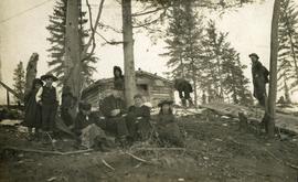
Cut Trees

Houses

A Street

Houses

A Street

Cottonwood Island

Stream on Cottonwood Island

Fishing

Ash Street and Patricia Boulevard

Hudson Bay Company Buildings at Fort George

View of Hudson Bay Company buildings from the burial grounds of the Lheidli T'enneh Nation at Fort George
"Settlers", South Fort George

Arrival of first steamer in 1910, South Fort George

First cricket match

Drying sugar

Nechako River at Fort George
Goose Country, Fraser River
Goose Country, Fraser River

Man bathing outside near log cache building

Crossing portage at Giscome Portage

V.L.A. Proposed Zoning as Recommended by the City Planner, April 20, 1976

Vancouver Carney Study
![Proposed Land Use 1978-2012, Official Community Plan, City of Prince George [1982 Amendment]](/uploads/r/northern-bc-archives-special-collections-1/6/6/9/669fc9dc3b840a6896f6a2a968a948283a3c5d972b6b48d718b427a57ebbe67f/2023.5.1.22_-_1982_-_Proposed_Land_Use_1982-2012_JPG85_tb_142.jpg)
Proposed Land Use 1978-2012, Official Community Plan, City of Prince George [1982 Amendment]

City of Prince George - East - Schedule B of the Official Community Plan, Bylaw No. 5909

City of Prince George - Soil Removal and Deposit Bylaw No. 7022 - Schedule A

City of Prince George - Schedule C of the Official Community Plan - Long Range Land Use Map

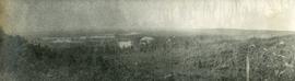
View of Fort George, B.C. from Above

CNR station, Prince George, BC
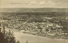
South Fort George in 1914

Hotel Northern in South Fort George
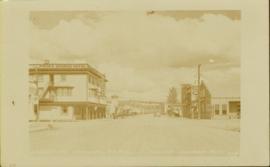
George Street looking north, Prince George, BC

The SS Operator and Conveyor at Fort George, BC

Aerial View of Prince George, BC, 1936

View of South Fort George, BC, 1912

View of Prince George, BC, 1914

View of Prince George, BC, 1914

Nechako Bridge, Prince George, BC

Ski Jump at Connaught Hill, Prince George, BC
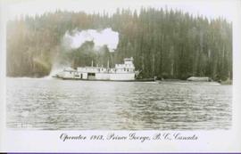
S.S. Operator at Prince George, BC
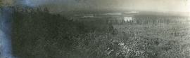
Geographic Features
Geographic Features

Overview of Prince George, BC

Prince George at Night

Prince George near Airport Road

Tabor Lake Subdivision

View from Gunn Point

View from Gunn Point

View from Gunn Point