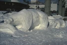
Image depicts a snow sculpture of a bear, possibly during the Winter City Conference, in Prince George, B.C. Taken at the Prince George Civic Center. Map coordinates 53°54'45.6"N 122°44'59.6"W
Slide depicts a black bear eating garbage by wooden outbuildings, possibly at the Aleza Lake Experiment Station.
Image depicts a view of Blackburn Schools, possibly taken from Tabor Mountain.
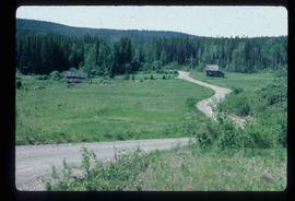
Image depicts an abandoned cabin and shed on Blackwater Road.
Item consists of transcript of interview with writer, film maker, and guide outfitter Andy Russell conducted by Bob Harkins at Prince George Radio Station, CJCI regarding Russell's experiences with guiding in Northern Rockies. Russell also discusses his new work The Life of a River and discusses the environmental impact of hydro-electric development on rivers
Harkins, BobItem consists of transcript of interview with Bob Nelson of the Caledonia Ramblers who discusses the hiking groups activities in the Prince George region
Harkins, BobItem consists of transcript of interview with Bruce Douglas conducted by Bob Harkins at Prince George Radio Station, CJCI regarding his career in early railways in Prince George region and memories of the sawmills in Giscome area..
Harkins, BobItem consists of transcript and tape summary of interview with trapper Hank Witter who discusses his life as a trapper in Northern BC. c.1920s-c.1960s.
Harkins, BobItem consists of transcript of taped interview with Prince George Fire Chief Harold Dornbierer conducted by Bob Harkins at Prince George Radio Station, CJCI regarding his career in fire protection. Dornbierer also discusses history of of the fire department of Prince George.
Harkins, BobItem consists of transcript of interview with writer and guide outfitter Jack Boudreau conducted by Bob Harkins at Prince George Radio Station, CJCI regarding Boudreau's experiences with grizzly bears. Boudreau also discusses other guide outfitters and hunters from Northern British Columbia.
Harkins, BobItem consists of interview with Joe Carty who discusses the trapping industry in the Prince George region
Harkins, BobItem consists of transcript of interview with Marilyn Rack who discusses birding and farming in Prince George region..
Harkins, BobItem consists of transcript and tape summary of interview with Tom Waller who discusses fire protection and forest fires in the Prince George and Peace River region.
Harkins, BobItem consists of transcript of interview with Ambrose Trick discussing the sawmilling and logging industry in Northern BC, c.1930s-1950s including the 1953 strike; the creation of the Northern Interior Lumbermen's Association. Trick also discusses his involvement in railway work, his involvement with hockey in Prince George and discusses Prince George politics, prominent personalities in the North.
Harkins, BobFile consists of two original copies of the Volume 17, No. 3 issue of UBC Forestry's Branch Lines newsletter from December 2006. This issue features various articles relating to the Aleza Lake Research Forest, including the front page article, "Percy Barr's Research Forest Legacy". Also includes correspondence relating to the newsletter issue.
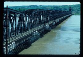
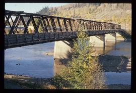
Image depicts a bridge in Prince George, B.C.
Image depicts a bridge in Prince George, B.C.
Image depicts a bridge in Prince George, B.C.
Item is a BC Forest Service beverage coaster.
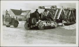
Photograph depicts man believed to be Bob Baxter on bulldozer by large framework structure in snow. House stands in background as well as a truck with "CITY OF PRINCE GEORGE" visible on its passenger door. Handwritten annotation on recto of photograph: "Civic centre 1948."
Slide depicts a bulldozer clearing ground, likely at the Aleza Lake Experiment Station.
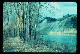
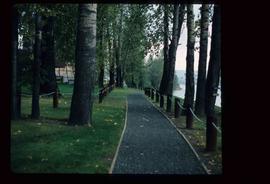
Image depicts a nature trail along the Nechako River at Island Cache looking west with the cutbanks in the background. Map coordinates 53°55'36.2"N 122°45'11.8"W
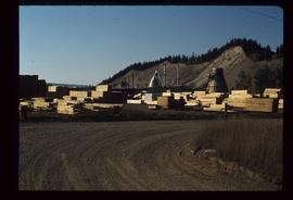
Image depicts numerous piles of wood planks at the Canadian National Railway Yards in Prince George, B.C. The cutbanks are seen in the background.
Image depicts a small slope on Carney Hill in Prince George, B.C.
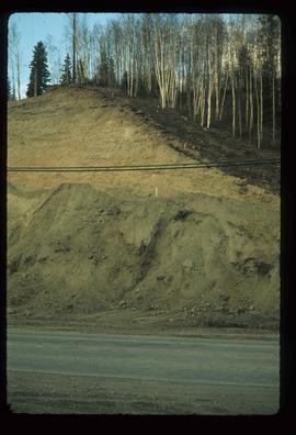
Image depicts miocene gravels on Carney Hill in Prince George, B.C.
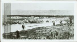
Photograph depicts landscape with cleared land in foreground, river in middle, building and trees in background.
Handwritten annotation on verso: "Central Fort George 1911".
File consists of photocopied material regarding the Aleza Lake Experimental Station from the Canadian Forest Service Archives in Victoria. Also includes handwritten notes.
Photographs are panoramas taken from the Churchill BC Forest Service Lookout, located at latitude 54°04' and longitude 122°16'. The photographs were bound together and include a transparent grid that was intended to be used for locating forest fires.
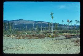
Image depicts a highway, and a section of mountain in the background which is bare due to clear-cut logging. It is possibly somewhere near Prince George, B.C.
Image depicts a logging area, and a section of mountain in the background which is bare due to clear-cut logging. The slide is also labelled "logging show." It is possibly somewhere near Prince George, B.C.
Slide depicts a cleared area at the Aleza Lake Experiment Station with plant regeneration.
Image depicts a clearing at Island Cache.
Slide depicts a cleared area in a forest, likely at the Aleza Lake Experiment Station.
Slide depicts a detonation in an area of cleared ground in a forested area, likely the Aleza Lake Experiment Station. Work may have been undertaken for roadbuilding activities at the Experiment Station.
File consists of:
- Draft "Joint Protocol for Co-ordination of Research and Operational Planning Activities at the Aleza Lake Research Forest" between the BC Ministry of Forests, Small Business Forest Enterprise Program, and Northwood Pulp and Timber Ltd. (7 Feb. 1996)
- Application for an Exemption to a Silvicultural Prescription and Logging Plan (19 Dec. 1996)
- Amendment to Special Use Permit #19070, Bowron Floodplain Addition, Aleza Lake Research Forest (1 Aug. 1995)
Image depicts a section of the Heritage Trail on Cottonwood Island in Prince George, B.C.
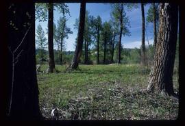
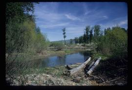
Image depicts Cottonwood Island.
File contains slides depicting Cottonwood Island in Prince George, B.C.
Image depicts Cottonwood Island.
File consists of records created and collected by Kent Sedgwick regarding Cottonwood Island. Includes: "Welcome to Cottonwood Island Nature Park" brochure [197-?]; "A Brief History of Cottonwood Island Park" by Kent Sedgwick (2001); "History of Cottonwood Island Park and Side Channel Restoration" (2001?); a Regional District of Fraser-Fort George "Notice of Public Hearing" (1973); an outline for "Cottonwood Island Brief" (1973); an original copy of the "Cottonwood Island Study" by the Regional District of Fraser-Fort George (1975); annotated hand-drawn small maps of Cottonwood Island; photocopied aerial photographs; and photocopied newspaper clippings about Cottonwood Island and Island Cache. Also includes 15 colour photographic prints and accompanying negatives taken of Cottonwood Island by Bob Nelson.
File consists of proposals and documents by Kent Sedgwick regarding Cottonwood Island. Includes: "Proposal for Cottonwood Island as a Park Reserve" and "Some Comments on the Cottonwood Island Park Designation of the Official Community Plan".
File consists of records created and collected by Kent Sedgwick regarding Cottonwood Island in connection with his employment with the City of Prince George Planning Department. Includes briefs, proposals, memoranda, correspondence, newspaper clippings, questionnaires, legal correspondence, meeting minutes, and photocopied excerpts from maps/plans. Also includes two polaroid photo prints depicting garbage in Cottonwood Island Park circa 1979. Highlights include:
- Prince George Kiwanis Club, "Brief to City Council, City of Prince George, re: Nechako Riverfront Park", 12 Mar. 1973.
- New Caledonia Institute of Environmental Studies, "Proposal for Cottonwood Island as a Park Reserve", Summer 1973.
- "Cottonwood Island Study", [before 1975] (photocopy).
- Mary Fallis, "Letter to the Editor of The Citizen", 5 Mar. 1976 (photocopy).
- City of Prince George Planning Department, "Ownership, Legal and Assessment Data - Private and School District Properties within the Proposed Replot Area [Island Cache]", 11 Oct. 1978.
- "Assessed Values for City and Crown Lands within the Proposed Replot Area North of First Ave" (handwritten table), 16 Oct. 1978.
File consists of maps and plans depicting the Cottonwood Island area in Prince George. Includes:
- "Plan of Subdivision pursuant to the replotting provisions of the Municipal Act of Parcel A of Plan 25046, of District Lots 343, 662, 1511, 4736, and 7813, Cariboo District" by McWilliam, Whyte, Goble & Associates B.C. Land Surveyors for the City of Prince George, 26 July 1979 (reproduction on 2 sheets)
- "Cottonwood Island" original draft map with annotations by Kent Sedgwick; the map may have been created by Sedgwick during his time as Senior City Planner with the City of Prince George [197-?]
- "Prince George B.C., Fraser Subdivision, Mile 146.05" plan for Canadian National Railways by Lockwood Survey Corporation Ltd., 1967. This very large technical drawing shows CN leases and private property buildings on Island Cache in detail.
- McWilliam-Whyte-Goble & Associates, B.C. Land Surveyors, "Plan Showing Sections in Proposed Lakeland Mill Site", July 1978 (original reproduction).
- Carroll, Hatch & Associates, "Lakeland Mills (1973) Ltd., Prince George, B.C., Stud Mill Studies, Site Plan", 31 July 1978 (original reproduction).
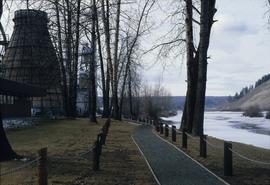
Image depicts a nature trail in Cottonwood Island Park by a beehive burner. Map coordinates 53°55'23.6"N 122°43'53.8"W
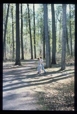
Image depicts a couple walking through a nature trail in Cottonwood Island Park. Map coordinates 53°55'23.6"N 122°43'53.8"W
File consists of records created and collected by Kent Sedgwick regarding the removal of Island Cache residents after the 1972 flood and suggestions for creation of park on Cottonwood Island. The majority of the file consists of reproduced City of Prince George records. Includes memoranda to and from the mayor, city manager, and aldermen; meeting minutes of the Flood Committee; city reports on Cottonwood Island and the flooding situation; a listing of Cottonwood Island properties offered for sale to the municipality; a report entitled "Cottonwood Island - A report on desirable land use" (Nov. 1970); a "Proposal for Cottonwood Island as a Park Reserve" (1973); a document from the Cottonwood Island Study Committee; correspondence from Mary Fallis; and a City of Prince George memorandum regarding a Public Hearing.
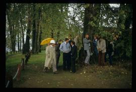
Image depicts a crowd of people in Cottonwood Park in Prince George, B.C.
Image depicts a the Cottonwood Island Nature Park sign and map in Prince George, B.C.
Image depicts a the Cottonwood Island Nature Park sign and map in Prince George, B.C.
