2011.3.2.12
·
Item
·
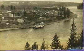
1924
Part of North Coast & Central BC Postcard Collection
River in foreground, railroad and city in mid ground and hill in background. Printed annotation on recto reads: “Prince George. B.C. 1924”