This photograph album consists of photographs of remote police barracks at Mile 47 and Mile 29; early settlements and/or mercantile stores at Tete Jaune Cache, McBride, Sand Creek, Fort George and South Fort George; Grand Trunk Pacific Railway forestry and railway camps; scows and paddlewheel conveyors on the Fraser River; automobiles; community leisure activities; as well as, images of the Bourchier family. The following South Fort George establishments are identifiable within these photographs: Empress Hotel, Ah Yee General Merchant, German Bakery, Northern Hotel, South Fort George Drug Store & Post Office, St. Michael’s Church, Prince George Hotel, Ford Monarch dealership, Astoria Hotel, and King George V Elementary School. Identified geographic locations featured in these photographs include: Tete Jaune, Upper Fraser, Mile 47, Mile 29, Fraser River, Mt. Robson, McBride, Sand Creek, Glacier Mountain, Moose River, Giscome Portage, Pott Falls, Red Deer River, Grand Canyon, Summit Lake, Canoe Pass, Connaught Hill, Nechako Bridge, and Island Cache.
Bourchier, Alan K.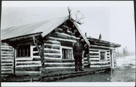
Photograph depicts man standing in front of log building with the sign "RCMP" above center window. Moose antlers mounted on roof. Forest visible in background on right.
This photograph album consists of photographs of members of both the Baxter and Taylor families including (the Baxters): Violet (nee Taylor) Allan, Fred, Dick, Edna, Harriet and Bob Baxter; Bea (nee Baxter) Skaret and Margaret (nee Baxter) Lund; and (the Taylors): Hermina, Ellen, Lucy, Arthur (and Art's wife and son), Virginia, Tom, and Hugh Taylor. Identified geographic locations include Summit Lake, Mud River, California, Cottonwood River, Cluculz Lake, and Prince George. Subjects identified in this album include: family gatherings, picnics, automobiles, working horse team, snowshoeing, landscape vistas, and a King George V Elementary School class photo. Textual items include two booklets and a brochure.
Baxter, Violet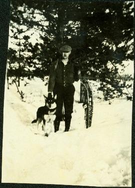
Percy Garland (married Ellen Taylor) stands with snowshoes and Husky dog in snowy area in front of two trees.

Image depicts Summit Lake.
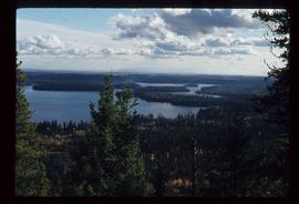
Image depicts Summit Lake.
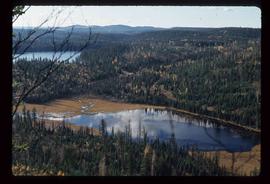
Image depicts Summit Lake.
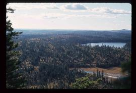
Image depicts Summit Lake.
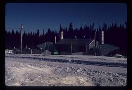
Image depicts a gas compression station located at Summit Lake, north of Prince George, B.C.
Subseries contains material collected and created by Kent Sedgwick for research regarding various areas surrounding Prince George. Includes materials on the Crooked River area; Summit Lake; Ferguson Lake; Chief Lake; Salmon Valley; Mud River; Beaverly; Buckwater; Chilako River; Indian Reserve no. 4; Blackburn; Pineview; Stone Creek; Red Rock; Woodpecker; and Hixon. The files primarily consist of research notes and photographs depicting the communities.
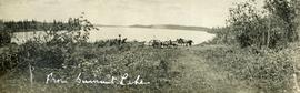
Photograph depicts two men preparing to load a canoe on a wagon. Two blanketed horses stand nearby with one person attending. There is a lake in the background, wild grasses and brush in the foreground.