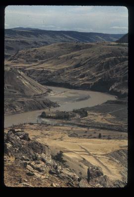
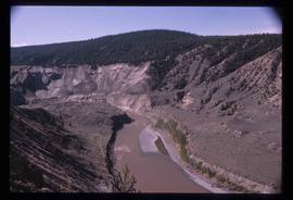
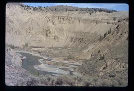
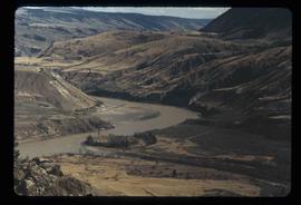
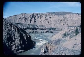
Mostrando 81 resultados

Archival description
79 resultados con objetos digitales Muestra los resultados con objetos digitales
Gang Ranch - Fraser River
2012.13.1.52.34 · Item · [1980?]
Parte de J. Kent Sedgwick fonds

Image depicts the Fraser River, and a sign pointing towards Gang Ranch with an unknown individual hugging it, in the Upper Fraser Canyon.

Moran Canyon
2012.13.1.53.21 · Item · Mar. 1975
Parte de J. Kent Sedgwick fonds

Image depicts the Fraser River running through the Moran Canyon near Lillooet, B.C.

Sand Creek near Mount Robson, BC
2009.5.3.75 · Item · 1912
Parte de Taylor-Baxter Family Photograph Collection

Photograph depicts creek barely visible at bottom of steep valley in cliffs. Trees and underbrush in foreground. It is believed that this photograph may have been taken near Mt. Robson. Handwritten annotation on recto of photograph reads: "Sand Creek."

Upper Fraser Canyon
2012.13.1.52.30 · Item · 1980
Parte de J. Kent Sedgwick fonds

Image depicts a view of the upper Fraser Canyon. The Fraser River is visible on the left side of the image.

Upper Fraser Canyon
2012.13.1.52.31 · Item · 1980
Parte de J. Kent Sedgwick fonds

Image depicts a view of the upper Fraser Canyon. The Fraser River is visible on the left side of the image.

Moran Canyon
2012.13.1.53.20 · Item · Mar. 1975
Parte de J. Kent Sedgwick fonds

Image depicts the Fraser River running through the Moran Canyon near Lillooet, B.C.

Moran Canyon
2012.13.1.53.22 · Item · Mar. 1975
Parte de J. Kent Sedgwick fonds

Image depicts the Fraser River running through the Moran Canyon near Lillooet, B.C.

Moran Canyon?
2012.13.1.53.27 · Item · Mar. 1975
Parte de J. Kent Sedgwick fonds

Image depicts what is possibly the Fraser River running through the Moran Canyon near Lillooet, B.C.

Moran Canyon
2012.13.1.53.50 · Item · July 1982
Parte de J. Kent Sedgwick fonds

Image depicts the Moran Canyon; the Fraser River is visible near the bottom.

Slump or Mining
2012.13.1.65.35 · Item · June 1975
Parte de J. Kent Sedgwick fonds

Image depicts an aerial view of a section of land, likely near the Fraser River, that is possibly either a slump or part of a mining operation. The slide is labelled "slump or mining."