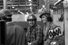
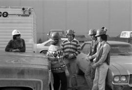
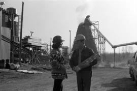
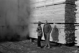
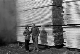
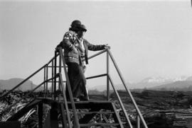
Photograph depicts Iona Campagnolo and an unknown man looking over the sawmill owned by Rim Forest Products in Hazelton.
Photograph depicts Iona Campagnolo and a man wearing a hard hat and ear protection at a sawmill owned by Rim Forest Products in Hazelton.
Photograph depicts Iona Campagnolo talking with four unknown men wearing hardhats and standing by vehicles at a sawmill owned by Rim Forest Products in Hazelton.
Photograph depicts Iona Campagnolo speaking with an unknown man wearing a hard hat and holding a package at a sawmill owned by Rim Forest Products in Hazelton.
Photograph depicts Iona Campagnolo wearing a hard hat and speaking with an unknown man in front of a lumber pile at a sawmill owned by Rim Forest Products in Hazelton.
Hand coloured photograph of a cemetery in Gitxsan territory. Annotation on recto reads: "Indian Cemetery, Hazelton, BC."
Photograph of a long bridge spanning two rock faces. A small settlement is visible on the lower right.
Photograph of a long bridge spanning two rock faces. Below is a smaller, half demolished wooden bridge. A small settlement is visible on the lower right. Annotation on recto reads: "Haquelqet Bridge." Handwritten annotation on verso reads: "Old & New. Old Indian built bridge & later one at Hazelton, BC."
View of stern wheeler traveling in river with mountains in the background. Printed annotation on recto reads: “S.S. Port ‘Simpson Hazelton BC” Handwritten message on verso is dated “July 31st 1911.”
Stern wheeler “Port Simpson” tied to riverbank. Printed annotation on recto reads: “On the Skeena river, Hazelton, B.C.” Handwritten message on verso is addressed to “Mrs. Flossie Strong 6 Nah St. Watermill ME, U.S.A” 1 cent Canadian postage stamp has been canceled with a date of “Dec 24, 5:30 PM 1915 Buffalo N.Y.”
Image depicts a church, somewhere between Hazelton and Hagwilget, B.C.
Image depicts the Skeena River at Hazelton, B.C.
Image depicts the historical village of 'Ksan near Hazelton, B.C.
Image depicts a totem pole in the historical village of 'Ksan near Hazelton, B.C.
Image depicts a beaver dam somewhere in Hazleton, B.C.
Image depicts a group of people in the historical village of 'Ksan near Hazelton, B.C.
Image depicts a group of people at a mine somewhere near Hazelton, B.C.
Image depicts a man, possibly Kent Sedgwick, leaning against a sign forbidding public traffic on the Stewart Access Road from between 5 am to 8 pm. Located in Hazelton, B.C.
Image depicts an unknown individual leaning against a sign at the Stewart Access Road which warns travellers to pack several days of food. Located in Hazelton, B.C.
Image depicts the Skeena River at Hazelton, B.C.
Image depicts the peak of the Rocher de Boule mountain from Hazelton, B.C.
Image depicts the Inlander Hotel in Hazelton, B.C. The peak of the Rocher de Boule mountain is visible in the background.
Image depicts a large gathering of people in the interior of a First Nations' longhouse located in the historical village of 'Ksan in Hazelton, B.C.
Image depicts the 'Ksan historical village in Hazelton, B.C.
Image depicts the public library in Hazelton, B.C.
Image depicts the entrance to the historical village of 'Ksan in Hazelton, B.C.
Image depicts the historical village of 'Ksan in Hazelton, B.C.
Image depicts the cemetery in Hazelton, B.C.
Image depicts a tombstone in the cemetery in Hazelton, B.C.
Image depicts Hazelton, B.C.
Photograph depicts Hazelton Bridge that was believed to be built in 1930. Crossing the Skeena River.
Photograph depicts the Hazelton suspension bridge.
Photograph depicts the Wrinch Memorial Hospital. It held 54 beds and was founded by Dr. Winch for the benefit of the local First Nations population.
Photograph depicts (from left to right) Jack Lee, Gordon Wyness, Jessie McInnes, and Archie McInnes at Pioneer Ranch.
In 1903, brothers Neil and Archie McInnes pre-empted a section of land two miles east of Cote Flat, each taking half. Archie McInnes' land later became known as Pioneer Ranch (later known as the Barnett Ranch); Neil McInnes' land became Meadowbrook Ranch. Archie McInnes married Jessie Aitken in October 1905. Pioneer Ranch became known as a stop-over for travellers en route from Hazelton to the Ootsa Lake area via the Telegraph Trail. Archie and Jessie McInnes had three daughters: Vera (m. Ivan Frank), Ivy (m. Eric Strimbold), and Neva (m. John Ivan Nickolichuk).
Photograph depicts (from left to right) Jack Lee, Philip Monckton, Jessie McInnes, and Archie McInnes at Pioneer Ranch.
In 1903, brothers Neil and Archie McInnes pre-empted a section of land two miles east of Cote Flat, each taking half. Archie McInnes' land later became known as Pioneer Ranch (later known as the Barnett Ranch); Neil McInnes' land became Meadowbrook Ranch. Archie McInnes married Jessie Aitken in October 1905. Pioneer Ranch became known as a stop-over for travellers en route from Hazelton to the Ootsa Lake area via the Telegraph Trail. Archie and Jessie McInnes had three daughters: Vera (m. Ivan Frank), Ivy (m. Eric Strimbold), and Neva (m. John Ivan Nickolichuk).