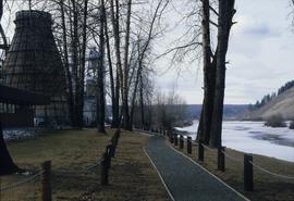
Image depicts a nature trail in Cottonwood Island Park by a beehive burner. Map coordinates 53°55'23.6"N 122°43'53.8"W
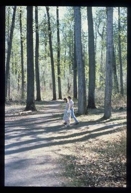
Image depicts a couple walking through a nature trail in Cottonwood Island Park. Map coordinates 53°55'23.6"N 122°43'53.8"W
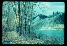
Image depicts a nature trail along the Nechako River at Island Cache looking west with the cutbanks in the background. Map coordinates 53°55'36.2"N 122°45'11.8"W
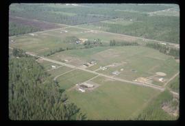
Image depicts a clearing in Prince George, B.C., possibly in the Pineview area.
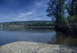
Image depicts the Fraser River and the Grand Trunk Pacific Bridge from Cottonwood Island Park.
File consists an oral history with Harry Coates recorded by Barbara Coupe. Includes a transcript and audio recording.
File consists an oral history with Harry Coates recorded by David Mills. Includes a transcript and audio recording.
File consists of:
- David Mills, "Aleza Lake Research Forest Historical Internship Summary" (2 Jan. 2007), 26 p. - In print and original digital .doc file
- David Mills, "Aleza Lake Forest Experiment Station Socio-Economic Time Line 1905-1937" (2007), 68 p. - In print and original digital .doc file
- ALRFS employment paperwork for David Mills, the ALRFS Natural Resource History Intern
- Research notes, including a copy of a map of the town of Aleza Lake in the 1920s
File consists of:
- Original version of Ralph Schmidt's 1993 BC Forest Service publication entitled "The Aleza Lake Experiment Station (1920's and 1930's)"
The Aleza Lake Research Forest Society (ALRFS) records encompass material that was created or collected by the Society over its existence (2001-present). Records created by the ALRFS consist of administrative and operational records, as well as publications from the Society. Collected records include historical records relating to the Aleza Lake Experiment Forest gifted to the Society or its members. These include maps, photographs, reference material, and documents. Members and associates of the ALRFS also documented the history of the forest through the creation of oral history recordings and written histories such as John Revel's "Devil's Club, Black Flies, and Snowshoes".
The fonds includes a significant amount of reproduced archival material about Aleza Lake from other institutions, such as BC Archives, the Canadian Forest Service, and the BC Forest Service. Many of these reproductions were created as part of the 2006 ALRFS Natural Resources History Internship in an effort to compile the history of the research forest.
Also included are cartographic and photographic materials that depict the Aleza Lake Research Forest and surrounding areas.
File consists of a booklet prepared for the May 9, 2002 UNBC/UBC Aleza Lake Research Forest Field Tour.
Photographs are panoramas taken from the Churchill BC Forest Service Lookout, located at latitude 54°04' and longitude 122°16'. The photographs were bound together and include a transparent grid that was intended to be used for locating forest fires.
Photograph depicts Harry Coates, Ted Baker, and John Revel at Aleza Lake Research Forest re-opening ceremony on July 9, 1992.
Aerial photograph depicts a view overlooking the Georges farm. Note on back stated that this photograph was presented in a frame to the Georges in 2008.
Slide depicts a bulldozer clearing ground, likely at the Aleza Lake Experiment Station.
Slide depicts cleared ground and felled trees in a forested area, likely at the Aleza Lake Experiment Station.
Slide depicts the Ranger Station at the Aleza Lake Experiment Station.
Slide depicts a view of what is possibly the Upper Fraser River.
Slide depicts a cleared area at the Aleza Lake Experiment Station with plant regeneration.
Slide depicts a burning building at the Aleza Lake Experiment Station on the date it was shut down by the BC Forest Service.
Slide depicts a cleared area in a forest, likely at the Aleza Lake Experiment Station.
Slide depicts a detonation in an area of cleared ground in a forested area, likely the Aleza Lake Experiment Station. Work may have been undertaken for roadbuilding activities at the Experiment Station.
Slide depicts the original wooden BC Forest Service sign for the Aleza Lake Forest Experiment Station.
Slide depicts a black bear eating garbage by wooden outbuildings, possibly at the Aleza Lake Experiment Station.
Slide depicts a sawmill in operation, likely located in the Upper Fraser area, with a pile of burning wood products and a beehive burner.
Slide depicts a heavily forested area with fallen logs, likely at the Aleza Lake Experiment Station.
Slide depicts a man operating heavy equipment in a forest, likely at the Aleza Lake Experiment Station.
Large-format map depicts the Monkman Public Sustained Yield Unit (PSYU) and Tree Farm Licence 30 east of Prince George.
Large-format map depicts Northwood Pulp & Timber operating areas in 1975.
Large-format map depicts the Monkman Public Sustained Yield Unit (PSYU) east of Prince George.
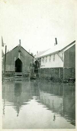
Photograph depicts lane in front of tent buildings flooded with water, and a man standing near doorway to first building. It is believed that this photograph may depict the Island Cache in flood, at Prince George, BC.
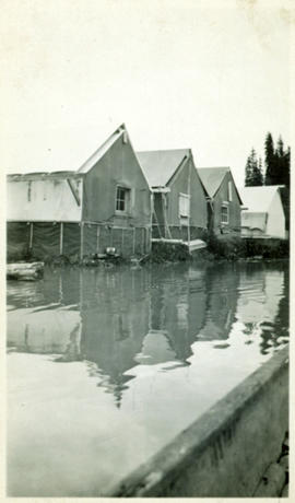
Photograph depicts lane in front of tent buildings flooded with water, forest trees in background. Photograph taken from canoe, portion of canoe visible in foreground. It is believed that this photograph may depict the Island Cache in flood, at Prince George, BC.
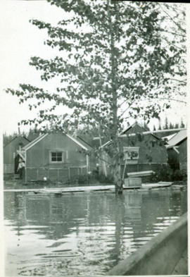
Photograph depicts lane in front of tent buildings flooded with water. Tree in midground, forest trees in background. A man can be seen between first and second row of tent buildings. Photograph taken from canoe, portion of canoe visible in right foreground. It is believed that this photograph may depict the Island Cache in flood, at Prince George, BC.
File consists of an audio recording of an interview with Jim Burbee. Includes one original recorded audio cassette and one copy.
File consists of an audio recording of an interview with Jack Boudreau. Includes one original recorded audio cassette and one copy.
File consists of:
- Informational material about visiting BC Archives
- Computer print-outs of BC Archives searches and finding aids relating to Aleza Lake archival material
- Copy of the Access to Personal Information Agreement signed by David Mills to access records at BC Archives
- Correspondence to David Mills from BC Archives
- Copy of the "British Columbia Archives Research Orientation Guide"
File consists of photocopied material regarding the Aleza Lake Experimental Station from BC Archives.
File consists of photocopied material regarding the Aleza Lake Experimental Station from BC Archives.
File consists of photocopied material regarding the Aleza Lake Experimental Station from BC Archives.
File consists a transcript of an oral history with Harry Coates recorded by Barbara Coupe.
File consists an audio recording of an oral history with Harry Coates recorded by Barbara Coupe.
File consists an audio recording of an oral history with Harry Coates recorded by Barbara Coupe.
File consists a transcript of an oral history with Harry Coates recorded by David Mills.
File consists of:
- Correspondence regarding the transfer of the Ministry of Forests records related to the Aleza Lake Experimental Station
- Aleza Lake Research Forest research notes on historical records
- Ministry of Forests Records Classifications
- Inventory report of BC Forest Service records relating to Aleza Lake
- Database print-out from the BC Forest Service Prince George Forest Region Research Installation Archive
- Ministry of Forests website print-outs from 2007, including a page on "Research Branch History"
File consists of photocopied material regarding the Aleza Lake Experimental Station from the Canadian Forest Service Archives in Victoria. Also includes handwritten notes.
Map reproduction depicts major areas of the Aleza Lake Experiment Forest.
Forest cover map showing a crossing area of the McGregor River is annotated with a road and ferry crossing.
File is a Resource Folio of maps and accompanying information created by Northwood Pulp & Timber regarding Timber Sale Harvesting Licence A01847, Willow River Block, Willow River P.S.Y.U. Includes maps that depict ungulates, waterfowl, recreation areas, special influence areas, and timber types. Most of the sheets have a duplicate, some with very slight variations. The following maps are supposed to be included in the but were missing upon arrival at the Archives: fish & topography, cutting permits & roads, and soils.
Map reproduction of the Sinclair Spruce Lumber Co. Ltd. T.S.H.L. A01848 C.P. 310 cutting area, likely in the Aleza Lake Research Forest.
