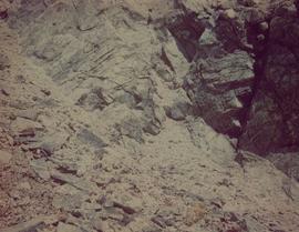
Print preview Close

Showing 193 results

Archival description
91 results with digital objects Show results with digital objects
2000.1.1.3.13.09 · Item · 1961
Part of Cassiar Asbestos Corporation Ltd. fonds

Photograph depicts view of mine road in valley, from mountain above. Plant, tailings pile, and town visible in distance. South mountains in background. Handwritten annotation on verso of photograph: "1961", on recto: Townsite and Plantsite from mine."

North Peak Strip Mining
2000.1.1.3.13.10 · Item · [1961?]
Part of Cassiar Asbestos Corporation Ltd. fonds

Photograph depicts the North peak of McDame mountain after extensive strip mining, South peak unmined in background. Old mine garage visible on right of West peak in foreground. Crusher plant partially visible on far right. Photograph believed to have been taken just prior to the development of the pit mine between the North and West peak.

Waste in Mine Valley
2000.1.1.3.13.12 · Item · 25 October 1965
Part of Cassiar Asbestos Corporation Ltd. fonds

Photograph depicts large swath of dark waste down mountainside to right of valley. The waste dump is believed to be visible at top of swath on right of image. Bench mining visible on the North and South peak in background. Handwritten annotation on recto of photograph: "Oct. 25 / 65 4:25 PM."

2000.1.1.3.13.13 · Item · 1959
Part of Cassiar Asbestos Corporation Ltd. fonds

Photograph depicts the North peak of McDame mountain in the earlier stages of strip mining, South peak unmined in background. Quonset and other shops visible in left foreground, unknown building built into mountainside in right foreground.

Strip Mining, 1971
2000.1.1.3.13.14 · Item · 1971
Part of Cassiar Asbestos Corporation Ltd. fonds

Photograph depicts the Cassiar mine after extensive strip mining. It is believed that the North and South peak stand in background, and the West peak in foreground. Handwritten annotation on recto of photograph: "1971".

Strip Mining & Cirque Dump
2000.1.1.3.13.20 · Item · [ca. 1973]
Part of Cassiar Asbestos Corporation Ltd. fonds

Photograph depicts the Cassiar mine. North peak featured in left background, South peak in right background, and West peak in right foreground. Area to left of the mining pit and West peak was called the "cirque waste dump." Location of new mine garage can be seen just above the "#7 switchback" road in bottom right foreground.

Strip Mining & Cirque Dump
2000.1.1.3.13.21 · Item · [ca. 1973]
Part of Cassiar Asbestos Corporation Ltd. fonds

Photograph depicts the Cassiar mine. North peak featured in left background, South peak in right background, and West peak in right foreground. Area to left of the mining pit and West peak was called the "cirque waste dump." Mountain range visible in distance.

Strip Mining & Cirque Dump
2000.1.1.3.13.22 · Item · [ca. 1973]
Part of Cassiar Asbestos Corporation Ltd. fonds

Photograph depicts the Cassiar mine. North peak featured in left background, South peak in right background, and West peak in right foreground. Area to left of the mining pit and West peak was called the "cirque waste dump." Mountain range visible in distance.

Mine & Crusher Plant
2000.1.1.3.13.24 · Item · [ca. 1973]
Part of Cassiar Asbestos Corporation Ltd. fonds

Photograph depicts the Cassiar mine. North and South peak featured in background, and West peak in left foreground. Pit is being developed between South peak and West peak. Old mine garage is visible in lower centre of image, and crushing plant in right foreground. Mountain range in distance.

2000.1.1.3.13.51 · Item · 1978
Part of Cassiar Asbestos Corporation Ltd. fonds

Photograph depicts the Cassiar mine in foreground, north east mountain range in background. Tramline station and crushing plant visible in foreground in front of pit. Photograph was taken from the air, portion of plane visible in top left of image.

2000.1.1.3.13.52 · Item · 1978
Part of Cassiar Asbestos Corporation Ltd. fonds

Photograph depicts the Cassiar mine in foreground, north east mountain range in background. Tramline station and crushing plant visible in foreground, west of pit. Photograph was taken from the air, portion of plane visible in top left of image.

2000.1.1.3.13.53 · Item · 1978
Part of Cassiar Asbestos Corporation Ltd. fonds

Photograph depicts the Cassiar mine above valley, north mountain range in background. Tramline station and crushing plant visible to west of pit. Photograph was taken from the air, portion of plane visible in top left of image.

West Peak from Airplane
2000.1.1.3.13.54 · Item · 1978
Part of Cassiar Asbestos Corporation Ltd. fonds

Photograph depicts the West peak of the Cassiar mine, pit partially visible below. Drill visible in left foreground at highest elevation of mine, north west mountain range in background.

West Peak from Airplane
2000.1.1.3.13.55 · Item · 1978
Part of Cassiar Asbestos Corporation Ltd. fonds

Photograph depicts the West peak of the Cassiar mine, pit partially visible below. Mining equipment barely visible in foreground at highest elevation of mine, north west mountain range stands in background, and mine valley crosses midground.

Pit & Crushing Plant
2000.1.1.3.13.60 · Item · [ca. 1975]
Part of Cassiar Asbestos Corporation Ltd. fonds

Photograph depicts a portion of the pit in foreground at the Cassiar mine. Crushing plant visible in centre below base of West peak. Footwall road in midground, mine valley in background. Building near trucks at top of pit was called the "shifter shack," where crews were relieved or dropped off for work.

Pit, West Peak, & Plant
2000.1.1.3.13.61 · Item · [ca. 1980]
Part of Cassiar Asbestos Corporation Ltd. fonds

Photograph depicts a portion of the Cassiar pit in right foreground. Crushing plant visible to left of pit, West peak visible in right background. Mountain range can be seen in distance.

2000.1.1.3.14 · File · 1952 - 1954
Part of Cassiar Asbestos Corporation Ltd. fonds

File contains portraits and sample photographs of exposed asbestos fibre: in veins of rock outcrops, and loose in talus on McDame Mountain (location of Cassiar mine). Some photographs were printed in Cassiar's Annual Reports, with labels and descriptions.

2000.1.1.3.14.01 · Item · 1952
Part of Cassiar Asbestos Corporation Ltd. fonds

Photograph depicts two pick hammers laid in asbestos fibre. Annotations on note glued to recto of photograph: "ASBESTOS"; "Detail view of asbestos talus. Early test pit near top of showing. Western slope." Areas of image have been labeled "A" and "B". Photo caption under printed copy of image in 1952 Annual Report: "A - Asbestos fibre partially opened by frost action. B - Serpentine rock originally containing the asbestos fibre."

2000.1.1.3.14.02 · Item · 1952
Part of Cassiar Asbestos Corporation Ltd. fonds

Photograph depicts a pick hammer hanging from outcrop. Annotations on note glued to recto of photograph: "ASBESTOS"; "Outcrop of fibre bearing serpentine about centre of deposit and vertically over 300 adit on western slope." Areas of image have been labeled "A" and "B". Photo caption under printed copy of image in 1952 Annual Report: "A - indicates asbestos talus. B - indicates asbestos veinlets."

2000.1.1.3.14.03 · Item · 1952
Part of Cassiar Asbestos Corporation Ltd. fonds

Handwritten annotation on recto of photograph: "ASBESTOS FIBRE VEINS AS THEY OCCURR IN A ROCK FACE". Photo caption under printed copy of image in 1952 Annual Report: "North Wall of adit approximately 225 feet from portal showing asbestos veinlets."