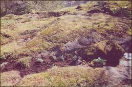
Image depicts what appears to be a ferry crossing a river at an uncertain location.
Image depicts two unidentified individuals speaking to each other in the doorway of what appears to be a mobile home. The location is uncertain.
Image depicts the Hansard railroad bridge taken from the new Hansard vehicle bridge. Map coordinates 54°04'58.1"N 121°50'58.0"W
Stone wall runs in background. Photograph taken at Terrace Gardens, Government House, Victoria, BC. See item 2009.6.1.658 for similar image.
Road visible in background. Photograph taken at Government House in Victoria, B.C.
Photograph taken at Government House in Victoria, B.C.
Photograph taken at terrace gardens, Government House in Victoria, B.C.
Photograph taken at Government House in Victoria, B.C.
Photograph taken at Government House, Victoria, B.C.
Photograph believed to have been taken at Terrace Gardens, Government House, Victoria, B.C.
Image depicts Bellos Road, most likely in Red Rock, B.C.
Stone wall runs in background. Photograph was taken at Terrace Gardens, Government House, Victoria, B.C. See item 2009.6.1.660 for similar image.
Photograph taken at Terrace Gardens, Victoria, B.C.
Photograph taken at Government House, Victoria, B.C.
Bench visible in left foreground.
Balcony overlooks Terrace Gardens in Victoria, B.C.
Photograph features Terrace Gardens.
Image depicts Bellos Road, most likely in Red Rock, B.C.
Photograph taken at Terrace Gardens.
Photograph taken at Government House in Victoria, B.C.
Building visible behind fence in background. Photograph taken at Government House in Victoria, B.C.
Image depicts a clearing through the woods, possibly an abandoned grade for the BCR. It is possibly located on Iron Road South, near Woodpecker B.C.
Image depicts Iron Road North, and a creek surrounded by trees. Located north of Woodpecker, B.C.
Image depicts a forest, possibly somewhere near Woodpecker, B.C.
Image depicts a dog in a forest, possibly somewhere near Woodpecker, B.C.
Image depicts a tree line in Woodpecker, B.C.
Image depicts a view south, possibly of an abandoned grade for the BCR; possibly somewhere near Woodpecker, B.C.
Image depicts a north view of a road somewhere in Woodpecker, B.C.
Image depicts the Mud River.
Image depicts a rail road bridge over the Mud River.
Image depicts a creek near Iron Road North, north of Woodpecker, B.C.
Image depicts a ditch near a road somewhere in Woodpecker B.C.
Image depicts a pair of dogs in a forest, possibly somewhere near Woodpecker, B.C.
Image depicts a forest, possibly somewhere near Woodpecker, B.C.
Image depicts a tree line in Woodpecker, B.C.
Typed message on front reads: “Happy Birthday Your Honour, You have a way of making each person you come in contact with feel so special, so we all want to wish you the happiest birthday year ever. Staff of Government House, October 18, 2002.” Signed by the staff of Government House.
Handwritten annotation on verso reads: “The Rock - I spent 6 years creating 6 gardens surrounding”.
Image depicts Iron Road South, which is located north of Woodpecker, B.C.
Image depicts a creek near Iron Road North, north of Woodpecker, B.C.