
2010.13.10
·
Pièce
·
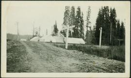
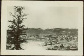
[15 March 1914?]
Fait partie de Prince George Historical Photograph Collection
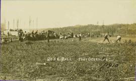
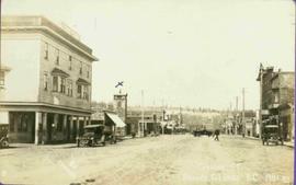
Winter landscape taken from behind railroad track. Cleared land in foreground, buildings in midground, low hills in background.
Handwritten annotation on recto: “PRINCE GEORGE 3-15-14”.


![City of Prince George - Schedule C of the Official Community Plan - Long Range Land Use Map [May 2006 Amendment]](/uploads/r/northern-bc-archives-special-collections-1/6/5/5/65536bc04aa97580c140131651dc357dfe5c3a1315822394f388d96940bc39cb/2023.5.1.39_-_2006_May_-_City_of_Prince_George_Long_Range_Land_Use_Map_JPG85_tb_142.jpg)


![City of Prince George - Schedule B of the Official Community Plan, Bylaw No. 5909 [1998 Amendment]](/uploads/r/northern-bc-archives-special-collections-1/d/6/d/d6d1c4e7e37fc948b97b3caa36447b52f7d2b76b13d45e3710aefee7b13840f0/2023.5.1.33_-_1998_Official_Community_Plan_City_of_PG_JPG85_tb_142.jpg)

![City of Prince George - Schedule B of the Official Community Plan, Bylaw No. 5909 [2001 Amendment]](/uploads/r/northern-bc-archives-special-collections-1/c/3/6/c36392b90696286cc6281e8cc2efbf7691c2617726495fa28db2cbdcc20e4e4c/2023.5.1.36_-_Official_Community_Plan_City_of_PG_Schedule_B_2001_JPG85_tb_142.jpg)