Mostrar 162 resultados

Archival description
67 resultados com objetos digitais Mostrar resultados com objetos digitais
Rural schools in the Prince George region
2012.13.2.16.46 · Dossiê/Processo · 2003-2007
Parte de J. Kent Sedgwick fonds

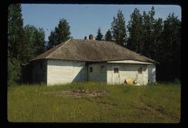
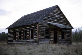
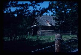
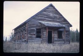
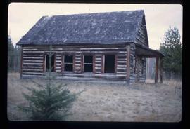
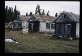
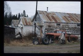
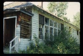
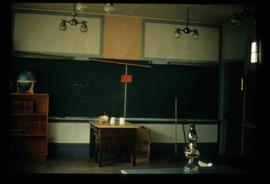
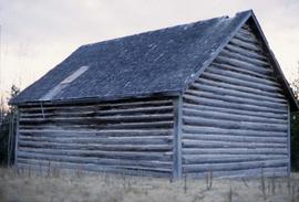
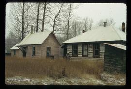
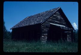
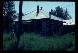
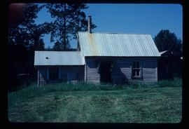
File consists of notes, clippings, and reproductions relating to rural schools in the Prince George region. Includes photographs depicting the first and second school buildings for the North Nechako school; one was sold and the other has been closed (2005).

BC Historical Federation East Line field trip
2012.13.2.17.08 · Dossiê/Processo · 2003
Parte de J. Kent Sedgwick fonds

File consists of notes and reproductions relating to the Upper Fraser historical geography field trip for the BC Historical Federation by Kent Sedgwick. Includes photographs depicting a group from the BC Historical Federation standing outside at one of the East Line communities listening to a presentation by Kent Sedgwick and Greg Halseth (May 2003).

Lethbridge field trip
2012.13.2.19.24 · Dossiê/Processo · 1982-2009
Parte de J. Kent Sedgwick fonds

File consists of a clipped article and a reproduction relating to a field trip to Lethbridge, Alberta. Includes "Lethbridge field trip" typescript document prepared by Kent Sedgwick for the field trip (1982).

Upper Fraser Elementary School
2012.13.1.87.057 · Item · [between 1975 and 1995]
Parte de J. Kent Sedgwick fonds

Image depicts Upper Fraser Elementary School, after closure of town site. Map coordinates 54°06'54.4"N 121°56'16.6"W

Giscome Bunkhouse
2012.13.1.87.158 · Item · [between 1975 and 1995]
Parte de J. Kent Sedgwick fonds

Image depicts the Giscome bunkhouse in Giscome, B.C. Map coordinates 54°04'17.6"N 122°22'06.1"W

Examining a Rock
2012.13.1.91.38 · Item · 1979
Parte de J. Kent Sedgwick fonds

Image depicts a group of individuals who appear to be examining a rock. It is possibly part of an educational trip.

Sediment Layers
2012.13.1.91.59 · Item · 1979
Parte de J. Kent Sedgwick fonds

Image depicts a large group of people examining the sediment layers in a rock face.

Museum? - Ship Model
2012.13.1.93.57 · Item · Sep. 1984
Parte de J. Kent Sedgwick fonds

Image depicts a woman standing next to a model of a ship in glass case in what appears to be a museum. The location is uncertain.

2012.13.4.07 · Dossiê/Processo · 1992-2002
Parte de J. Kent Sedgwick fonds

File consists of notes, clippings, and reproductions relating to Kent Sedgwick's book chapter "Crossing the Divide Northern Approaches to New Caledonia" from the book "Simon Fraser's New Caledonia: A Geography of Northern B.C". published by the College of New Caledonia. Includes: typescript letter correspondence between Kent Sedgwick and J. Alistair McVey (Sept. 1992); "RE: Book on the Geography of Northern B.C" typescript letter from Jim Windsor to Kent Sedgwick (June 2002); and "BC Studies" typed letter from Cole Harris to Kent Sedgwick (24 Jan. 2001).

"Giscome Chronicle" information
2012.13.4.21 · Dossiê/Processo · 2008-2009
Parte de J. Kent Sedgwick fonds

File consists of notes, clippings, and reproductions relating to Kent Sedgwick's book "Giscome Chronicle: The Rise and Demise of a Sawmill Community in Central British Columbia, 1912-1976". Includes various printed email correspondences regarding copies of "Giscome Chronicle"; and "New book explores Giscome's history" clipped article from the Prince George Citizen newspaper (18 Dec. 2008).

"From Broadaxe to Clay Chinking"
2012.13.4.29 · Dossiê/Processo · 2001-2006
Parte de J. Kent Sedgwick fonds

File consists of notes and reproductions relating to the local history project done by June Chamberland and her book "From Broadaxe to Clay Chinking: Stories about the Pioneers in and around the Prince George area" winning the Jeanne Clarke history award. The book includes a chapter "Introduction to Early Agricultural Settlement in the Prince George Area" by Kent Sedgwick. Includes a CD titled "June photos" containing photographs depicting interviewees of the project (2003).

Prince George writings by Kent Sedgwick
2012.13.4.43 · Dossiê/Processo · [between 1980 and 2010]
Parte de J. Kent Sedgwick fonds

File consists of typed documents titled "The Prince George Writings of Kent Sedgwick" by Kent Sedgwick, and includes "The Land of Sunshine, Warm Days, and Cool Nights: Early Agricultural Settlement in the Prince George Area,"; "Prince George as a Central Place"; "A New Historical Framework for New Caledonia,"; "The Salmon River Portage," "Dr. George in the Central Interior,"; "Chala-oo-chick Revisited,"; "Connaught Hill Park,"; "A Brief History of Cottonwood Island,"; and "Some comments on the Cottonwood Island Park Designation of the Official Community Plan".

Professorial Records
2012.13.5 · Série · 1972-2009
Parte de J. Kent Sedgwick fonds

Series contains material created during Kent Sedgwick’s teaching appointments at the College of New Caledonia and the University of Northern British Columbia. He held a position as a Geography Instructor at CNC from 1970 until 1983 and did frequent guest lectures at UNBC until he became an adjunct professor from 2003 until 2009. He conducted guest lectures and taught course on historical geography and local history. The files primarily consist of lectures, notes, and correspondence between Sedgwick and the institutions.

Kamloops Residential School
2012.13.1.66.16 · Item · June 1987
Parte de J. Kent Sedgwick fonds

Image depicts the old Kamloops Residential School which operated until either 1977 or 1978 before becoming part of the Secwepemc Musem in 1982.

Central Fort School
2012.13.1.40.07 · Item · 1979
Parte de J. Kent Sedgwick fonds

Image depicts an old, boarded up school, possibly the Central Fort George Traditional School in Prince George, B.C.

Upper Fraser Elementary School
2012.13.1.87.058 · Item · [between 1975 and 1995]
Parte de J. Kent Sedgwick fonds

Image depicts Upper Fraser Elementary School, after closure of town site. Map coordinates 54°06'54.4"N 121°56'16.6"W

Giscome School - After
2012.13.1.87.085 · Item · [between 1975 and 1995]
Parte de J. Kent Sedgwick fonds

Image depicts the Giscome mill site in Giscome, B.C. The bunkhouse is no longer there and the school is in the foreground on the right. Map coordinates 54°04'04.8"N 122°22'04.7"W

A Classroom
2012.13.1.87.109 · Item · [between 1975 and 1995]
Parte de J. Kent Sedgwick fonds

Image depicts the interior of a classroom at an uncertain location.

Man in a Yellow Hat
2012.13.1.91.53 · Item · 1979
Parte de J. Kent Sedgwick fonds

Image depicts an unidentified man in a yellow hat who appears to be speaking to large group of people. It is possibly an educational event.

Man in a Yellow Hat - Wood Pieces?
2012.13.1.91.54 · Item · 1979
Parte de J. Kent Sedgwick fonds

Image depicts an unidentified man in a yellow hat who appears to be speaking to large group of people and showing them small pieces of wood. It is possibly an educational event.

Honeycombs?
2012.13.1.91.55 · Item · 1979
Parte de J. Kent Sedgwick fonds

Image depicts an unidentified man holding what appears to be a broken screen of honeycombs. The group is likely at an educational event.

Salmon School
2012.13.1.2.015 · Item · 30 Oct. 2002
Parte de J. Kent Sedgwick fonds

Image depicts the Salmon School in the Prince George vicinity.

Central Fort George Elementary School
2012.13.2.16.10 · Dossiê/Processo · 2002-2011
Parte de J. Kent Sedgwick fonds

File consists of notes, clippings, and reproductions relating to the Central Fort George Elementary School. Also includes photographs depicting the Central Fort George School prior to its demolition (2004).