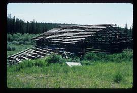
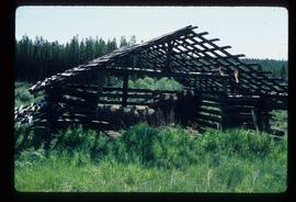
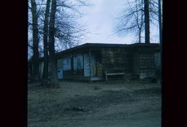
Showing 581 results

Archival description
482 results with digital objects Show results with digital objects
Bear Snow Sculpture
2012.13.1.3.147 · Item · Apr. 1999
Part of J. Kent Sedgwick fonds

Image depicts a snow sculpture of a bear, possibly during the Winter City Conference, in Prince George, B.C. Taken at the Prince George Civic Center. Map coordinates 53°54'45.6"N 122°44'59.6"W

Bee Hive Burner
2012.13.1.7.001 · Item · Oct. 1975
Part of J. Kent Sedgwick fonds

Image depicts a bee-hive burner beside a rail-road track at an unidentified mill somewhere in Prince George, B.C.

Beehive Burner
2012.13.1.3.088 · Item · 12 Oct. 1989
Part of J. Kent Sedgwick fonds

Image depicts a Beehive Burner along the Nechako on River Road. Map coordinates 53°55'34.1"N 122°44'58.0"W

Beehive Burner
2012.13.1.3.089 · Item · 12 Oct. 1989
Part of J. Kent Sedgwick fonds

Image depicts a Beehive Burner along the Nechako on River Road. Map coordinates 53°55'34.1"N 122°44'58.0"W.

2012.13.2.09 · Subseries · 1967-2005
Part of J. Kent Sedgwick fonds

Subseries contains secondary material collected by Kent Sedgwick for research on the history and geography of Prince George and its region. Includes secondary sources and bibliographic references regarding the history and geography of Prince George and the Central Interior of British Columbia. The files primarily consist of photocopied articles and printed bibliographies.

Businesses
2012.13.1.7.250 · Item · [2003?]
Part of J. Kent Sedgwick fonds

Image depicts a street of businesses, possibly 3rd Avenue, in Prince George, B.C.

Businesses along 3rd Avenue
2012.13.1.135.01.24 · Item · [between 1980 and 2000]
Part of J. Kent Sedgwick fonds

Photograph depicts various businesses along 3rd Avenue. The businesses include the Europe Hotel and The Bay in the background. Annotation on verso: "left Europe Hotel, right shearer bldg".

Cache Walk
2012.13.1.3.035 · Item · Oct. 1976
Part of J. Kent Sedgwick fonds

Image depicts a nature trail along the Nechako River at Island Cache looking west with the cutbanks in the background. Map coordinates 53°55'36.2"N 122°45'11.8"W

Central Business District
2012.13.1.3.057 · Item · July 1979
Part of J. Kent Sedgwick fonds

Image depicts the Central Business District of Prince George looking north from Connaught Hill. Map coordinates 53°54'41.4"N 122°44'58.5"W

Central Fort School
2012.13.1.40.07 · Item · 1979
Part of J. Kent Sedgwick fonds

Image depicts an old, boarded up school, possibly the Central Fort George Traditional School in Prince George, B.C.

Central Street West
2012.13.1.3.115 · Item · 12 Oct. 1989
Part of J. Kent Sedgwick fonds

Image depicts Central Street West, parallel to Highway 97 in Prince George, B.C. looking north. Shown: Prince George Motors and other car dealerships, Burger King, Grama's Inn, and the Spruceland Shopping Mall sign. Map coordinates 53°54'42.1"N 122°46'53.1"W

City Hall
2012.13.1.3.165 · Item · May 2001
Part of J. Kent Sedgwick fonds

Image depicts Prince George City Hall. Map coordinates 53°54'46.3"N 122°44'41.9"W