Affichage de 3025 résultats

Archival description
3025 résultats avec objets numériques Afficher les résultats avec des objets numériques
Crestbrook Forest Industries Operations
2012.13.1.122.34 · Pièce · July 1982
Fait partie de J. Kent Sedgwick fonds

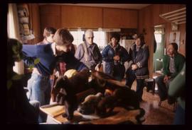
Image depicts a man attaching a logging trailer to a crane on a wooden structure to stack the trailer on the truck. A Crestbrook Forest Industries sawmill is located in the background.

Forestry Heavy Machinery
2012.13.1.122.30 · Pièce · May 1980
Fait partie de J. Kent Sedgwick fonds

Image depicts several pieces of heavy machinery used in forestry. The Coast Inn of the North is seen in the background.

Forestry Heavy Machinery
2012.13.1.122.29 · Pièce · May 1980
Fait partie de J. Kent Sedgwick fonds

Image depicts several pieces of heavy machinery used in forestry. The Coast Inn of the North is seen in the background.

Sawmill - Interior
2012.13.1.122.24 · Pièce · June 1980
Fait partie de J. Kent Sedgwick fonds

Image depicts logs being cut into planks in the interior of a saw mill somewhere in Prince George, B.C.

Sawmill - People and Logs
2012.13.1.122.22 · Pièce · June 1980
Fait partie de J. Kent Sedgwick fonds

Image depicts numerous stripped logs and several unidentified individuals in hard hats at a saw mill somewhere in Prince George, B.C.

Sawmill - Saw
2012.13.1.122.18 · Pièce · June 1980
Fait partie de J. Kent Sedgwick fonds

Image depicts a saw cutting a log in half at a saw mill in Prince George, B.C.

Sawmill
2012.13.1.122.15 · Pièce · [1979?]
Fait partie de J. Kent Sedgwick fonds

Image depicts logs being stripped of their bark at a saw mill in Prince George, B.C.

Sawmill - Lakeland Mills?
2012.13.1.122.07 · Pièce · Oct. 1975
Fait partie de J. Kent Sedgwick fonds

Image depicts a saw mill, possibly Lakeland Mills, with a beehive burner and numerous piles of logs in the foreground, in Prince George, B.C.

Sawmill - Wood Planks
2012.13.1.122.10 · Pièce · Oct. 1975
Fait partie de J. Kent Sedgwick fonds

Image depicts numerous blocks of wood planks at a saw mill, possibly Lakeland Mills, somewhere in Prince George, B.C.

Suspended Trailer
2012.13.1.122.09 · Pièce · Oct. 1975
Fait partie de J. Kent Sedgwick fonds

Image depicts a trailer for a logging truck suspended off the ground by a wooden structure. This is used to load the trailer onto the back of the truck. The name on the truck says "Rormarniewich Trucking Ltd."

Canadian National Railway Yards
2012.13.1.122.14 · Pièce · 1979
Fait partie de J. Kent Sedgwick fonds

Image depicts numerous piles of wood planks at the Canadian National Railway Yards in Prince George, B.C. The cutbanks are seen in the background.

Group of People in a Kitchen
2012.13.1.15.41 · Pièce · [1975?]
Fait partie de J. Kent Sedgwick fonds

Image depicts a group of people in a kitchen area of the Mueller home in Sinclair Mills, B.C.; the man in the grey shirt is Ray Mueller displaying his taxidermy collection. Map coordinates 54.014188, -121.676973

Hansard Rail Bridge
2012.13.1.89.184 · Pièce · 2004
Fait partie de J. Kent Sedgwick fonds

Image depicts the Hansard railroad bridge taken from the new Hansard vehicle bridge. Map coordinates 54°04'58.1"N 121°50'58.0"W

Hansard Bridge
2012.13.1.89.183 · Pièce · 2004
Fait partie de J. Kent Sedgwick fonds

Image depicts the new Hansard Bridge. Map coordinates 54°04'57.9"N 121°51'10.1"W

Hansard Bridge
2012.13.1.89.182 · Pièce · 2004
Fait partie de J. Kent Sedgwick fonds

Image depicts the new Hansard Bridge. Map coordinates 54°04'57.9"N 121°51'10.1"W

Willow River - Playground
2012.13.1.89.139 · Pièce · 1999
Fait partie de J. Kent Sedgwick fonds

Image depicts a playground in Willow River, B.C. The slide labels it as being a "former hotel site." Map coordinates 54°04'23.7"N 122°28'26.9"W

Train on Hansard Bridge
2012.13.1.89.137 · Pièce · 1999
Fait partie de J. Kent Sedgwick fonds

Image depicts a train on the Hansard Bridge across the Fraser River looking west. Map coordinates 54°04'37.7"N 121°50'39.9"W

UNBC Faculty Members near Hansard Bridge
2012.13.1.89.136 · Pièce · 1999
Fait partie de J. Kent Sedgwick fonds

Image depicts four individuals sitting on a log, possibly somewhere near the Hansard Bridge, B.C. The individuals are UNBC faculty members Gail Fondahl, Tracey Summerville, Greg Halseth and an unidentified individual. The slide is labelled: "Hansard Bridge UNBC." Map coordinates 54°04'37.7"N 121°50'39.9"W

Eaglet Lake Creek
2012.13.1.89.095 · Pièce · [1980?]
Fait partie de J. Kent Sedgwick fonds

Image depicts the creek flowing into Eaglet Lake. A grey area of hill on the right side of the image appears to be the Giscome Quarry. Map coordinates 54°04'26.2"N 122°22'04.3"W

Giscome Field and Townsite Remnants
2012.13.1.89.084 · Pièce · [1980?]
Fait partie de J. Kent Sedgwick fonds

Image depicts Giscome with the school on the left, the remnants of the town site in the middle and the church on the right. Map coordinates 54°03'58.2"N 122°22'04.8"W

Giscome Dairy Farm
2012.13.1.89.080 · Pièce · [1980?]
Fait partie de J. Kent Sedgwick fonds

Image depicts the dairy farm in Giscome, B.C. Map coordinates 54°03'53.3"N 122°21'22.6"W

Bowron Canyon - Log Jam
2012.13.1.89.063 · Pièce · Sep. 1978
Fait partie de J. Kent Sedgwick fonds

Image depicts what appears to be a log jam on what is possibly the Bowron River. The slide is simply labelled "Bowron Canyon."

Building in Upper Fraser, BC
2012.13.1.89.018 · Pièce · Feb. 1973
Fait partie de J. Kent Sedgwick fonds

Image depicts a vehicle parked beside a small, wooden house in Upper Fraser, B.C. Map coordinates 54°07'05.7"N 121°56'38.9"W

Upper Fraser Road in Winter
2012.13.1.89.016 · Pièce · Feb. 1973
Fait partie de J. Kent Sedgwick fonds

Image depicts several unidentified individuals walking along the snow-covered Upper Fraser Road with numerous buildings on either side. Map coordinates 54°07'05.7"N 121°56'38.9"W

Giscome Sawmill
2012.13.1.87.176 · Pièce · [between 1975 and 1995]
Fait partie de J. Kent Sedgwick fonds

Image depicts the Giscome, B.C. mill site looking west. Map coordinates 54°04'18.5"N 122°21'57.7"W

Giscome
2012.13.1.87.175 · Pièce · [between 1975 and 1995]
Fait partie de J. Kent Sedgwick fonds

Image depicts the Giscome, B.C. town site with the Giscome railway station and the Giscome store in the center surrounded by vehicles. Map coordinates 54°04'18.5"N 122°21'57.7"W