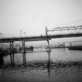
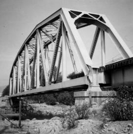
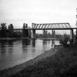
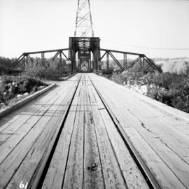
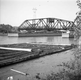
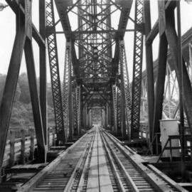
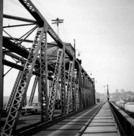
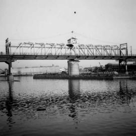
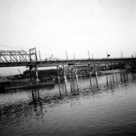
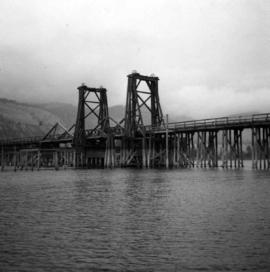
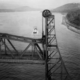
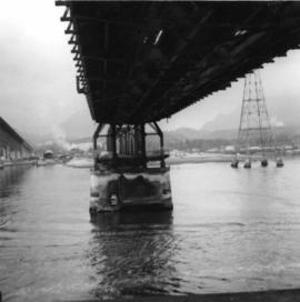
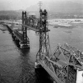
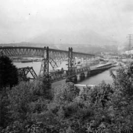
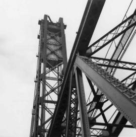
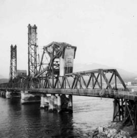
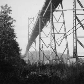
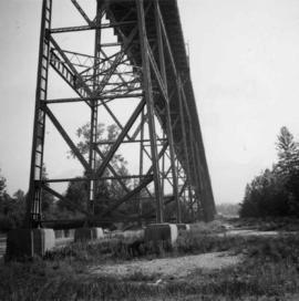
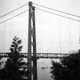
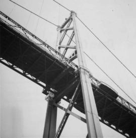
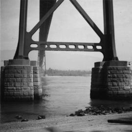
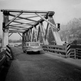
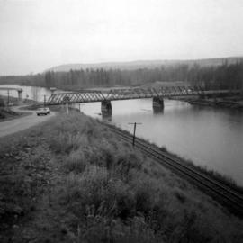
Photograph depicts the road bridge crossing over the Kootenay River at Fort Steele, 10 miles northwest of Cranbrook, looking downstream. Two piers of a new bridge can be seen behind the present one. The railway is from Golden to Fernie and built in approximately 1913.
Photograph depicts the Cambie St. Bridge in Vancouver, BC, looking east and showing the north fixed span of the bridge.
Photograph depicts the Alexandra Bridge in the Fraser Canyon. It is closed to wheeled traffic and has a grid iron deck. Photo looks east.
Photograph depicts the Alexandra Bridge in the Fraser Canyon. It is closed to traffic but is possible to drive a vehicle across but the road is blocked on the east bank. The bridge is in good condition. Photo looks east.
Photograph depicts the Alexandra Bridge in the Fraser Canyon. The view is looking northeast and depicts the Fraser River running downstream to the right of the photo. There is First Nations salmon net pole in the bottom left-hand corner.
Photograph depicts the Cambie St. Bridge in Vancouver, BC, showing the west side and view facing south.
Photograph depicts the Cambie St. Bridge in Vancouver, BC, looking east and showing the central swing span.
Photograph depicts the Cambie St. Bridge in Vancouver, BC, looking southeast and showing the southern fixed span on the bridge.
Photograph depicts an old wooden lifting span bridge (now rigid) over the east Thompson River at Pritchard, 25 miles east of Kamloops. View is looking northeast. The bridge was built for sternwheeler traffic.
Photograph depicts a Pacific Great Eastern rail bridge to crossing the Capilano River in west Vancouver. Photo is taken from the east shore looking west.
Photograph depicts a wooden arch supporting the sagging Georgia Viaduct in Vancouver, BCThe road in the foreground is Taylor Way.
Photograph depicts the B.C. Hydro railway bridge crossing the Vedder River. View is looking northeast and upstream.
Photograph depicts the Alexandra Bridge in the Fraser Canyon, about 20 miles north of Hope. Photo looks to east bank.
Photograph depicts a CPR road and rail bridge at Mission City from the south bank looking towards the city.
Photograph depicts the swing span of the road and rail bridge at Mission City, looking upstream from the south bank.
Photograph depicts a bridge over the south Thompson River at the west end of Shuswap Lake at Squilax. The left or northern span used to be a lifting span for sternwheelers (pre 1920s?).
Photograph depicts the Fraser St. road bridge over the north section of the north arm of the Fraser River (ie. between Vancouver and Mitchell Island). Shot is looking northeast.
Photograph depicts a trestle bridge for road traffic leading to the Second Narrows Bridge in Vancouver, BCThe shot is taken from the south bank.
Photograph depicts a rail bridge.
Photograph depicts a bridge, possibly over the Fraser River.
Photograph depicts the road bridge crossing the south section of the north arm of the Fraser River at Fraser St. The view is from the north bank of Lulu Island.
Photograph depicts the Fraser St. road bridge over the north section of the north arm of the Fraser River, looking north from Mitchell Island to Vancouver, BC
Photograph depicts the Second Narrows Railway Bridge in Vancouver, BC; view from the lifting span looking south.
Photograph depicts the lifting span of the Second Narrows Bridge with a motor car on the west roadway, as the span is about to close to its normal, flush position.
Photograph depicts the Second Narrows Railway Bridge in Vancouver, BC, from a view on the lifting span looking north.
Photograph depicts the Second Narrows Railway Bridge in Vancouver, BCfrom the south east shore.
Photograph depicts the rail approach to the Second Narrows Railway Bridge in Vancouver, BCThe shot taken on CPR trackage and from underneath the road bridge on the south bank.
Photograph depicts the Second Narrows Railway Bridge, looking east.
Photograph depicts the Second Narrows Railway Bridge in Vancouver, BCas the lifting span is being lowered. The span lifts about every 1 to 2 hours.
Photograph depicts the Second Narrows Bridge from the south end, showing the railway in the center and the south and north bound road traffic ways on either side. The latter is disused.
Photograph depicts the Second Narrows Railway Bridge in Vancouver, BC, as a coastal tanker going upstream to a refinery passes beneath it.
Photograph depicts the Second Narrows Railway Bridge in Vancouver, BC, as the lifting span is starting to drop. The view is looking east towards Capitol Hill and Berry Point.
Photograph depicts the underside of the lifting span of the Second Narrows Railway Bridge in Vancouver, BCView is from the south, fixed side.
Photograph depicts the Second Narrows Railway Bridge in Vancouver, BCwith the lifting span up.
Photograph depicts the road and rail bridges at Second Narrows, Vancouver B.C. The photograph was taken from Boundary Rd. looking north.
Photograph depicts the Second Narrows railway bridge in Vancouver, BC
Photograph depicts a plaque attached to the east side girder of bascule section of the Second Narrows railway bridge in Vancouver, BC
Photograph depicts the span of the Second Narrows bridge lifting from the southwest bank of Vancouver, BC
Photograph depicts the Second Narrows railway bridge in Vancouver, BCfrom the south end of the road bridge with the lifting span up.
Photograph depicts the Second Narrows railway bridge in Vancouver from the south bank. The bascule does not move.
Photograph depicts the north side lifting tower of the Second Narrows railway bridge in Vancouver, BC
Photograph depicts the Second Narrows railway bridge in Vancouver, BC
Photograph depicts the Lions Gate Bridge on the east side looking south from the shore of North Vancouver, BC
Photograph depicts the decking and piers of the northern section of the Lions Gate Bridge, looking north from the shore of North Vancouver, BC
Photograph depicts the south tower of the Lions Gate Bridge looking east with the SS Prince George in the background.
Photograph depicts the piers of the south tower on the Lions Gate Bridge in Vancouver, BC
Photograph depicts the Lions Gate Bridge on west side looking south from the shore of North Vancouver, BC
Photograph depicts the south tower and a segment of decking of the Lions Gate Bridge in Vancouver, BCPhotograph taken from the east side.
Photograph depicts the southern granite piers of the Lions Gate Bridge in Vancouver, BC
Photograph depicts a road bridge at Squamish B.C., looking north onto the road leading into the village.