These blueprints show the proposed layouts and profiles of the tramway to be constructed in Cassiar. Detailed plans for the bucket design as well as the transfer station and operations of the monocable are included.
This blueprint shows the side profile of the proposed tramway to be built in Cassiar. It includes scale drawings of the crusher building, power house and support structures. The degree of tilt of the support structures are marked down where applicable. The side profile is divided into five sections due to the scaled height in elevation and the lack of drawing space. Annotation written along the leading edge of the blueprint reads "Proposed Tramway Riblet".
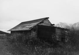
This file contains images of a land dispute around Cassiar. The photographs depict a cabin on a lot, a destroyed cabin, and outhouses. The accompanied documents in the original file refer to the subjects of "Claims, Leases, and Land lots," and it is implied that there were issues of squatters, illegal occupation, and mineral claims.
Blueprint of the Cassiar Recreational Centre depicting various details regarding aspects of the building. Perspectives included within the blueprint are top-down as well as cross-sections. There are notes by the architect towards how certain building aspects and details are to be found and built throughout the blueprint.
Blueprint of the Cassiar Recreational Centre depicting various details regarding aspects of the building. Perspectives included within the blueprint are top-down as well as cross-sections. There are notes by the architect towards how certain building aspects and details are to be found and built throughout the blueprint. There are annotations located throughout the blueprints written in gold pen and pencil regarding certain errors, changes and further clarification on various aspects of the building from the original plans. Numerical annotation at the bottom right hand of plan imposed new numbering system (3002/09/06 to 12 repectively).
This blueprint depicts the outside layout of the recreation centre and includes its north, south, east and west elevations. Details are included regarding the materials to be used for construction.
This blueprint depicts the outside layout of the recreation centre and includes its north, south, east and west elevations. Details are included regarding the materials to be used for construction. Annotations in gold pen and pencil regarding clarification and changes to certain details are included. Numerical annotation at the bottom right hand of plan imposed new numbering system (3002/09/07).
This blueprint depicts the detailed plans for the recreational centre's entrance hall. There are details pertaining to the elevation of entrance doors, the overall plan of the entrance hall, the upper level staiwell as well as handrailing details.
This blueprint depicts the detailed plans for the recreational centre's entrance hall. There are details pertaining to the elevation of entrance doors, the overall plan of the entrance hall, the upper level staiwell as well as handrailing details. Annotations in gold pen and pencil regarding clarification and changes to certain details are included. Numerical annotation at the bottom right hand of plan imposed new numbering system (3002/09/08).
This blueprint depicts the overall framing structure of the recreational centre. Details include a cross section layout of the recreational centre with relevant framing dimensions, the locations and instructions for assembly as well as types of framing materials to be used.
This blueprint depicts the overall framing structure of the recreational centre. Details include a cross section layout of the recreational centre with relevant framing dimensions, the locations and instructions for assembly as well as types of framing materials to be used. Annotations in gold pen and pencil regarding clarification and changes to certain details are included. Numerical annotation at the bottom right hand of plan imposed new numbering system (3002/09/10).
This blueprint depicts the general layout of the recreational centre. Top-down, side and front perspectives are used. The ground floor, second floor, outside walls and stage layouts are shown.
This blueprint depicts the general layout of the recreational centre. Top-down, side and front perspectives are used. The ground floor, second floor, outside walls and stage layouts are shown. Annotations in gold pen and pencil regarding clarification and changes to certain details are included. Numerical annotation at the bottom right hand of plan imposed new numbering system (3002/09/06).
This blueprint depicts a cross-section layout of the recreational centre which includes a 1/4 scale drawing of a wall unit.
This blueprint depicts a cross-section layout of the recreational centre which includes a 1/4 scale drawing of a wall unit. Annotations in gold pen and pencil regarding clarification and changes to certain details are included. Numerical annotation at the bottom right hand of plan imposed new numbering system (3002/09/09).
This blueprint depicts the overall layout of the heating and ventilating units to be used for the first and second floor of the recreational centre. Details include the locations of fans, boilers, ducts and exhausts as well as typical heating connector connections and the plumbing layout.
This blueprint depicts the overall layout of the heating and ventilating units to be used for the first and second floor of the recreational centre. Details include the locations of fans, boilers, ducts and exhausts as well as typical heating connector connections and the plumbing layout. Annotations in gold pen and pencil regarding clarification and changes to certain details are included. Numerical annotation at the bottom right hand of plan imposed new numbering system (3002/09/11).
This blueprint depicts the gymnasium lighting layout. Also shown is an isometric view of the air supply unit piping as well as a ventilating unit automatic control diagram. Included are detailed notes regarding system desriptions, its plan and layout as well as directions for the automatic control of the ventilation unit and heating systems.
This blueprint depicts the gymnasium lighting layout. Also show is an isometric view of the air supply unit piping as well as a ventilating unit automatic control diagram. Included are detailed notes regarding system desriptions, its plan and layout as well as directions for the automatic control of the ventilation unit and heating systems. Annotations in gold pen and pencil regarding clarification and changes to certain details are included. Numerical annotation at the bottom right hand of plan imposed new numbering system (3002/09/12).
Photograph of Cassiar Towniste with pen annotation on front "Deyo August 1979 - 2 October 1992)."
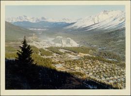
Photograph depicts the Cassiar townsite behind shadow in foreground. Plantsite can be seen including the mill, dry rock storage building, tailings pile, and many other buildings. Mountains in background. Handwritten annotation on recto: "<- 13 1/2" ->". (This photograph was made into a promotional poster.)
Cassiar Asbestos Corporation Ltd opened a second mine in 1967 at what became the one-industry town of Clinton Creek, Y.T. File contains photographs depicting progressive construction of buildings at the Clinton Creek mine, plant, townsite and powerhouse. Mine photos depict the crusher site and tramline station. Plant photos depict the dryer, fibre storage, mill, service, vault, and office buildings, as well as the dry rock storage tunnel, reclaim tunnel, and loading dock. Construction living quarters are depicted as well as the construction of residences at the townsite. The power house was built south of the town and plant, on the shore of the 40 Mile River. Some annotations describe the type of material being used for construction.
Cassiar Asbestos Corporation Ltd opened a second mine in 1967 at what became the one-industry town of Clinton Creek, Y.T. File contains photographs depicting different areas of operations at Clinton Creek. Locations include the mine, plant, town, tailings pile, main office, the 40 Mile River, and surrounding area. Town photos depict the grocery store, cafeteria, medical clinic, school, auditorium residential area, Connell Street and power house. File also includes aerial photographs and images depicting forest fighting, photographers capturing the tailings pile, asbestos samples, mining machinery, staff offices, and operations in the mill, lab, and garage.
Additional photographs integrated into file depict Clinton Creek's surrounding area, and three slides of a tailing pile explosion believed to be Clinton Creek.
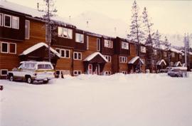
Photograph depicts trees and pickup trucks in front of long building speculated to be an apartment residence.
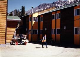
Photograph depicts an unidentified man walking in front of orange and brown two-story building speculated to be bunkhouse residences. Second unknown individual can be seen unloading car in left foreground. Trees and mountains visible in background.
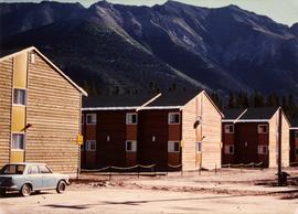
Photograph depicts four orange and brown two-story buildings speculated to be bunkhouse residences. Blue car in foreground, forest and mountains in background.
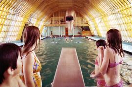
Photograph depicts group of children standing in front of diving board, watching a peer dive into water below. Group of swimmers visible in background below domed roof of pool.
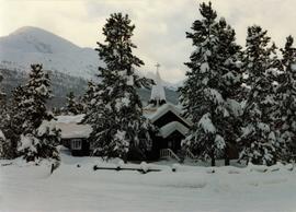
Photograph depicts church believed to be the All Saints Anglican Community Church at Cassiar, B.C. Trees and fence in foreground, forest and mountain in background.
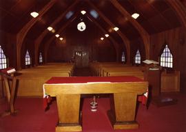
Photograph depicts interior of church believed to be the All Saints Anglican Community Church at Cassiar, B.C. Table and pulpit in foreground, pews and door in background. Stained glass windows line both sides of the building.
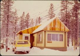
Photograph depicts mobile home modified for Cassiar winters (steeply sloped roof added). Yellow suburban parked in driveway in left foreground. Forest trees and mountainside visible in background. Sign reading "686" posted on tree in left foreground. Believed to be the home of Gerry Cooper.
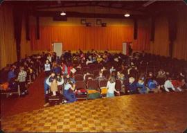
Photograph depicts large auditorium, seats filled with unidentified individuals (mostly children). Rounded stage in foreground, curtain on wall in background. This building was built in the late 1970s and belonged to the community's cultural society.
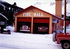
Photograph depicts two fire trucks semi-visible in garage with the sign "FIRE HALL". House and snowmobile can be seen in left midground, truck and power pole in right foreground. Mountains in background. Warning visible on front of trucks: "KEEP BACK 500m".
Photograph depicts unknown individuals seated in chairs of room speculated to be a living room or common area. Potted plants, television, open door, and wall hangings in background. Lamps, chairs, and side tables in foreground.
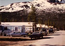
Photograph depicts vehicles parked in driveways and on street to right of mobile homes. Mountain base in background.
Photograph depicts four unidentified individuals walking in front of Cassiar Private Hospital. Sign in foreground reads "VISITING HOURS EVERY DAY / 2 PM - 4 PM / 7 PM - 8 PM".
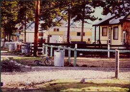
Photograph depicts residences and fenced front yards to left of street, trash cans in front. Small tricycle, camping trailer, power poles, and trees also visible.
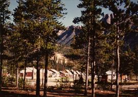
Photograph depicts row of houses on either side of street in midground. Forest trees in foreground, mountains in background.
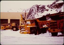
Photograph depicts the new mine garage behind machinery, mountains in background. Mobile blast hole drill can be seen in left foreground (manufactured by Robbins with Caterpillar undercarriage). Two 50-tonne Wabco "haul paks" in right foreground (ore haulage trucks).
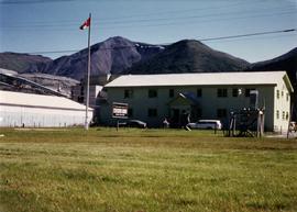
Photograph depicts two-story main office building in right midground behind sign reading "CASSIAR ASBESTOS CORPORATION Ltd / CASSIAR MINE / MAIN OFFICE". Building believed to be warehouse can be seen behind raised Canadian flag on pole in left midground. New mill building and tailings pile visible behind warehouse and office, mountains in background.
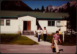
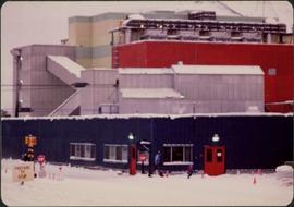
Photograph depicts long building with blue siding. Security was located at corner of building in centre foreground, behind stop sign. Single red door on left was main entrance into mine dry, where individuals were checked through security. Two larger windows on left indicate the location of the mine store where work apparel could be purchased. Building also housed change house (see item 2000.1.1.3.19.121) and offices of the mine department supervisory staff. Employee parking lot located out of frame to right. Mill building stands in background, tramline dump station on left. Ore car visible, about to enter dump station. Unidentified man and child can be seen in foreground.
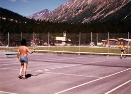
Photograph depicts two unidentified men playing tennis in foreground. Buildings stand in midground, including what appears to be the All Saints Anglican Community Church. Forest and mountain in background.
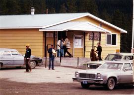
Photograph depicts unidentified men and women in front of yellow building with the signs "POST OFFCE / BUREAU DE POST / CASSIAR, B.C.", "NO PARKING". Three cars (one with siren on top) can be seen in foreground; forest in background.
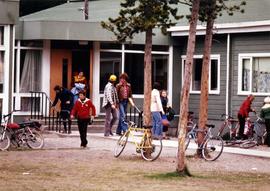
Photograph depicts group of men, women, and children exiting main entrance of building believed to be the school at Cassiar, B.C. Trees and bicycles in foreground.
Photograph depicts man seated in chair while reading newspaper, bed on left, chair and mirror on right. Winter scene visible through window in background.
Photograph depicts woman seated at desk. Chair, bedside lamp and table, and bed also visible in room. Counter area in left foreground, curtains on window in background.
Photograph depicts two unidentified men using weight training equipment in indoor gymnasium. Weights and other equipment in background.
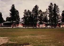
Photograph depicts three long panabode buildings behind trees across from ball park. Power lines and other buildings visible in background. The winter bunkhouses contained double occupancy rooms with a common bathroom, and were distinguished from the summer bunkhouses which were generally considered less accommodating (see item 2000.1.1.3.19.84).
Unidentified wood structures in foreground on far left.
Handwritten caption below this photo reads: "Completed Foundations for Crusher, with forms being stripped." Men can be seen working on site. Switchback road, power lines and tramline towers are believed to be in valley in background.
Photograph depicts framework of one side of the crusher building next to rocks from excavated mountain wall. Lumber in foreground. Handwritten caption beside this photo reads: "Note confined area to work in, and need for rock fences."
