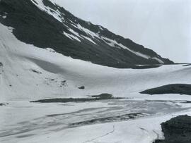
Photograph depicts a frozen pond located in a snowy landscape on the east side of Copper Mountain.
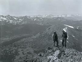
Photograph depicts two men (Bill McPhee and Shorty Weber) standing at the summit of Copper Mountain with a snowy mountain range visible in the background of the image.
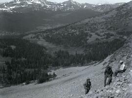
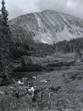
Photograph depicts (from left to right) Bill McPhee, Frank 'Shorty' Weber, and another man resting along the rocky terrain on the west slope of Copper Mountain with a forested area at the base of the mountain. In the background of the image another mountain range is visible. The location of the photograph is noted to be at Copper Mountain; however, that name does not appear to be in current use. Location is assumed to be somewhere in the vicinity of 55.979291, -125.208415, near what is currently named Wasi Peak.
Frank ‘Shorty’ Weber had a trapline on the upper Ingenika for over 30 years. and he was well-known in the Finlay River area.
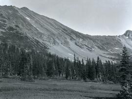
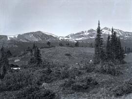
Photograph depicts Copper Mountain with forested area at base and grassy area in the foreground.
Photograph depicts four men seated around a small camp in front of Copper Mountain. The location of the photograph is noted to be at Duck Creek at Copper Mountain; however, those names may no longer be in current use. Location is assumed to be approximately 55.979291, -125.208415 near what is currently named Wasi Peak.
Photograph depicts three men sitting in a circle in a clear area near a sparsely forested area in front of a snowy mountain range. The location of the photograph is noted to be at Duck Creek at Copper Mountain; however, those names may no longer be in current use. Location is assumed to be approximately 55.979291, -125.208415 near what is currently named Wasi Peak.
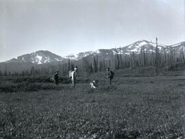
Photograph depicts (from left to right) Bill McPhee, an unidentified man, a dog, and Frank 'Shorty' Weber standing in tall meadow grass in front of a sparsely forested landscape in front of a mountain range. The location of the photograph is noted to be at Duck Creek below Copper Mountain; however, those names may no longer be in current use. Location is assumed to be approximately 55.979291, -125.208415 near what is currently named Wasi Peak.
Frank ‘Shorty’ Weber had a trapline on the upper Ingenika for over 30 years. and he was well-known in the Finlay River area.
Photograph depicts Frank 'Shorty' Weber steering a dug-out canoe on the Omineca River. The background of the photograph depicts log cabins at Old Hogem built along the shoreline of the river in front of a forest with a mountain ridge in the background.
Frank ‘Shorty’ Weber had a trapline on the upper Ingenika for over 30 years. and he was well-known in the Finlay River area.
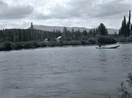
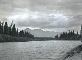
Photograph depicts a wide view of the Omineca River with a man standing on a boat in the right corner of the image. In the background the river a forested shoreline and mountain range are visible.
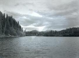
Photograph depicts the view from Germansen Lodge of Omineca River with a forested shoreline and mountain ranges in the background.
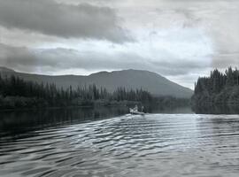
Photograph depicts Ralph Meiser and another man ("Crites"?) paddling a wooden boat on the Omineca River near Germansen Landing.
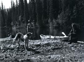
Photograph depicts two men and two dogs resting near a wooden rowboat stopped along the shoreline of upper Osilinka River near Swiggums mining claims.
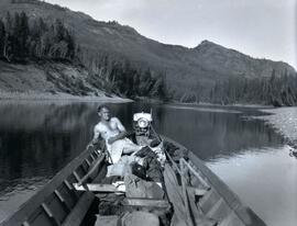
Photograph depicts Emil Bronlund at the back of a wooden motor boat resting after a swim in the Omineca River, located near Germansen Landing.
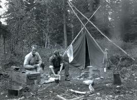
Photograph depicts Emil Bronlund and another man kneeling at camp with a tent and cooking fire. The camp is located at Little Canyon near the upper Omineca River.
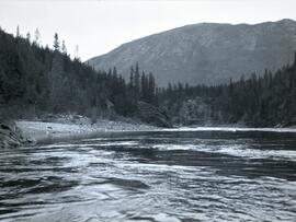
Photograph depicts the rocky shoreline and forest environment at the entrance to Little Canyon viewed from the Omineca River.
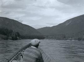
Photograph depicts a man siting in a wooden boat on the Omineca River leading to the entrance of Little Canyon toward a forested shoreline.
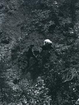
Photograph depicts two men inspecting dirt at Swiggums' mining claim near Osilinka River.
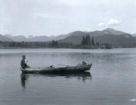
Photograph depicts Clarence Waldof sitting on the bow end of a wooden boat floating on End Lake off the Osilinka River with a forested landscape along the shoreline. A mountain range is visible in the background of the photo.
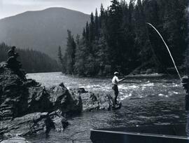
Photograph depicts men fishing off a rocky point between the Omineca and Osilinka Rivers.
The fonds consists of 5 - 16mm prints of Tompkins's films, and 48 slide boxes featuring natural history images. Includes "Nahani," "Where Timber Wolves Call," "White Bear of the Kalum," and "Waterway Adventure with Tommy Tompkins."
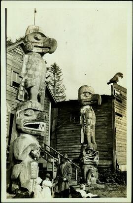
Zonder titelPhotograph depicts two large totem poles on either side of the front steps of Kwakwaka'wakw cedar plank houses. An unidentified woman and three small children can be seen in foreground. A second building stands in background on right. Handwritten annotation on recto of photograph states: "New Hazelton". However, this annotation has been determined to be incorrect; this photograph is believed to depict Alert Bay. The nearest tall pole seen in the picture may be "Raven of the Sea" carved by Mungo Martin in 1902.
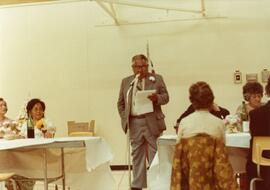
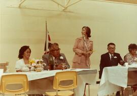
Photograph depicts Heber Maitland speaking at microphone with Iona Campagnolo, Mrs. Ivy Maitland, and others seated at the opening of the Haisla Recreation Centre in Kitamaat Village.
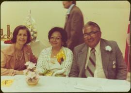
Photograph depicts Iona Campagnolo, Heber Maitland, Mrs. Ivy Maitland, and others at the opening celebrations of the Haisla Recreation Centre in Kitamaat Village.
Photograph was taken during a tour of the Skeena riding in the summer of 1978. Unidentified man walks in background.
Handwritten annotation on verso reads: “June 78, Kitamaat, Heber Mrs. Maitland”.
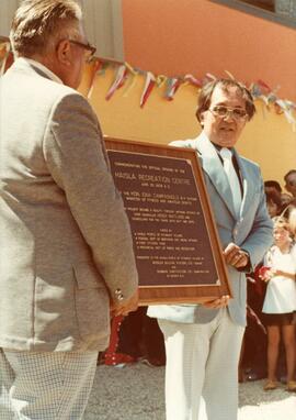
Photograph depicts Heber Maitland holding a commemorative plaque at the opening of the Haisla Recreation Centre in Kitamaat Village.
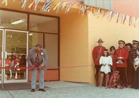
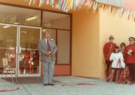
Photograph depicts Heber Maitland cutting the ribbon at the opening of the Haisla Recreation Centre in Kitamaat Village.
Photograph depicts Heber Maitland with cut ribbon at the opening of the Haisla Recreation Centre in Kitamaat Village.
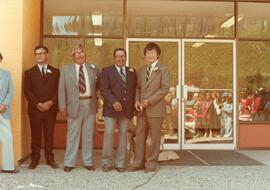
Photograph depicts Heber Maitland and three unknown men at the opening of the Haisla Recreation Centre in Kitamaat Village.
Fonds predominately reflects Ainley's research as a professor at the University of Northern British Columbia. Her research is arranged into thirteen subseries. Research material includes: photocopies of publications and archival material, correspondence, bibliographies, research interviews, transcripts, draft manuscripts, photographs, and other records. A series of personal records includes: retirement activities, her hobbies of art and writing, diplomas, and photographs. The series on her administrative and supervisory activities of professorship of women’s studies and environmental studies is arranged according to the major activities with which Ainley was involved and includes: meeting minutes, memoranda, reports, correspondence, employment, and other records. A series of electronic records relating, predominately, to Ainley’s research includes: draft manuscripts, conference proceedings, bibliographies, transcripts, correspondence, curricula vitae and other records. A series of professional development records includes records from conferences she attended and occasionally presented at as well as other professional development activities that she undertook. A series of correspondence predominantly consists of personal correspondence but also includes professional correspondence related to her research and occupation.
Zonder titelSeries largely consists of Ainley's administrative activities as professor and chair of the Women's Studies Program at the University of Northern British Columbia. Material is arranged, predominately, according to the activities with which Ainley was involved, including overseeing program restructuring, coverage of the Women's Studies Program in the media, presentations to prospective students, planning for research presentations and conferences, curriculum development and retirement preparation. Series also documents Ainley's appointment as an adjunct professor in the Environmental Studies department at the University of Victoria. The series also includes records concerning Ainley's graduate student research assistants and their work with her. The series consists of memoranda, meeting minutes, reports, posters, speaking notes, correspondence, brochures, pamphlets, articles, course descriptions and syllabi, notes, printed emails, and employment contracts.
File contains a presentation on women with invisible disabilities at the University of Northern British Columbia by Dr. Sharon Stone and an interview with Nupur Gogia.
Item consists of transcript and tape summary of interview with guide outfitter Bruce Russell conducted by Bob Harkins in Fort St. James regarding Russell's experiences as a guide outfitter. Russell also discusses other guide outfitters and hunters from Northern British Columbia.
Zonder titelThis photograph of a book page depicts a printed image of a mountain with text under the image that says "Hazelton District uranium strike proving up".
This photographic reproduction from the BC Provincial Archives is captioned: "#38210 - Mule train at Hazelton, B.C."
This photographic reproduction from the BC Provincial Archives is captioned: "#56538 - Copied from original watercolor in album by Mr. J.C. White, during Western Union Telegraph Expedition - 1865. Resembles terrain encountered in the Skeena area."
This photographic reproduction from the BC Provincial Archives is captioned: "#36523 - Transportation - Hazelton, B.C. Believed to be a Hudson Bay Pack train."
This photographic reproduction from the BC Provincial Archives is captioned: "#68319 - G.T.P. Track Layer Laying Steel from Kitselas to Hazelton."
This photographic reproduction from the BC Provincial Archives is captioned: "#59852 - Passengers, first class, open air express ride now pay later - maybe. In front of Siems-Carey (sub-contractors) office). Mile 53, BC. - c. 1913." Mile 53 was located west of Tete Jaune Cache, BC.
This photographic reproduction from the BC Provincial Archives is captioned: "Prince George District - Another 'town' - Mile 129, BC - Summer 1913". In August 1913, Foley, Welch and Stuart, railway contractors, moved their distribution depot from Tete Jaune to Mile 129, in the vicinity of present day Loos, BC.
File consists of photographs from Audrey L'Heureux's manuscript for publication entitled "Trail to Rail: Settlement Begins, 1905-1914". The following photographs are reproductions from the BC Provincial Archives:
- BC Provincial Archives, "Hudson's Bay Co. Post at Fort St. James (Stuart Lake)", [191?] (photograph reproduction)
- BC Provincial Archives, "Fort St. James, Hudson Bay Boat at Fort St. James area", 1909 (photograph reproduction)
- BC Provincial Archives, "Grading Prince George Railway Yards Marion Steam Shovel and Mules", 1913 (photograph reproduction)
- BC Provincial Archives, "Hudson's Bay Co Building Fort George B.C", 1911 (photograph reproduction)
- BC Provincial Archives, "Prince George, B.C. from the foot of Victoria St., looking Southeast", April 12, 1914 (photograph reproduction)
- BC Provincial Archives, "Northern Hotel at South Fort George Note the water on the street", [191?] (photograph reproduction)
- BC Provincial Archives, "Another town mile 129 BC", 1913 (photograph reproduction)
- BC Provincial Archives, "H.B. Co. Post at Fort Fraser (Fraser Lake) with barley field in the foreground", [191?] (photograph reproduction)
- BC Provincial Archives, "Fort Fraser, B.C.", 1914 (photograph reproduction)
- BC Provincial Archives, "Mr. Olds as he entered British Columbia to locate 100 miles ahead of steel at Endako", February, 1913 (photograph reproduction)
- BC Provincial Archives, "S.S Chileatin and the S.S. at Stuart lake", 1913 (photograph reproduction)
- BC Provincial Archives, "Showing Track layer Arriving from the east making the last connection G.T.P.P Ft. Fraser", 1914 (photograph reproduction)
This photographic reproduction from the BC Provincial Archives is captioned: "#59864 - S.S. Chilcotin and the S.S. Conveyor at Foley, Welch & Stewart dock at the "cache" - Prince George, B.C. - Summer of 1913".
This photographic reproduction from the BC Provincial Archives is captioned: "#70002 - Hudson Bay Boat at Fort St. James - circa 1909."
This photographic reproduction from the BC Provincial Archives is captioned: "#66313 - Northern Hotel at South Fort George. Note the water on the street. (possibly around 1913)."
This photographic reproduction from the BC Provincial Archives is captioned: "#59876 - Grading Prince George railway yards. Marion steam shovel + mules. Late summer 1913." Photograph depicts Foley Welch & Stewart rail cars filled with gravel, a work horse, and a Marion Shovel Model 40 shifting gravel.
This photographic reproduction from the BC Provincial Archives is captioned: "#59874 - Prince George, B.C. from the foot of Victoria St., looking Southeast. April 12, 1914."
This fonds encompasses the journalism, writing, and research of Audrey Ruth Smedley L'Heureux. L'Heureux's research interests focussed on northern and central British Columbia, beginning with pioneer settlement through to community life in the 2000s. L'Heureux's research also covered transitional phases of British Columbia history such as natural resource extraction, the impact of the railways, industrialization, and interactions with Indigenous communities. Predominantly organized in subject files, the L'Heureux's fonds provides collected research material on many topics relevant to the history of northern and central British Columbia. L'Heureux also collected numerous oral histories from pioneers in various northern and central British Columbia communities which informed her journalism and published works.
The Audrey Ruth Smedley L'Heureux fonds consists of three series. The first series consists of L'Heureux's research and subject files, a collection spanning her career as a journalist and author from 1970 to 2005. The second series consists of records relating to L'Heureux's writing, including manuscripts from her "From Trail to Rail" book series. The third series contains a small selection of L'Heureux's personal records, including a video that recounts L'Heureux's life story and accomplishments.
Zonder titelFile consists of maps and pamphlets for British Columbia historic trails, waterways, historic towns, and geological features. Materials include newspaper clippings, placemats, pamphlets, and maps. Highlights include:
- Parks Canada, "Fort Langley National Historic Park British Columbia", [198-?] (pamphlet)
- North Pacific Cannery Village & Museum, "Discover British Columbia's Oldest Surviving Salmon Cannery Only 20 minutes from Prince Rupert", [198-?] (pamphlet)
- Ministry of Lands, Parks and Housing, "Barkerville Provincial Historic Park", 1986 (pamphlet)
- Map, "Yellowhead Highway 16 West Gateway to Alaska", [197-?]
- Columbia River Projects, "Mica Dam", [197-?] (pamphlet)
- Ministry of Lands, Parks and Housing, "Crooked River Provincial Park", 1980 (pamphlet)
- Parks Canada, "Fort St. James National Historic Park", 1981 (pamphlet)
- "Centennial Map of Canadian History and Achievements 1867-1967"
- B.C. Hydro, "W.A.C Bennett Dam Peace River", 1971 (pamphlet)
- Ministry of Lands, Parks and Housing, "Tweedsmuir Provincial Park (south)', 1984 (pamphlet)
- McKenzies M7 Trails West, "Explore the Canadian Rockies", [198-?] (pamphlet)
- Department of Lands, Forests, and Water Resources, "Coastal Systems", 1968 (map)
This photographic reproduction from the BC Provincial Archives is captioned: "#51779 - Hudson's Bay Co buildings - Fort George, B.C. 1911".
This photographic reproduction from the BC Provincial Archives is captioned: "#80977 - Fort Fraser, B.C. - c 1914." Photograph depicts the Fort Fraser general store.
This photographic reproduction from the BC Provincial Archives is captioned: "#10843- Hudson's Bay Co. post at Fort St. James (Stuart Lake)."
