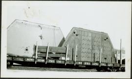
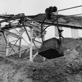
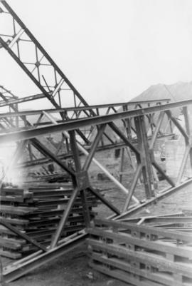
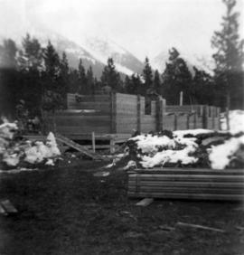
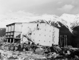
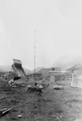
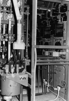
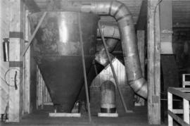
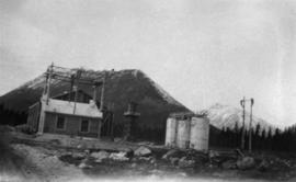
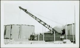
Photograph depicts crane visible behind large metal structures, building materials in foreground.
Photograph depicts two large metal structures on flatbed trailer. Trees visible in background.
Photograph depicts boat hull resting on trailer flatbed pulled by truck. Trees and hills in background.
Photograph depicts lumber and brush piles, forest in background. Crane semi-visible on left, small boat semi-visible on right.
Photograph depicts three men panning in stream, sluiceway behind them. Rocky banks in foreground, forest in background.
Photograph depicts man standing in front of large streams of water spraying from pipe into mining area, hills in background.
Photograph depicts sluice trunk in mining area, men on tall structure in background.
Handwritten caption beside this photo reads: "Sumit Lake." Trees can be seen on shore jutting into the lake on left, as well as on opposite shore in distant background. Unidentified objects can be seen in distance, possibly buildings on far shore.
Photograph depicts unidentified man standing on boom of dragline crane, apparently without safety gear. Unidentified building and equipment can be seen in background against forest.
Photograph depicts a numerous variety of buildings in snowy clearing of forest. A car is parked in foreground on road leading into the camp. Handwritten caption beside this photo reads: "Sumit Lake Camp". It is speculated that this may be the Campbell Construction Co. road camp.
Handwritten annotation on recto of photograph: "POURING RIBS JUNE 29/64." Photograph depicts construction workers on large wooden framework structure extending from base of crusher building. Ladders stand parallel to structure against mountainside. The boom of a crane is visible in foreground. Miscellaneous construction equipment and materials throughout.
Photograph depicts view of mine road in valley, from mountain above. Plant, tailings pile, and town visible in distance. South mountains in background. Handwritten annotation on verso of photograph: "1961", on recto: Townsite and Plantsite from mine."
Photograph depicts the North peak of McDame mountain in the earlier stages of strip mining, South peak unmined in background. Quonset and other shops visible in left foreground, unknown building built into mountainside in right foreground.
Photograph depicts the Cassiar mine. North peak featured in left background, South peak in right background, and West peak in right foreground. Area to left of the mining pit and West peak was called the "cirque waste dump." Location of new mine garage can be seen just above the "#7 switchback" road in bottom right foreground.
Photograph depicts the Cassiar mine. North and South peak featured in background, and West peak in left foreground. Pit is being developed between South peak and West peak. Old mine garage is visible in lower centre of image, and crushing plant in right foreground. Mountain range in distance.
Photograph depicts two pick hammers laid in asbestos fibre. Annotations on note glued to recto of photograph: "ASBESTOS"; "Detail view of asbestos talus. Early test pit near top of showing. Western slope." Areas of image have been labeled "A" and "B". Photo caption under printed copy of image in 1952 Annual Report: "A - Asbestos fibre partially opened by frost action. B - Serpentine rock originally containing the asbestos fibre."
Photograph depicts a man and woman standing on what is believed to be an early mining bench. Two men with air track drill can be seen in background, one man father down on left, mountain range in background. Image slightly distorted due to poor quality of negative.
Photograph depicts two men working with air track drill in mine area. Hose and dynamite box in foreground, mountains in background. Handwritten annotation on verso of photograph: "Sept. 1954." This photograph was originally stored inside duotang labeled "CASSIAR ASBESTOS CORPORATION LIMITED PHOTOGRAPHS 1954"; photo caption beneath this image: "Starting New Bench at South end of Deposit."
Photograph depicts unknown man driving bulldozer on edge of mine area at high elevation. The dozer is an International model TD24 (manufactured between 1947 and 1955). A second man stands on edge of cliff, directing driver. Expansive mountain range in background.
Photograph depicts bucket hanging from tramline in foreground. Support tower stands in midground in front of station building. Another building can be seen at top of mountain in background. Handwritten annotation on recto of photograph: "INCOMING BUCKET #1 STATION". Photograph was glued to cardboard backing with the annotation: "1962".
Photograph depicts a car and two dump trucks near a small garage by road in mine. One man stands at garage site among tires and miscellaneous tools. Blasthole drills, shovels, and dump trucks visible in distance. Rocks in foreground, mountains in background. Handwritten annotation on verso of photograph: "1961".
Photograph depicts men standing near two Atlas Copco Drillmasters (blasthole drills). These are precision hammer drills which had their own power source. Large bags of ammonium nitrate in foreground, mountaintops in background. The men depicted here were likely members of the explosive crew. It is believed that this photo was taken on the North ridge, near the cirque dump. Handwritten annotation on verso of photograph: "1961".
Photograph depicts tower and bucket tram in left foreground, plantsite in midground, mountains across valley in background. Dry rock storage building, mill, tailings pile, and many other buildings visible in plantsite. Handwritten annotation on verso of photograph: "1961".
Photograph depicts a fan from the air system used to transport fibre throughout the mill system. It is believed that this photograph was taken on the top floor of the mill. Handwritten annotation on verso of photograph: "1961".
Photograph depicts long wood building believed to be the bar and snackbar at Cassiar B.C. Two men can be seen standing on one of three porches to building. Pole, car, and trees in foreground; unknown buildings and mountain base in background. Handwritten annotation on verso of photograph: "1961".
Photograph depicts foundation of building in Cassiar plant site. Dump truck on left, steel framed building on right, crane in background.
Photograph depicts steel materials for framework of dry rock storage building, mountains in background.
Photograph depicts numerous illegible sign posts on dirt road.
Photograph depicts power poles along dirt road, truck in distance, trees on either side. Building on right of road speculated to be bunkhouse. Mountain slope in background.
Photograph depicts a tarp-covered truck, man climbing on front. Dump truck and mountain in background.
Photograph depicts a man in long coat and hat on bridge over water, trees in background. Believed to be same bridge shown in item 2000.1.1.2.17.
Photograph depicts ore gravity chute on McDame Mountain, view facing up mountain.
Photograph depicts four large trucks hauling miscellaneous material on road. Mountain in background, believed to be Cassiar area.
Photographs depict electrical room.
Photograph depicts tanker truck overturned in snow, trees in foreground. Corresponding note on accompanying photo description page: "March 29th: 1. Jack Ward's tanker over the bank at Centreville."
Photograph depicts bunkhouse under construction in wooded area, men barely visible, mountain in background. Corresponding note on accompanying photo description page: "April 7th: 6. Erecting the walls for # 1 Bunkhouse. Looking east."
Photograph depicts dirt road in snow, trees on either side, mountain in background. Corresponding note on accompanying photo description page: "April 7th: 8. Street running east and west closest to creek. Looking west."
Photograph depicts digging area in front of large building. Corresponding note on accompanying photo description page: "April 7th: 12. Excavation for Symons crusher foundation."
Photograph depicts man in snow-covered area, trees and mountain in background. Corresponding note on accompanying photo description page: "Feb. 27th: 11. Clearing site for bunkhouses. Picture shows that some trees being left. Looking N.E."
Photograph depicts two men at bottom of steep mountain slope, second mountain in background.
Photograph depicts close perspective of equipment believed to be in concentrator, dryer, or mill building. Typed annotation taped to verso of page stapled to photograph: "View of fan at right which provides vacuum for screen hoods and at left, collector which removes fibre from the air stream and drives it to the fans below for further processing."
Photograph depicts equipment believed to be in the concentrator, dryer, or mill building. Typed annotation taped to verso of page stapled to photograph: "Close-up of vacuum hood which sucks fibre away from the rock."
Photographic negative depicts power house on left, water and diesel storage tanks on right. Rocks in foreground, trees and mountains in background.
Photographic negative depicts ore gravity chute. Portion of switchback mountain road in foreground, mountains in background.
Photograph depicts mill under shadow of mountain. Three white piles in foreground. Power poles, one white pile, and mountains in background. Speculated corresponding annotation on verso of page stapled to photograph: "Cassiar Mill".
Photograph depicts overturned tanker in snow bank, man on left, mountainside in background. Speculated corresponding annotation on verso of page stapled to photograph: "Overturned Tanker (Glacier 1 mile north of Joe Reed's)".
Photograph depicts mill building. Rocks in foreground, mountains in background.
Photograph depicts mill, scaffolding on left side of building. Second scaffolding structure in foreground, trees and mountains in background.
Photograph depicts building under construction on snow-covered mountainside. Men on roof, building materials on ground. Dirt road and unknown object [part of vehicle?] in foreground.
Photograph depicts sub-station building built on tall wood poles adjacent to power house, roof under construction. View north west, building materials in foreground, mountain in background.