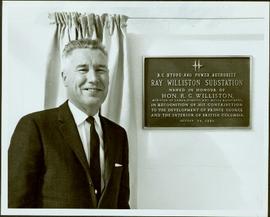
Image depicts several old, ruined cars and an unknown individual in Island Cache.
Image depicts a house in Island Cache.
Image depicts what appears to be an animal pen in Island Cache. There is a goat and numerous chickens in the image, as well as a pile of miscellaneous material.
Image depicts a few houses in Island Cache. There are two unknown individuals present.
Image depicts a damaged, upturned car in Island Cache.
Image depicts a view of Tabor Mountain in Prince George, B.C.
Image depicts some fallen trees at Island Cache.
Image depicts two dogs and numerous chickens in a yard at Island Cache.
Image depicts the bank of the Nechako River at Island Cache.
Image depicts a few houses and a dog on a porch at Island Cache.
Image depicts a body of water in Island Cache. It is possibly a small section of the Nechako River.
Image depicts what appears to be an animal pen in Island Cache. There are two horses and a chicken in the enclosure, and a rundown building.
Image depicts a backyard filled with various items piled against a shed in Island Cache.
Image depicts a house in Island Cache.
Image depicts a house in disrepair, and possibly abandoned, in Island Cache.
Image depicts the interior of a house that appears to be abandoned and in disrepair in Island Cache.
Forest cover map showing a crossing area of the McGregor River is annotated with a road and ferry crossing.
Item is a photograph of Mr. Williston (Minister of Lands, Forests & water Resources), Pat Jordan (Minister without Portfolio), Prince George Mayor Harold Moffat, Grace McCarthy (Minister without Portfolio) and Premier W.A.C. Bennett.
Image depicts a number of small houses at Island Cache.
Image depicts a stand of trees and a shed at Island Cache.
Image depicts what is likely an outhouse at Island Cache.
Image depicts a clearing at Island Cache.
Image depicts a grocery store at Island Cache.
Image depicts a house in Island Cache. There are several cars parked outside it.
Image depicts a boarded up building in Island Cache.
Image depicts two children standing near an old car in Island Cache.
Image depicts a number of sheds in Island Cache.
Map reproduction of the Aleza Lake Research Forest depicts timber sale areas, forest cover, and other details.
This very large drawing shows CN leases and private property buildings on Island Cache in detail.
Lockwood Survey Corporation Ltd.Item is a photograph of, from left: John G. Prentice of Canadian Forest Products; Peter Bentley of CanFor; Mr. Williston; unknown; Premier W.A.C. Bennett; an unknown representative of Reed Paper and L.L.G. “Poldi” Bentley of Can For.
Photograph depicts a bridge at the east end of the CNR yards in Prince George, crossing the Fraser River.
Photograph depicts the CNR depot in Prince George. To the right area of the photograph lay the downtown area of the city.
Photograph depicts a disused snow plow #6001 that was built of wood. Snow plough #6002 is found behind.
Photograph depicts the CNR depot. Considerable renovation work was taking place on both sides of the building and in the interior nearest to the camera.
Photograph depicts a possible fence post or well digger found near the Prince George Airport.
Photograph depicts a rail bridge over the Fraser River. Canter levelled on both sides were vehicle roadways which ceased to be used in 1987 when a new road bridge was supposed to be completed. The right lane took cars into the city of Prince George.
Photograph depicts a plough found near Clulculz Lake, 45 miles west of Prince George. Its metal parts were made in the USA.
Item is a photograph of Ray Williston standing beside a plaque at the dedication of the Peace River Power Project Substation bearing his name in Prince George on August 30, 1965.
Item is a photograph of Prince George taken from the air on August 2, 1965.
Item is a photograph of Prince George taken from the air.
Slide depicts a black bear eating garbage by wooden outbuildings, possibly at the Aleza Lake Experiment Station.
Slide depicts a detonation in an area of cleared ground in a forested area, likely the Aleza Lake Experiment Station. Work may have been undertaken for roadbuilding activities at the Experiment Station.
Slide depicts a cleared area at the Aleza Lake Experiment Station with plant regeneration.
Slide depicts a heavily forested area with fallen logs, likely at the Aleza Lake Experiment Station.
Slide depicts the original wooden BC Forest Service sign for the Aleza Lake Forest Experiment Station.
Slide depicts a burning building at the Aleza Lake Experiment Station on the date it was shut down by the BC Forest Service.
Slide depicts a view of what is possibly the Upper Fraser River.
Slide depicts the Ranger Station at the Aleza Lake Experiment Station.
Slide depicts a man operating heavy equipment in a forest, likely at the Aleza Lake Experiment Station.