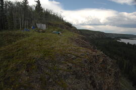
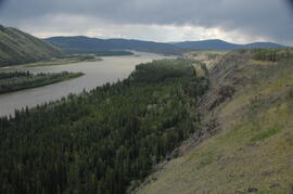
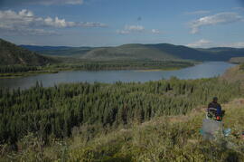
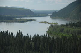
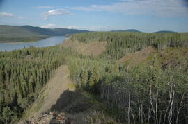
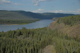
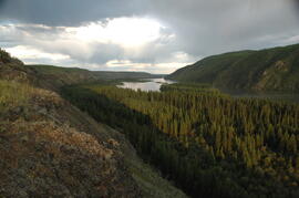
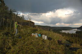
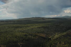
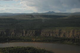
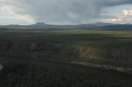
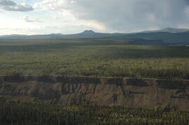
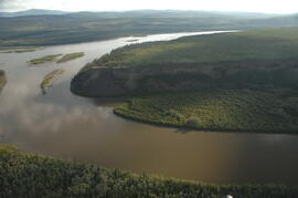
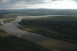
In July 2009, Dr. Paul Sanborn undertook the first soils field research at the Fort Selkirk volcanic field in central Yukon, with helicopter support and funding from the Yukon Geological Survey. This file includes digital photographs of the 2009 field work at the Ft. Selkirk site. Some of the digital photographs have been annotated as PDFs.
- Ft Selkirk 110114069.xls [particle size analysis data, CANTEST]
- S1090final.xlsx [chemical analysis data, Ministry of Forests & Range, Analytical Chemistry Laboratory]
- S1112final.xlsx [chemical analysis data, Ministry of Forests & Range, Analytical Chemistry Laboratory]
- Ft Selkirk 2009 soils data (updated Sept 15, 2010 and April 10, 2023).xls [consolidated lab data for all 2009 samples]
In July 2009, Dr. Paul Sanborn undertook the first soils field research at the Fort Selkirk volcanic field in central Yukon, with helicopter support and funding from the Yukon Geological Survey. This document is a complete transcription of field notes, with
soil and site photographs.
In July 2009, Dr. Paul Sanborn undertook the first soils field research at the Fort Selkirk volcanic field in central Yukon, with helicopter support and funding from the Yukon Geological Survey. This file consists of prints of aerial photographs that depict the area accessed for the study, upstream from the confluence of the Yukon River and the Pelly River.
Air photographs include:
Flight line A17210, Photo Nos. 54-60 (taken 1960)
Flight line A22354, Photo Nos. 43-45, 47-48 (taken 1971)
Flight line A27516, Photo Nos. 48-52 (taken 1989)
Tarnocai and Smith recorded their site locations on NTS topographical maps, and provided a set of scans of these maps.
Scanned topographical maps with Tarnocai & Smith site locations:
ARCTIC RED RIVER.TIF
AUSTRALIA MOUNTAIN.TIF
CARMACKS.TIF
CLEAR CREEK.TIF
COLDSPRING MOUNTAIN.TIF
DAWSON-1.TIF
DAWSON-2.TIF
DAWSON-3.TIF
ETHEL LAKE.TIF
FLAT CREEK.TIF
GARNER CREEK.TIF
GRAND FORKS.TIF
GRAND VALLEY CREEK.TIF
GRAVEL CREEK.TIF
GRAVEL LAKE.TIF
HART RIVER.TIF
LARSEN CREEK.TIF
LEE CREEK.TIF
MAYO.TIF
McQUESTEN-1.TIF
McQUESTEN-2.TIF
McQUESTEN-3.TIF
MEDRICK CREEK.TIF
MINTO LAKE.TIF
MOOSE CREEK.TIF
OGILVIE RIVER.TIF
PIRATE CREEK.TIF
RABBIT CREEK-1.TIF
RABBIT CREEK-2.TIF
REID LAKES.TIF
ROSEBUD CREEK.TIF
SEATTLE CREEK.TIF
SPRAGUE CREEK.TIF
STEWART CROSSING.TIF
STEWART RIVER.TIF
SUMMIT LAKE.TIF
SWEDE CREEK.TIF
WILLOW LAKE.TIF
This data set consists of elemental analysis data for selected B horizons from Wounded Moose paleosols sampled by Tarnocai and Smith. The file includes the original ALS lab report, additional panes showing comparison of replicates, and calculation of a weathering index.
During the 1980s, Agriculture Canada pedologists Scott Smith (retired from Summerland Research Station, formerly based in Whitehorse) and Charles Tarnocai (retired from Central Experimental Farm, Ottawa) had a large field program which addressed the trends in soil development in the central Yukon. Across this region, particularly between Whitehorse and Dawson City, the land surfaces and surficial deposits vary greatly in age due to the differing extents of glaciations over the past ~2 million years.
Tarnocai and Smith shared the unpublished data and soil samples from this work with Dr. Paul Sanborn, and this resulted in a student project published as:
Daviel, E., P. Sanborn, C. Tarnocai, and C.A.A. Smith. 2011. Clay mineralogy and chemical properties of argillic horizons in central Yukon paleosols. Canadian Journal of Soil Science 91: 83-93. https://doi.org/10.4141/cjss10067
This data set consists of transcribed data from lab data sheets, showing McQuesten-Dawson City paleosol data from the Tarnocai and Smith 1983 AAFC Yukon Paleosol Study. The data set includes chemical and particle size data for Tarnocai & Smith samples, as determined by the Ag Canada lab. Note that the “Site” column indicates the NTS topographic map sheet (e.g. 115P/13) for the sampling locations.
During the 1980s, Agriculture Canada pedologists Scott Smith (retired from Summerland Research Station, formerly based in Whitehorse) and Charles Tarnocai (retired from Central Experimental Farm, Ottawa) had a large field program which addressed the trends in soil development in the central Yukon. Across this region, particularly between Whitehorse and Dawson City, the land surfaces and surficial deposits vary greatly in age due to the differing extents of glaciations over the past ~2 million years.
Tarnocai and Smith shared the unpublished data and soil samples from this work with Dr. Paul Sanborn, and this resulted in a student project published as:
Daviel, E., P. Sanborn, C. Tarnocai, and C.A.A. Smith. 2011. Clay mineralogy and chemical properties of argillic horizons in central Yukon paleosols. Canadian Journal of Soil Science 91: 83-93. https://doi.org/10.4141/cjss10067
This file consists of photocopies of 76 detailed soil description forms from the 1983 Yukon Paleosol Study by Tarnocai and Smith.
During the 1980s, Agriculture Canada pedologists Scott Smith (retired from Summerland Research Station, formerly based in Whitehorse) and Charles Tarnocai (retired from Central Experimental Farm, Ottawa) had a large field program which addressed the trends in soil development in the central Yukon. Across this region, particularly between Whitehorse and Dawson City, the land surfaces and surficial deposits vary greatly in age due to the differing extents of glaciations over the past ~2 million years.
Tarnocai and Smith shared the unpublished data and soil samples from this work with Dr. Paul Sanborn, and this resulted in a student project published as:
Daviel, E., P. Sanborn, C. Tarnocai, and C.A.A. Smith. 2011. Clay mineralogy and chemical properties of argillic horizons in central Yukon paleosols. Canadian Journal of Soil Science 91: 83-93. https://doi.org/10.4141/cjss10067
This file consists of photocopies of lab data sheets for Tarnocai & Smith Yukon soil samples from the Land Resource Research Institute, Agriculture Canada.
These lab data sheets were transcribed into an Excel spreadsheet (see item 2023.2.2.6.3).
File consists of material relating to gold mining in British Columbia. Materials include articles, a magazine, and newspaper clippings. Highlights include:
- Envex Investments Inc., "The Gold Guide: The Buy & Sell in The Mining Industry", Vol. 1 No. 2, 1982
- "First Gold in British Columbia: The Pend-d'Oreille", BC Historical News, Summer 1980
File consists of research materials regarding forestry in British Columbia. Includes newspaper clippings, booklets, pamphlets, correspondence, photocopied articles, and a proposal on land and resource management of Vanderhoof. Highlights include:
- Vanderhoof Forest District, "Vanderhoof Land and Resource Management Plan: Summary", 1997 (booklet)
- MacMillan Bloedel, "How the forest grows...", 1975 (booklet)
- MacMillan Bloedel, "Enjoying the forest...", 1974 (booklet)
- B.C. Business Magazine, "Forestry in B.C. The Winter Years", 1981 (booklet)
- Province of British Columbia Ministry of Forests, "Integrated Resource Management", [198-?]
- Province of British Columbia Ministry of Forests, "Reforestation: more than 7 seedlings planted every second", 1992 (booklet)
- The Shared Resource, "Our Forests" Vol. 2, 1993 (booklet)
- Plateau Forest Products Ltd., "2000 Forest Development Plan: 2000-2005 Beetle Management", Dec. 1999 (map)
File consists of research materials on the Fraser River such as newspaper clippings, correspondence, and reports on Fraser River management programs. Highlights include:
- Fraser Basin Management Board, "What People in the Communities Told Us: A Report on the Open House Discussions", 1993 (booklet)
- Fraser Basin Management Board, "What Basin-Wide Stakeholders Told Us: A Summary of the Presentations", 1993 (booklet)
- Fraser Basin Management Board, "Sustainability Together", 1993 (booklet)
- Environment Canada, "Fraser River Action Plan 1992-93, Progress Report", 1992 (booklet)
- The Mighty Fraser River, "Portraying its Scenic Beauty and Rugged Canyons", 1976 (booklet)
File consists of research collected regarding the Groundhog coalfield, 150 miles north of Hazelton and 95 miles northeast of Stewart. Materials include newspaper clippings, as well as reproductions of maps, mine reports, and an article. Highlights include:
- Fleet Robertson, "The New Coalfield at The Headwaters of the Skeena River: North of Groundhog Mountain", 1912 (reproduction)
- George Hanson, "The Groundhog Coalfield: British Columbia", 1949 (article reproduction)
File consists of newspaper clippings and reproductions related to British Columbia history. Highlights include:
- Tsitika Publications Ltd., "The Sea Otter", magazine issue Vol. 1 No. 6, Mar. 1978 (magazine)
- Reproduction of North Coast Marine Museum Society, "North Pacific Cannery: British Columbia", [197-?] (brochure)
File consists of notes, clippings, and reproductions relating to the Cariboo and Northwest Digest publication. Also includes a CD-R that contains Sedgwick's index spreadsheet and accompanying documentation about the publication.
File consists of Harry Gairns' speaking notes for his 18 Sept. 2009 banquet talk at the "Exploring Our Roots: Forest History in Our Communities Annual Conference of the Forest History Association of BC" at UNBC in Prince George, September 19, 2009. Gairns' speech was entitled "Prince George Forest History - The 50s and the 60s".
File consists an audio recording of an oral history with Harry Coates recorded by David Mills.
Series consists of records created or accumulated by the Aleza Lake Research Forest Society regarding the research forest's history. Includes oral histories and material from long-time personnel that worked at the ALRF, such as Harry Coates, John Revel, and Frank Hellenius. Also contains copies of archival records from other archival institutions that concern the history of ALRF, which were compiled as part of a 2006/2007 history internship project.
File consists of two letters written by John McCormick to a friend describing his experiences in Barkerville and the gold mining conditions on Williams Creek.
McCormick, JohnSeries contains historical information regarding the Aleza Lake Research Forest. Includes photographs and slides pertaining to the Aleza Lake Experiment Station.
Series consists of records reflecting the activities of the Dezell and Rustad families. Series include mayoral records from Bea and Garvin Dezell when Garvin served as Mayor of Prince George. Series includes materials celebrating Bea Dezell's life created by her family. Series also includes fundraising efforts for the Northern Medical Programs Trust. Finally, series includes a collection of "spruce" dollars and commemorative coins.
Fonds consists of material created and collected by wildlife biologist Grant Hazelwood in relation to his work and research regarding wildlife, habitat, and wilderness parks. Includes material regarding Hazelwood's Tailed Frog (Ascaphus truei) research. Also includes records regarding his contracted biologist work via his consultancy business, Alpenglow Resources, on the BC Ministry of Environment's "Upper Nass Assessment Project", a project that included the biophysical mapping of the Northwest-Klappan Road Access Area.
Hazelwood, W. GrantSeries consists of records created and collected by wildlife biologist Grant Hazelwood in relation to his Tailed Frog (Ascaphus truei) research.
Series consists of textual material regarding wildlife and habitat in British Columbia created or collected by Grant Hazelwood. Predominantly includes reports (published and draft), discussion papers, article reprints, memoranda, and booklets.
Series consists of records relating to Grant Hazelwood's career as a wildlife biologist.
File consists of selected review work by Grant Hazelwood.
File consists of Grant Hazelwood's speeches. Includes:
- Grant Hazelwood, "Lands, Parks and Access Committee Report" to the BC Wildlife Federation 1987 Annual Convention
- Grant Hazelwood, "Land Use and Wildlife towards the Year 2000", B.C. Wildlife Federation, 1988
- Grant Hazelwood, "Nocturnal Piscatorial Predations", after 1987
- Grant Hazelwood, "Will There Ever Be Enough Park and Wild Lands in BC??", March 1990
File consists of records related to Grant Hazelwood's period of employment with Northwood Pulp & Timber Ltd. as a Resources Biologist. Includes:
- Don Morberg, "'More concern shown by private companies'" article clipped from the Prince George Citizen
- W.G. Hazelwood, "Underwater Survey of Northwood's Babine Lake Water Log Transport and Bubble System", 1980 - includes original photographic prints pasted into report
- "Changes in the air" article clipped from 7 June 1983 newspaper (likely the Prince George Citizen)
- "Submission to City Council on the Intercontinental Level 'B' Recovery Boiler Emission Application", 7 Feb. 1983
File consists of Grant Hazelwood's work plan and employment classification during the period he was employed with the Ministry of Environment as a Forest Ecosystem Specialist.
File consists of papers and speeches written by Mike Halleran, including "Wilderness Discussion Paper", "In Search of Wilderness" (1983), and "The Politics of Scarcity" (1979).
File consists of records and textual material regarding biogeoclimatic regions of British Columbia collected by Grant Hazelwood. Highlights include:
- V.J. Krajina, "Revision of Biogeoclimatic Regions and Zones in British Columbia", 1964
- BC Department of Agriculture, "Climate of British Columbia: Tables of Temperature, Precipitation, and Sunshine - Report for 1969"
- "Temperature Normals for British Columbia", 1965 (reproduction)
- "Precipitation Normals for British Columbia", 1965 (reproduction)
Item is an original "Yukon Resident Hunter's Opinion Survey 1981".
Item is a photocopied reproduction of "Abstracts from Reports on the Peace River and Cassiar Districts made by British Columbia Land Surveyors to the Department of Lands, 1891-1928".
Item is a draft of "B.C. Hydro Proposed 287 kV Transmission Line - Kitimat to Terrace - Preliminary Environmental Assessment of Fish and Wildlife Values" by Grant Hazelwood. Also includes accompanying print pages for a 2015 BC Hydro powerpoint slideshow regarding the Terrace to Kitimat Transmission Project (TKTP).
Item is a photocopied preliminary copy of "Effects of Forest Management Practices on Wildlife in the Forests of British Columbia".
Item is a photocopied preliminary copy of a report entitled "Applying Ecological Classification Systems to Wildlife Research and Management - E.P. 917: A problem analysis". Includes accompanying map.
