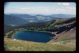
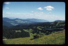
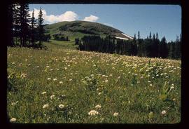
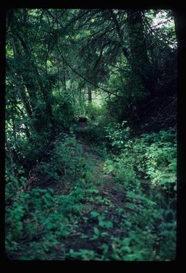
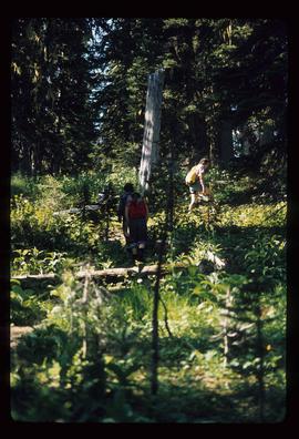
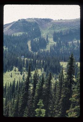
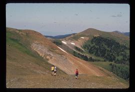
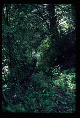
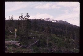
Image depicts the start of the Raven trail, with the view angled towards Raven Peak in the distance.
Image depicts several individuals walking the Raven trail.
Image depicts a woman standing in a field, with a sign in a tree behind her pointing the way towards the Raven Cabin.
Image depicts a small grey building, possibly Raven Cabin, sitting at the foot of a ridge.
Image depicts a woman standing on the porch of a hut located by Raven Lake.
Image depicts several individuals hiking in the area surrounding Raven Lake.
Image depicts a view of Raven Lake.
Image depicts a view of Raven Lake and the surrounding area.
Image depicts a small section of the area surrounding Raven Lake.
File contains slides depicting Sechelt, B.C.
Image depicts an old, abandoned church located somewhere in Seton Portage, B.C.
Image depicts a trail through the forest somewhere in or near Seton Portage, B.C.
Image depicts an individual, possibly Kent Sedgwick, standing on a trail through a forest somewhere in or around Seton Portage, B.C.
Image depicts a view of Anderson Lake near Seton Portage, B.C.
Image depicts the side of a train and the tracks it is on, somewhere in the Seton Portage area.
Image depicts a collapsing shack somewhere in the Seton Portage area.
Image depicts water flowing through an irrigation channel in an orchard, somewhere in or near Seton Portage, B.C.
Image depicts the Robert Stewart house, built in 1910 and inhabited by the Stewart family until 1945. It is located in Stewart, B.C.
Image depicts several houses in Stewart, B.C. A section of Mt. Shorty Stevenson is visible in the background.
Image depicts the interior of the St. Marks Community Church in Stewart, B.C.
Image depicts the Provincial Government Building located in Stewart, B.C.
Image depicts an old, boarded up hotel in Stewart, B.C.
Image depicts a glacier on the side of a road at an uncertain location; the slide labels it as "avalanche glac."
Image depicts a glacier at an uncertain location; the slide labels it as "avalanche glac."
Image depicts a glacier at an uncertain location; the slide is labelled "after two days," and shows how much it has melted.
Image depicts Bear Glacier in the foreground and numerous mountain peaks in the background in Bear Glacier Provincial Park.
Image depicts two individuals and three dogs standing by a stream at an uncertain location, possibly somewhere in Bear Glacier Provincial Park. The woman in purple is possibly Sue Sedgwick.
Image depicts Sue and Kent Sedgwick with two dogs, standing with the Bear Glacier in the background.
Image depicts Sue Sedgwick with a dog, standing with the Bear Glacier in the background.
Image depicts numerous mountains surrounding the Bear Glacier.
Image depicts several unidentified individuals inside a building, one of which is carving a totem pole. The location is uncertain.
Image depicts several unidentified individuals standing outside a building, and holding intricately painted drums; the woman on the right is Sue Sedgwick. The location is uncertain.
Image depicts an intricately painted drum. The location is uncertain.
Image depicts Sue Sedgwick seated in a lawn chair near a campfire and several other unidentified individuals, as well as three dogs. The location is uncertain.
The item is a photograph depicting the front exterior of King George V school. Sign above the door reads, "École King George V School." The windows are boarded up. Annotation on the reverse side of the photograph states, "2005."
The item is a photograph depicting a dirt road in Ten Mile Park, BC. Annotation on reverse side of photograph states, "in 10 ml park."
The item is a photograph depicting Ahbau railway bridge. Annotation on reverse side of photograph states, "Ahbau bridge."
The item is a photograph depicting Clanston Road. Annotation on reverse side of photograph states, "Clanston Rd."
The item is a photograph depicting a roadbed in a forest. Annotation on reverse side of photograph states, "roadbed mn road."
The item is a photograph depicting a hiking trail West of Osprey Rd. in BC. Annotation on the reverse side of the photograph states, "W. of Osprey Rd."
The item is a photograph depicting the front exterior side of Central Fort George School prior to demolition in 2004. The windows are boarded up. Annotation on reverse side of photograph states, "Central Ft Geo school just before demo summer 2004."
The item is a photograph depicting the exterior of Central Fort George School from the court prior to demolition in 2004. The windows are boarded up.
The item is a photograph depicting the front exterior side of Central Fort George School prior to demolition in 2004. The windows are boarded up.
The item is a photograph depicting the front exterior of Central Fort George School and an adjacent house prior to demolition in 2004.
The item is a photograph depicting the exterior of the Woodpecker School. The log school is dilapidated with a caved in roof.