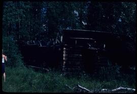
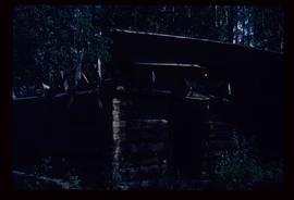
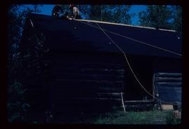
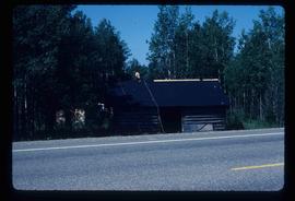
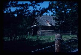
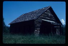
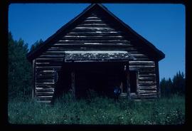
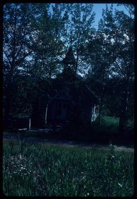
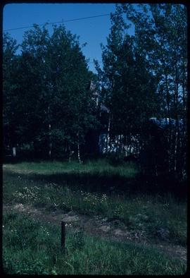
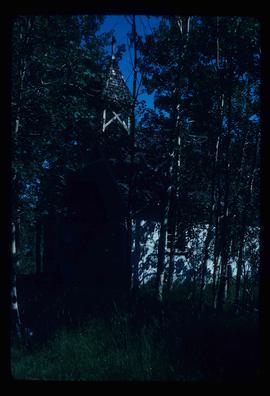
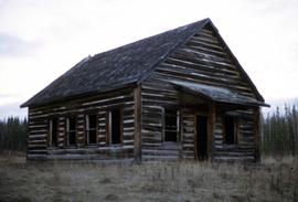
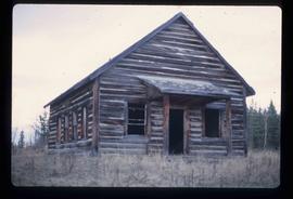
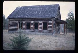
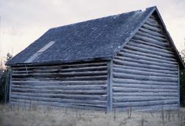
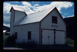
The item is a photograph of an old wooden garage behind Prince George's first hospital at 1584 8th Avenue, Prince George.
Photograph depicts the base of a wooden canoe on a wheeled cart, presumably at the Fort St. James historic site.
Image depicts the Bachelor's Hall in Woodpecker, B.C.
Image depicts a log cabin, with a few unknown individuals working on the roof, in Woodpecker, B.C.
Image depicts the old school in Woodpecker, B.C.
File consists of notes, clippings, and reproductions relating to Woodpecker and Hixon. Includes: "Heritage Week" poster with photographs depicting Huble Homestead, Valemount Museum, St Mark's Anglican Church, and the Church of St Pius X (Feb. 1994). File also includes photographs depicting various buildings in Woodpecker and Hixon, including the Woodpecker Church (2001).
Image depicts a church in Woodpecker, B.C.
The item is a photograph depicting a painting of Woodpecker Church by Vivian Antoniw. The plaque in the picture states, "'Woodpecker Church' Handcoloured Dry Point Etching by Vivian Antoniw."
Image depicts a church in Woodpecker, B.C.
File consists of notes and reproductions relating to the Woodpecker Elementary School. Also includes photographs depicting the Woodpecker School, weathered with the roof beginning to cave in (2001).
Image depicts the grade for the British Columbia Railway, which was formerly known as the Pacific Great Eastern until 1972. It is located somewhere near the Woodpecker Ranch in Woodpecker, B.C.
Image depicts the grade for the British Columbia Railway, which was formerly known as the Pacific Great Eastern until 1972. It is located somewhere near the Woodpecker Ranch in Woodpecker, B.C. There are two unknown individuals present in the image.
The item is a photograph depicting the exterior of the Woodpecker School. The log school is dilapidated with a caved in roof. Annotation on reverse side of photograph states, "Nov 2001."
The item is a photograph depicting the exterior of the Woodpecker School. The log school is dilapidated with a caved in roof.
Image depicts the Woodpecker School building.
Image depicts the old Woodpecker School.
The item is a photograph depicting the exterior of the Woodpecker School. The log school is dilapidated with a caved in roof. Annotation on reverse side of photograph states, "Fuji Aps Nexia 200, Woodpecker school Nov/01."
Image depicts the Woodpecker School building.
The item is a photograph depicting the exterior of the Woodpecker School. The log school is dilapidated with a caved in roof.
The item is a photograph depicting the exterior of the Woodpecker School. The log school is dilapidated with a caved in roof. Annotation on reverse side of photograph states, "Nov 2001."
Image depicts a tree line in Woodpecker, B.C.
Image depicts Parkwood Place taken from Connaught Hill looking west with the hospital in the background. Map coordinates 53°54'39.9"N 122°45'02.5"W
File contains slides depicting the Woolsey and Place Glaciers.
Image depicts two unknown individuals at the Woolsey Glacier.
Image depicts a helicopter flying over the Woolsey Glacier.
Series consists of material collected and created by Kent Sedgwick in relation to his writings, publications, editorial work, and lectures. The files contain material regarding Kent Sedgwick’s writing and lectures on the Lheidli T’enneh cemetery; his book "Monumental Transformation: The Story of Prince George's National Historic Monument"; his book chapter "Crossing the Divide: Northern Approaches to New Caledonia"; his book "Giscome Chronicle: The rise and demise of a sawmill community in central British Columbia, 1912-1976"; edits done to June Chamberland’s book "From Broadaxe to Clay Chinking: Stories about the Pioneers in and around the Prince George area"; writing for the Prince George Heritage Advisory Committee; and Sedgwick’s MA thesis on the Peyto Glacier. The files primarily consist of notes, correspondence, and completed works.
The item is a black and white photograph depicting a boarded up workshop on a farm.
The item is a black and white photograph depicting a boarded up workshop, garage and covered farm building. Picture is taken from the road.
File consists of clippings, notes, and reproductions relating to World War 2 in Prince George. Includes various clipped articles from the Prince George Citizen newspaper; "Wartime bldgs" handwritten notes by Kent Sedgwick (2005); and a John Bogle UNBC history course paper (1999). Also includes photographs taken in 2005 of various buildings and houses in Prince George.
Image depicts Kent Sedgwick standing beside a wrecked plane somewhere in South Tweedsmuir Provincial Park.
File consists of notes, clippings, and reproductions relating to an event for writers on the East Line at the Prince George Railway & Forestry Museum. Includes photographs depicting people visiting Giscome, a community on the East Line (2009).
Image depicts an unknown individual pointing at some writing on a rock; it possibly reads "ACC Aug 10 1911."
File contains slides depicting the Writing on Stone Provincial Park in Alberta.
Image depicts a building in Wells, B.C. It possesses the letters "W.V.F.B." on it.
File contains slides depicting places in Wyoming, USA.
Image depicts a field of yellow plants at an uncertain location.
Image depicts the Fraser River and the Yellowhead and Grand Trunk Railway Bridges from LC Gunn Park. Map coordinates 53°54'30.7"N 122°43'27.0"W
Image depicts the Yellowhead Bridge across the Fraser River. Map coordinates 53°54'45.2"N 122°43'27.9"W
Image depicts Yellowhead Lake, located near the Yellowhead Pass.