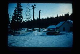
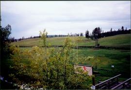
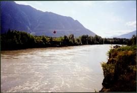
Showing 4134 results

Archival description
3619 results with digital objects Show results with digital objects
Shacks and a Mountain
2012.13.1.87.028 · Item · [between 1975 and 1995]
Part of J. Kent Sedgwick fonds

Image depicts two old shacks and a mountain in the background. Possibly located in or near Longworth, B.C.

Cabin
2012.13.1.87.038 · Item · [between 1975 and 1995]
Part of J. Kent Sedgwick fonds

Image depicts a cabin at an uncertain location.

Upper Fraser Mill
2012.13.1.87.062 · Item · [between 1975 and 1995]
Part of J. Kent Sedgwick fonds

Image depicts the entrance to the Upper Fraser mill yard in Upper Fraser, B.C. Map coordinates 54°07'10.8"N 121°56'51.7"W

Upper Fraser Mill
2012.13.1.87.063 · Item · [between 1975 and 1995]
Part of J. Kent Sedgwick fonds

Image depicts the Upper Fraser mill yard with a CN train in Upper Fraser, B.C. Map coordinates 54°07'10.8"N 121°56'51.7"W

Giscome Quarry
2012.13.1.87.074 · Item · [between 1975 and 1995]
Part of J. Kent Sedgwick fonds

Image depicts what is possibly the quarry located at Eaglet Lake in Giscome, B.C.

Eaglet Lake?
2012.13.1.87.082 · Item · [between 1975 and 1995]
Part of J. Kent Sedgwick fonds

Image depicts a lake at an uncertain location, likely Eaglet Lake.

Giscome School - After
2012.13.1.87.085 · Item · [between 1975 and 1995]
Part of J. Kent Sedgwick fonds

Image depicts the Giscome mill site in Giscome, B.C. The bunkhouse is no longer there and the school is in the foreground on the right. Map coordinates 54°04'04.8"N 122°22'04.7"W

2012.13.1.87.087 · Item · [between 1975 and 1995]
Part of J. Kent Sedgwick fonds

Image depicts the Giscome mill site in Giscome, B.C. The railroad tracks are in the foreground. Map coordinates 54°04'17.6"N 122°22'06.1"W

Giscome Dairy Farm
2012.13.1.87.141 · Item · [between 1975 and 1995]
Part of J. Kent Sedgwick fonds

Image depicts the dairy farm in Giscome, B.C. Map coordinates 54°03'53.3"N 122°21'22.6"W

Fenced Off Forest Area
2012.13.1.87.149 · Item · [between 1975 and 1995]
Part of J. Kent Sedgwick fonds

Image depicts two unidentified individuals standing outside a small, enclosed area somewhere in a forest. The location is uncertain.

Giscome Dairy Farm
2012.13.1.87.152 · Item · [between 1975 and 1995]
Part of J. Kent Sedgwick fonds

Image depicts the dairy farm in Giscome, B.C. Map coordinates 54°03'53.3"N 122°21'22.6"W

Small Town
2012.13.1.87.155 · Item · [between 1975 and 1995]
Part of J. Kent Sedgwick fonds

Image depicts a view of what appears to be a small town at an uncertain location.

House in Giscome
2012.13.1.87.159 · Item · [between 1975 and 1995]
Part of J. Kent Sedgwick fonds

Image depicts a house in Giscome, B.C. Map coordinates 54°04'17.6"N 122°22'06.1"W

Giscome CN Station
2012.13.1.87.161 · Item · [between 1975 and 1995]
Part of J. Kent Sedgwick fonds

Image depicts the old CN station in Giscome, B.C. Map coordinates 54°04'20.7"N 122°22'01.1"W

Open Field in Giscome
2012.13.1.87.163 · Item · [between 1975 and 1995]
Part of J. Kent Sedgwick fonds

Image depicts an open field and Giscome, B.C. in the background. Map coordinates 54°03'52.9"N 122°22'10.0"W

Giscome Houses
2012.13.1.87.164 · Item · [between 1975 and 1995]
Part of J. Kent Sedgwick fonds

Image depicts a row of houses at an uncertain location, possibly in Giscome, B.C.

2008.3.1.22.14 · Item · [ca. 1995]
Part of Bridget Moran fonds

Woman stands in front of sign that reads "ALASKA / STEWART 237 km / HYDER AK. 240 km / BEAR GLAC. 201 km". Second sign in background indicates restaurant, convenience store, and service centre. Car, road, and highway can be seen in midground; mountains in background. (This woman is also featured in item 2008.3.1.22.13).

River and Mountains
2008.3.1.22.32 · Item · [ca. 1995]
Part of Bridget Moran fonds

Photograph depicts wide river with forest shores on either side. Power lines in foreground, mountain in background.

Old House
2012.13.1.87.018 · Item · [between 1975 and 1995]
Part of J. Kent Sedgwick fonds

Image depicts an old house missing windows and doors at an uncertain location.

Old House in Sinclair Mills
2012.13.1.87.019 · Item · [between 1975 and 1995]
Part of J. Kent Sedgwick fonds

Image depicts an old house missing windows and doors in the foreground, and a bunkhouse in the background, in Sinclair Mills, B.C. Map coordinates 54°01'17.4"N 121°40'53.0"W

Three Children and Two Goats
2012.13.1.87.022 · Item · [between 1975 and 1995]
Part of J. Kent Sedgwick fonds

Image depicts three unidentified children standing in the doorway of a house, with two goats ascending the porch steps. The location is uncertain, likely Sinclair Mills, B.C.

Dirt Road
2012.13.1.87.024 · Item · [between 1975 and 1995]
Part of J. Kent Sedgwick fonds

Image depicts a dirt road leading through numerous trees toward a mountain. The location is uncertain, likely on the way to Longworth, B.C.

Dirt Road
2012.13.1.87.025 · Item · [between 1975 and 1995]
Part of J. Kent Sedgwick fonds

Image depicts a dirt road leading through numerous trees toward a mountain. The location is uncertain, likely on the way to Longworth, B.C.

Longworth - Railway Tracks
2012.13.1.87.031 · Item · [between 1975 and 1995]
Part of J. Kent Sedgwick fonds

Image depicts two unidentified individuals standing next to the train station, and two railway tracks running through Longworth, B.C.

A Saw
2012.13.1.87.036 · Item · [between 1975 and 1995]
Part of J. Kent Sedgwick fonds

Image depicts a saw and numerous wooden boards at an uncertain location.