File consists of notes and clippings relating to the Cariboo Road. The Cariboo Road (also called the Cariboo Wagon Road, the Great North Road or the Queen's Highway) was a project initiated in 1860 by the Governor of the Colony of British Columbia, James Douglas. The road stretched from Fort Yale to Barkerville, B.C. through hazardous canyon territory in the Interior of British Columbia.
File consists of notes, clippings, and reproductions relating to a failed tunnel build for the Grand Trunk Pacific Railway line between McBride and Goat River and a potential homestead on the land surrounding the tunnel. The land was later owned by Russ Purvis of Dunster in 2006.
File consists of notes, clippings, and reproductions relating to the King George V Elementary School in Prince George. Includes: "RE: Heritage Designation of KGV School" typed letter from George Paul, City Manager to Secretary of the Heritage Commission (21 Apr. 1997). File also includes photographs depicting the exterior of the King George V school prior to its demolition (2005).
File consists of notes and printed emails relating to a Japanese internment camp and sawmill near Penny and Hungary Creek.
File consists of notes, clippings, and reproductions relating to the Cariboo region of British Columbia. Includes: "Walking Tour of Historic Clinton" pamphlet prepared by Clinton Museum Society and Clinton & District Chamber of Commerce (1980); "Central Cariboo British Columbia, Canada" pamphlet approved by Tourism British Columbia (2010); and "Cariboo field trip" duotang with typescript notes (1978). Also includes photographs depicting Quesnel Forks, British Columbia (2010).
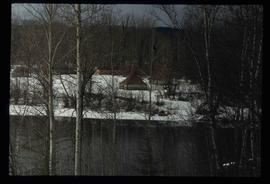
File consists of notes, clippings, and reproductions relating to Fort St. James, the community and historic site. Includes material regarding the development of the community as a trading post for Hudson's Bay Company and the development of the historic site. Includes: "Fort St. James National Historic Site" pamphlet prepared by Parks Canada (1981); "Fort St. James National Historic Park" pamphlet prepared by Parks Canada (1974 and 1978); and photographs entitled "UNBC Student trip" and depict a snowy landscape and wooden cabin (Mar. 2004).
File consists of clippings, notes, and reproductions relating to heritage development in Prince George. Includes: "Heritage Trust Programs" handwritten notes by Kent Sedgwick; "GO BC: Growth & Opportunities" brochure from Minister of Tourism and Provincial Secretary (1988); "GO B.C". typescript document to Review Committee from W.D. Kennedy, Director of Finance (23 Dec. 1988); "Fort George Park" typescript document from Ren Settle, Assistant Planner (25 Apr. 1988); "Minutes Heritage Advisory Committee" typescript document (9 Feb. 1989); "Native Cemetery Desecration" typescript document from the Joint Heritage Advisory Committee to the Mayor and Council of Prince George regarding complaints at the BC Heritage Society Conference held that year in Revelstoke regarding the desecration to the native cemetery at Fort George Park (18 June 1991); and a CD-R containing photographs from Suzanne Krejcha depicting Fort George Park farm (2006). The file also consists of printed photographs of the cemetery at Fort George Park from The Exploration Place Museum database and the Royal BC Museum and Archives.
File consists of audio and visual material relating to the interview of Trelle Morrow conducted by Kent Sedgwick. Also includes an audio cassette entitled "Trelle Morrow interview"; an audio microcassette entitled "Kent - CBC -Trelle"; and a CD-ROM entitled "Trelle Morrow interview colour photos" depicting photographs of the interview.
The item is an audio compact disc interview with Trelle Morrow.
File consists of photographs depicting various buildings in downtown Prince George and the Fraser River taken by Trelle Morrow.
This item is a photograph of 575 Quebec Street, Prince George. Building is white, pink and blue. Telus tower can be seen in the background.
This item is a photograph of the Fane Building in downtown Prince George. The Telus building can be seen in the background.
This item is a photograph of Dr. D. G. Wheatcroft Chiropractors, Happy Scrappers and the Law Office of Brian Gilson, George Leven, and Jason LeBlond.
This item is a photograph of the Freemason building at 480 Vancouver Street, Prince George.
This item is a 35 mm photograph negative of the Nechako River, Prince George. Water level is very low.
File consists of notes, clippings, and reproductions regarding Kent Sedgwick's research about Treaty 8.
File consists of clippings and reproductions relating to the history of photographers in Prince George, including material on Wally David West, Dave Milne, John Simonson, and Jacob Simonson. Includes clipped article from the Prince George Free Press "Capturing historic firsts" (4 Mar. 2001); "West proves to be very best" (9 May 1999); and "Mysterious photographer left behind a rich legacy" clipped article from Prince George This Week newspaper (23 Feb. 1997).
Item is a CD-ROM containing photographs of Exploration Place's World War II Aviation Exhibit. Photographs compiled by Katherine Plett.
File consists of notes and reproductions relating to the Royal Engineers and Henry Spencer Palmer, a British Army military engineer and surveyor. Henry Spencer Palmer was sent to British Columbia and completed a report in 1863 on Wiliams Lake, the Caribou Districts, and the Fraser River from Fort Alexandria to Fort George. File primarily consists of Kent Sedgwick's handwritten notes on Henry Palmer and his work in British Columbia.
Subseries consists of newspapers collected by Kent Sedgwick and documents regarding the newspaper history of Prince George and region. Includes newspaper clippings relating to the history of newspapers in Prince George; issues of "The Spruce Needle" Prince George community newspaper; issues of the "Prince George Echo" newspaper; special editions of the Prince George Citizen Newspaper; and issues of "The Islander" magazine from Victoria.
Photograph depicts an open grassy field surrounded by trees in Soda Creek.
Photograph depicting a garden and backyard in someone's personal residence.
Photograph depicting a garden and backyard in someone's personal residence.
Photograph depicting a garden and backyard in someone's personal residence.
Photograph depicting a dog laying in the grass in someone's backyard of a personal residence.
The item is a photograph and negative of a survey map of the Prince George townsite South of the Nechako River and West of the Fraser River.
The item is a photograph and negative of a survey map of the Prince George townsite surrounding Connaught Park.
The item is a photograph and negative of a survey map of the Prince George townsite. Areas highlighted are in the Nechako and Fraser River area, including Connaught Park.
The item is a photograph and negative of a survey map of the Prince George townsite. Areas highlighted are in the Nechako and Fraser River area, including Connaught Park.
The item is a photograph negative of a man and woman sitting in front of a house. They are dressed in formal attire and are drinking what appears to be a glass of wine.
File predominantly consists of photocopies of newspaper articles, along with notes and reproductions relating to the development of the Prince George townsite and subdivision of Fort George, especially the area covered by Cariboo District Plan 1268. Includes material on investments and sale of lots in Prince George, Grand Trunk Pacific development in Prince George, and incorporation of the city of Prince George.
File consists of notes and reproductions relating to the first Pentecostal church originally at 1405 Sixth Avenue, Prince George.
File consists of notes, clippings, and reproductions relating to St. Michael's Anglican Church, originally built at 1505 Fifth Avenue in Prince George.
File consists of notes and reproductions relating to Luther Collins Gunn and L.C. Gunn Park. Luther Colins Gunn was a survey engineer who had done work for the Grand Trunk Pacific Railway and the Pacific Great Eastern Railway when he arrived in Prince George. The L.C. Gunn trail follows the same route used by Gunn when surveying the rail routes in the Prince George area. Includes: "Gunn Point" typescript document by Ted Williams for the Heritage Advisory Committee (1985); "A Proposal - The L.C. Gunn Viewpoint" typescript letter to Mr. Mac Norris, president of the B.C.R. Company from Ted Williams and the Heritage Advisory Committee (27 Jan. 1987); and "Item of business, proposed use of District Lot # 486" typescript letter from the Heritage Advisory Committee to Beverley Pitman, Planning Assistant (31 May 1979). Also includes photographs depicting the Moffat farm (2005).
The item is a photograph depicting the exterior of old stable on the Moffat farmland.
File consists of notes and reproductions relating to the local history project done by June Chamberland and her book "From Broadaxe to Clay Chinking: Stories about the Pioneers in and around the Prince George area" winning the Jeanne Clarke history award. The book includes a chapter "Introduction to Early Agricultural Settlement in the Prince George Area" by Kent Sedgwick. Includes a CD titled "June photos" containing photographs depicting interviewees of the project (2003).
The item is a CD-R containing 36 jpg. photographs relating to Kent Sedgwick's guest lecture on Prince Gorge geography and development.
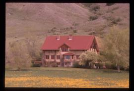
Image depicts the Alkali Lake Ranch in Akali Lake, B.C.
Image depicts a shed in an unknown location.
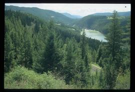
Image depicts rail road tracks through a forest, as well as a river; located in Soda Creek, B.C.
Image depicts the old community hall in Soda Creek, B.C.
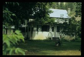
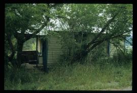
Image depicts a house in Soda Creek, B.C.
Image depicts the old BX Sternwheeler office building in Soda Creek, B.C.
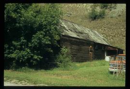
Image depicts an old building located somewhere are the Pickard farm north of Soda Creek, B.C.
File contains slides depicting places along the east line of the BC Railway.
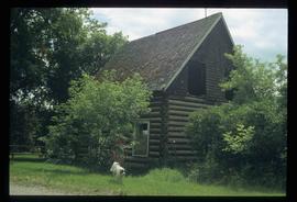
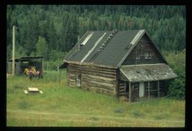
Image depicts an old log cabin at an uncertain location.
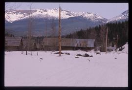
Image depicts several old log cabins, possibly at McLeod Lake.
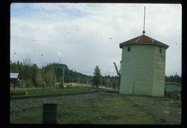
Image depicts a train track and several buildings in an unknown location.
This item is a photograph of a blue and white building in downtown Prince George. The Coast Hotel can be seen in the background.
This item is a photograph of the backside of the United Way building in Prince George in 2006. The Coast Hotel can be seen in the background.
