Audio recording is of an interview by Bridget Moran with both Mr. George Henry and Mr. Arnold Davis to discuss their memories of the early town site development of South Fort George and Central Fort George c.1910-c.1917. Mr. Henry was born in 1882 and his family arrived in Quesnel in 1909. Mr. Henry’s interview is primarily about his work as a captain on the BX Sternwheeler up until the time of the railroad arriving in Prince George in 1914. Mr. Davis, who was a Sherriff in Prince George, recalls his childhood memories of Fort George and Central Fort George c.1917. Mr. Davis also discusses his family roots from Ireland, the family’s arrival in Fort George from Ashcroft in 1917 and memories of his father who worked on the sternwheelers on the Fraser River.
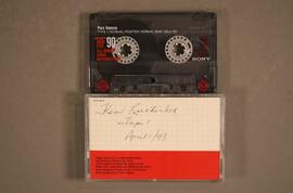
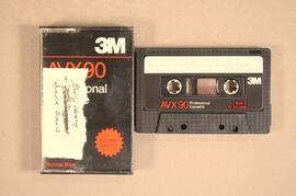
Audiocassette Summary
Scope and Content:
Interview with Mr. George Henry
Mr. Henry was born in 1882 in Northern California and his family came to the Cariboo in 1909. He recalls riding his bicycle from Ashcroft to Quesnel in 3 days to find work with the BC Express Company.
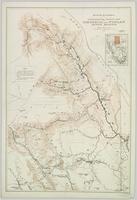
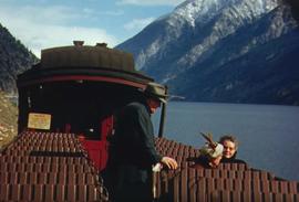
Mr. Henry recalls working on the BX and describes the sternwheeler trip from Quesnel to South Fort George; it was a 3 hour trip from Quesnel and included two mail stops ;
Henry recalls an accident onboard the sternwheeler going through the Fraser Canyon (see p.p.11-12 of
Prince George Remembered)
Mr. Henry describes his homestead at South Fort George
Mr. Henry describes the BX sternwheeler being aground at South Fort George c.1920
Mr. Henry recalls spending winters in South Fort George in his log cabin; that work was “plentiful” in 1910 and the population at “about 700”
Mr. Henry notes that the “Indian reserve was at the Hudson’s Bay company” and that the native population was at “about 50”
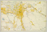
Mr. Henry recalls the early commercial businesses in South Fort George c.1910 including the Northern Hotel; the candy store and ice cream store and theatre.
Mr. Henry describes the start of the town site of Central Fort George as a “viable little town” which started once the Grand Trunk Railway arrived and recalls the change in population between South Fort George & Central Fort George.
Henry recalls how all the workers came and lived in tents in Central Fort George.
Mr. Henry was not happy about the arrival of the railway as it meant he lost his job on the sternwheeler – he recalls that “us old river rats were just lost” (see p.p.34 of Prince George Remembered)
Bridget then asks Mr. Arnold Davis to recall his memories of early South Fort George
But first asks him to describe his family’s roots (See p.p. 1-2 of Prince George Remembered)
Scope and Content:
Interview with Mr. Arnold Davis
Davis notes he is 6th generation Canadian; family came from Ireland and his grandfather’s brother Jeff Davis became the President of the Confederate States of America.
Davis refers to his mother’s family being on the Prairies at time of the trial of Louis Riel
Davis explains that his grandfather first homesteaded at Banff; then Kamloops; then Ashcroft and on to South Fort George in 1917.
Davis’ father worked for the BC Express Company and he recalls being on the sternwheeler as a child during same time that George Henry worked the boats. Recalls workers on the boat; eating pie on the boat baked by the Chinese cook; (See p. 33 of Prince George Remembered)
Davis recalls the town site of South Fort George. He notes it had a population by 1917 of only “about 300” and that the “boom was over”
Davis describes location of various businesses in South Fort George including the Rex Theatre, George St. Poole Room, McKay Bros. Grocery store, Drugstore, Bairds, Peters Butcher Shop.
Davis recalls that there were many “Yukoners” here at the time and recalls a tale about an old Yukoner
Mr. Davis recalls other people who worked on the BX with his father including Margaret “Granny” Seymour’s father;
Mr. Davis recalls riding up and down the river to Foley’s Cache on the sternwheeler as a child
Mr. Henry then speaks up and recalls trips on the sternwheeler with Arnold Davis on the boat as a child
Tape ends