2023.2.2.9.4
·
Dossiê/Processo
·
2001
Parte de Dr. Paul Sanborn fonds
File contains the following data sets:
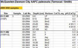
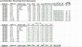
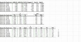
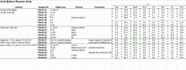
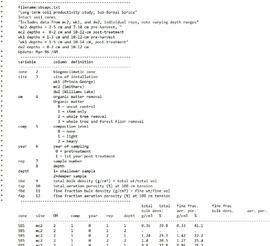
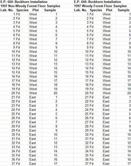
- Phytolith contents.xls [phytolith content in 5-20 µm silt, tallied by morphological categories; also summarized as % of total soil fine (< 2 mm) fraction]
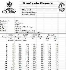
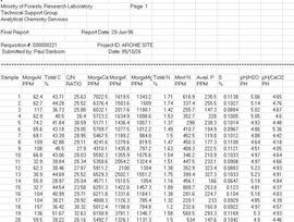
- M-K (2001) soil LOI data.pdf [LOI (loss-on-ignition) data for sampled soil horizons – proxy measurement for organic matter content]