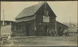
2009.5.2.77
·
Item
·
[ca. 1935]
Part of Taylor-Baxter Family Photograph Collection
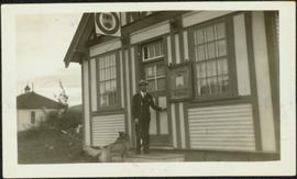
Photograph depicts H.F. Glassey at door to building with the sign "BC Government Liquor Store." A dog stands at his feet and the Atlin Schoolhouse building can be seen in the background. See also items 2009.5.2.75 & 2009.5.2.76.