Showing 69 results
Archival description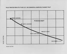
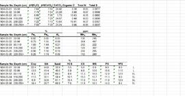
Valley Beater Results at 400 C.S.F. on Commercial Samples of Market Pulp chart
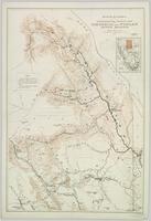
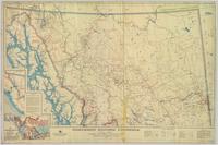
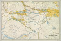
Topographical Sketch Map of Omineca and Finlay River Basins, British Columbia

"The Scenic and Industrious Route of BC Rail"
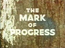
The Mark of Progress

"The Land is Yours"

"The Agriculture Land Reserve: What it is and how it got here" Presentation

Stuart Lake Sheet

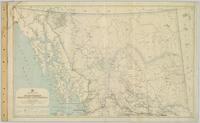
Stikine River, Preliminary Map

Status of Sustained-Yield Forestry Programme as at December 31, 1969

Status of Sustained-Yield Forestry Programme as at 31 December 1962
Status of Sustained-Yield Forestry Programme

Sketches of Harbours, Queen Charlotte Islands, 1878

Sketch Map Showing the Proposed Route of the Western Union Telegraph between Fort Fraser and the Stikine River
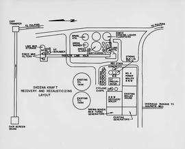
Skeena Kraft Recovery and Recausticizing Layout
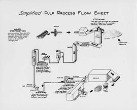
Simplified Pulp Process Flow Sheet
Reports of Western Union Telegraph Company Explorations in Western Canada
Record of travel from Skeena Mouth to Peace River mines
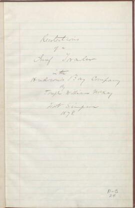
Recollections of a chief trader in the Hudson’s Bay Company
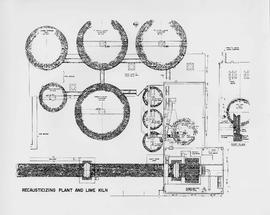
Recausticizing Plant and Lime Kiln
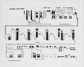
Process Flow Chart

Preliminary Map, Grenville Channel

Pre-Emptor’s Map, Tête Jaune Sheet

Pre-Emptor’s Map, Tête Jaune Sheet

Pre-Emptor’s Map, Stuart Lake Sheet

Pre-Emptor’s Map, Stuart Lake Sheet

Pre-Emptor’s Map, Prince Rupert Sheet

Pre-Emptor’s Map, Peace River Sheet

Pre-Emptor’s Map, Nechako Sheet

Pre-Emptor’s Map, Fort George Sheet

Pre-Emptor’s Map, Fort George Sheet
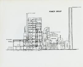
Power Group
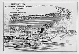
Perspective View: Skeena Kraft and Prince Rupert Pulp Division of Columbia Cellulose

Peace River
Paleosol data from Inlin Brook and Red Ochre River sites

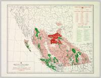
Northwood Pulp & Timber Limited 1975 Operating Areas
Northern British Columbia
Northern British Columbia
Nechako Sheet

Monkman P.S.Y.U., T.F.L. 30, and area

Monkman P.S.Y.U. forest cover map
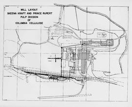
Mill Layout: Skeena Kraft and Prince Rupert Pulp Division of Columbia Cellulose
Materials relating to the Haida
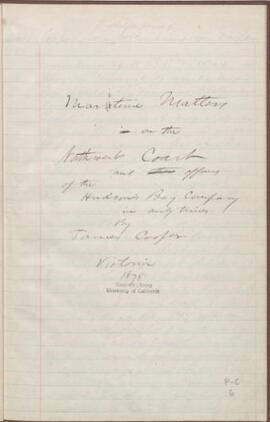
Maritime matters on the Northwest Coast and affairs of the Hudson's Bay company in early times

Map showing Mining Properties in Vicinity of Stewart and Salmon River. Portland Canal Mining Division. British Columbia

"Map of the Pacific Great Eastern Railway"

Map of the Colony of New Caledonia and the British & American Territory West of the Rocky Mountains

Map of area covered by Tree Farm Licences no. 1 and no. 40 for Columbia Cellulose and Skeena Kraft
Log-book of a trip among the Siwash of British Columbia

Location & Watershed Map
Ken Rutherford (Tape 1)