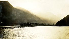
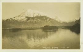
Photograph depicts a view of Hyder Alaska. Handwritten annotation below photograph reads, "Hyder Alaska 25/6/28".
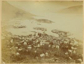
View of town on shore, from above. Boats docked along piers and buildings. Hills visible on either side of water in background.
Handwritten photo captions with arrows pointing to sections of image read: "General Merchandise", "Fort Wrangell Hotel".
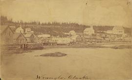
Photograph depicts community buildings on shoreline, water in foreground.
Handwritten annotation on image reads: "Wrangle, Alaska."; on verso: "Fort Wrangle, Alaska Territory. visited by W.H.Collison, C.M.S. 1877. Prior to the establishment of any mission, [...? illegible] 1875 - 1876. Presbyterian. Insert this illustration of Wrangle on Page 77 as marked."
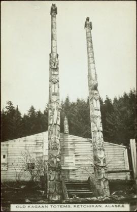
Two carved poles stand in front of a wide wooden building. Forest in background.
Printed below image: "OLD KAGAAN TOTEMS, KETCHIKAN, ALASKA".
Map depicts Chilkoot Inlet, Port Chilkoot, Taiya Inlet, Skagway, Tagish Lake, Golden Gate, and Graham Lake.
Alpine Club of Canada's 1967 Yukon Alpine Centennial Expedition, Kluane National Park, Yukon
Partially visible handwritten annotation on verso reads: "Mrs. O.M. Helgerson, Prince Rupert, BC"
Alpine Club of Canada's 1967 Yukon Alpine Centennial Expedition, Kluane National Park, Yukon
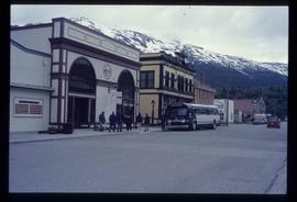
Image depicts the bus depot in Skagway, Alaska (USA).
A plan produced by Central Planning and Management Consulting LTD.
Original plan for basement floor.
Item is a Canadian Pacific Railway "CP Rail" pamphlet for ferry services in British Columbia for the following locations: Vancouver, Nanaimo, Seattle, Victoria, and Port Angeles. Also advertises an "Alaska cruise" on the Princess Patricia from Vancouver to Skagway, with stops at Prince Rupert, Ketchikan, Wrangell, Juneau, and Bartlett Cove.
A second floor plan of a building produced by Central Planning and Management Consulting LTD.
A second floor plan of a building produced by Central Planning and Management Consulting LTD.
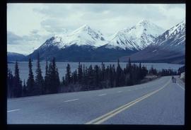
Image depicts the road to Skagway, Alaska. Possibly located on the Klondike Highway in British Columbia with Tutshi Lake on the left.
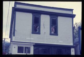
Image depicts a pair of mannequins in the second story windows of a building, possibly located in Skagway, Alaska.
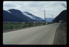
Image depicts the road leading to Hyder, which is on the other side of the Alaska-British Columbia border and is just a little south-west of Stewart, B.C.
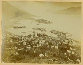
Town in a harbour - Alaska (?)
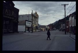
Image depicts one of the main streets, Broadway, in Skagway, Alaska.
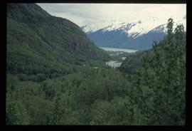
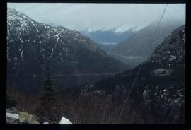
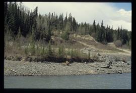
Image depicts a view over a forested, mountainous area and a river somewhere in the area of Skagway, Alaska.
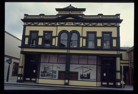
Image depicts the old railroad building in Skagway, Alaska.
Image depicts a view over a forested, mountainous area and a river towards the vicinity of Skagway, Alaska.
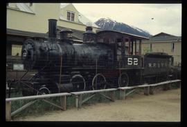
Image depicts the original steam engine for the White Pass Train, located in Skagway, Alaska.
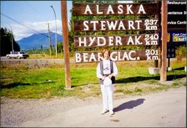
Woman stands in front of sign that reads "ALASKA / STEWART 237 km / HYDER AK. 240 km / BEAR GLAC. 201 km". Second sign in background indicates restaurant, convenience store, and service centre. Car, road, and highway can be seen in midground; mountains in background. (This woman is also featured in item 2008.3.1.22.13).
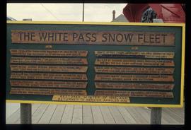
Image depicts a sign, labelled "The White Pass Snow Fleet," which details the history of the fleet; it is located in Skagway, Alaska.
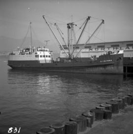
Photograph depicts a ship named "Alaska Prince" at the Northland Pier in Vancouver Harbour.
Alpine Club of Canada's 1967 Yukon Alpine Centennial Expedition, Kluane National Park, Yukon
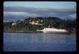
Image depicts the ferry to Alaska in the port of Prince Rupert, B.C.
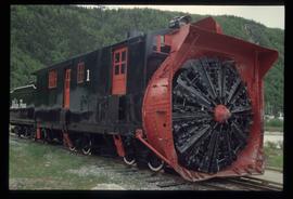
Image depicts the restored White Pass Snow Plow No.1 in Skagway, Alaska.
Image depicts a small section of the Alaska Highway somewhere near Whitehorse, Y.T. The slide also appears to be labelled "army washing" for unknown reasons.
Publication is entitled "The Alaska Panhandle Boundary Dispute" by Hugh Finsten of the Research Branch, Library of Parliament.
Shop front in Skagway Alaska, Alpine Club of Canada's 1967 Yukon Alpine Centennial Expedition, Kluane National Park, Yukon
Alpine Club of Canada's 1967 Yukon Alpine Centennial Expedition, Kluane National Park, Yukon
? Colorful map of mostly Yukon, BC, AB, and parts of Alaska, Northwest Territories and southern part of the United States.
? Legend, Mileage Tables and notes are printed on a white sheet that is then glued onto the map
? Legend includes: 1) Main Routes shown, 2) Roads Fully or Partially Constructed in B.C. and Yukon, 3) Roads Elsewhere, 4) Airports.
B.C.-Yukon-Alaska Highway Commission – Map showing Highway Routes to Accompany Preliminary Report on Proposed Highway to Alaska
? January 1940
? Legend includes: 1) Existing Main Highways, 2) Roads in Northern Area, 3) Routes Under Construction.
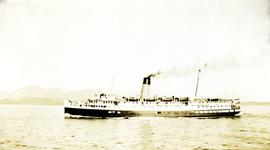
Photograph depicts a passenger steamship on open water, mountains in the background. Handwritten annotation below photograph reads, "S.S. Alameda".
Item is a printed seasonal greeting card. Includes a printed image of an Alaskan Highway view from Dawson Creek and an outline map of the Alaska Highway. Printed card inscription states "Major and Mrs. C.C. Clitheroe Rae Pauline and David Charles Send Greeting and Best Wishes for Christmas 1944 and the New Year 1945".
Alaska/Canada border
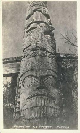
Photograph depicts an Indigenous totem pole. Annotation on recto of photograph states: "Totems of Old Kasaan Alaska"
? With suggested highway routes to Alaska.
? Legend includes: 1) Main Highways Constructed, and In Use, 2) Suggested highway to Alaska, 3) Connections.
Map depicts various gas projects across North America including: the "El Paso Project" along American and Mexican boarder; the "Arctic Gas Project" which runs from the Beaufort Sea through Alberta towards San Francisco and Chicago; the "Alcan Project" which runs through Alaska, British Columbia, Alberta and onwards to San Francisco and Chicago; the "Maple Leaf Project" which runs from the Beaufort Sea into Alberta; and the "Polar Gas Project" which runs from the Parry Islands and circles the Hudson Bay towards Quebec.
The map is part of an advertising pamphlet that depicts the Yellowhead Highway 16. The map highlights towns and tourist attractions along Highway 16 like Hazelton, Kitimat, Vanderhoof, Fraser Lake, Burns Lake, Fort St. James, Prince George, Terrace, and Smithers.
? Blueprint Plan
? Alaska proposed pipeline, oil route noted as “confidential”
? Legend includes: 1) Railroads: i) Existing, ii) Possible Connections; 2) Roads (Including truck, sled): i) Existing, ii) Possible Future; 3) Navigable Waterways, 4) Airways, 5) Proposed Pipe Line, Oil.
? File no. N-186-10
Completed Map Suggested Highway Routes to Alaska with Legend.
? Map Showing Suggested Highway Routes to Alaska “to accompany report of the Inter-departmental Committee on the British Columbia, Yukon, Alaska Highway.”
? Legend includes: 1) Proposed Main Routes, 2) Possible Alternative Routes, 3) Possible Connections or Branch Roads, 4) Roads Fully or Partially Constructed in Province and Yukon, 5) Roads Elsewhere.
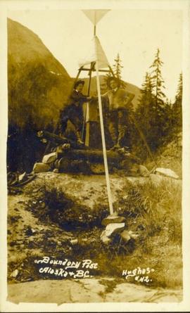
Photograph of two men posing next to a four-legged post erected in the wilderness. Printed annotation on recto reads: "Boundery[sic] Post Alaska & BC. Hughes #42."
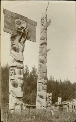
Two carved poles stand in foreground, a third smaller pole visible by wood structure in background.
Handwritten annotation on verso reads: "For heading of Page 12. Fin Back Whale Crest. [?] Totems, S.E. Alaska".
Map depicts all current rail lines in Western Canada and Alaska and major railway stations. Includes insets for Alaska & Yukon, Edmonton area, Winnipeg area, and the Vancouver area.
Accompanied by a 1942 job estimate cost summary sheet for the "Survey railway location west of Fairbanks" work to be done for the Alaska Western Railway project approved by a Colonel of the U.S. Army Corps of Engineers.
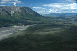
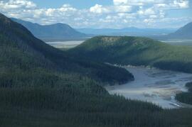
This image is part of the return trip sequence of aerial images obtained on the helicopter flight leaving the Klutlan Glacier study site. On the return leg at the end of the day, the flight initially went upvalley to pick up another party. This image was taken after the helicopter turned north to return to base camp.
This image is part of the return trip sequence of aerial images obtained on the helicopter flight leaving the Klutlan Glacier study site. On the return leg at the end of the day, the flight initially went upvalley to pick up another party. This image was taken after the helicopter turned north to return to base camp.
