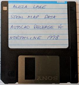
Mostrar 507 resultados

Archival description
507 resultados com objetos digitais Mostrar resultados com objetos digitais
Aleza Lake Stem Map Data
2007.1.45.04.1 · Item · 1998
Parte de Aleza Lake Research Forest fonds

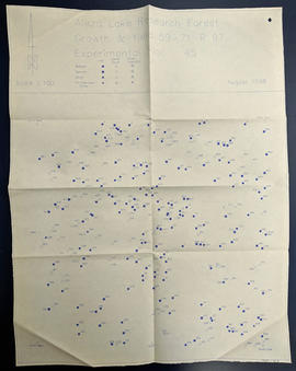
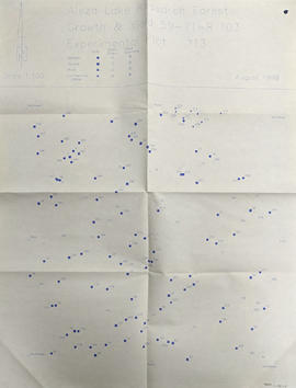
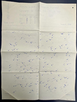
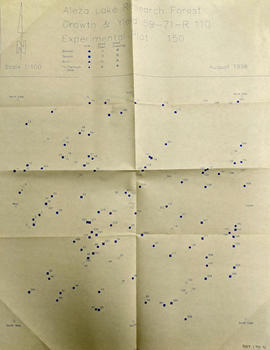
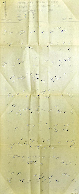
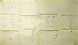
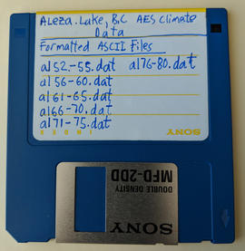
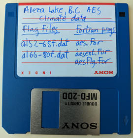
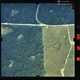
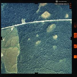
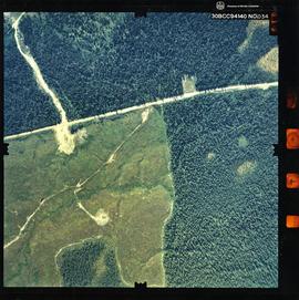
Item is a 3.5" floppy labelled "Aleza Lake Stem Map Data – AutoCAD Release 14 – Northline 1998". Floppy contains the following file: mofcopy.dwg.

2007.1.80.1.15 · Item · Sept. 1998
Parte de Aleza Lake Research Forest fonds

Map commissioned from Ministry of Forests Prince George Region from Madrone Consultants shows Aleza Lake Research Forest Management Compartments and Administrative Boundaries. Map is 1 of 6. Map shows the Aleza Lake Ecological Reserve, Natural Forest Reserve, the Special Management Area, and Riparian Management Research Area.

Aleza Lake Research Forest - Terrain Theme Map
2007.1.80.1.20 · Item · Sept. 1998
Parte de Aleza Lake Research Forest fonds

Map commissioned from Ministry of Forests Prince George Region from Madrone Consultants shows Aleza Lake Research Forest terrain themes. Map is 6 of 6. Map shows the following types of terrain units: typic, slope, percipitous, gullied, hummocky, rocky, alluvial, and organic. Ecosystem classification and mapping by Oikos Ecological Services Ltd.

Aleza Lake Research Forest - TRIM Base Map
2007.1.80.1.18 · Item · Sept. 1998
Parte de Aleza Lake Research Forest fonds

Map commissioned from Ministry of Forests Prince George Region from Madrone Consultants shows an Aleza Lake Research Forest TRIM Base Map. Map is 4 of 6. Map shows the following: roads, old roads, buildings, rail line, transmission line, definite streams, intermittent streams, indefinite streams, marshes, swamps, lakes, wooded area boundaries, intermediate contour lines (20m intervals), and index contour lines (100m intervals).

Aleza Lake Research Forest - Access and Access Management
2007.1.80.1.17 · Item · Sept. 1998
Parte de Aleza Lake Research Forest fonds

Map commissioned from Ministry of Forests Prince George Region from Madrone Consultants shows Aleza Lake Research Forest Access and Access Management. Map is 3 of 6. Map shows the following road types: all weather 1-lane gravel road, dry weather road, and proposed road access. Also shows areas for parking/turnaround, toilets, and information signs.

Aleza Lake Research Forest - Ecosystem Theme Map
2007.1.80.1.19 · Item · Sept. 1998
Parte de Aleza Lake Research Forest fonds

Map commissioned from Ministry of Forests Prince George Region from Madrone Consultants shows Aleza Lake Research Forest ecosystems. Map is 5 of 6. Map shows many sub-types of the following ecosystem types: upland, lowland wet forest, wetlands, and the Bowron floodplain benches. Ecosystem classification and mapping by Oikos Ecological Services Ltd.

2007.1.60.03.3 · Item · 1993-1996
Parte de Aleza Lake Research Forest fonds

Item is a 3.5 in. floppy containing Excel 4.0 files for the Aleza Lake polygon attributes by photo number. Files include: ALEZAENV.DAT, ALEZAENV.DOC, ALEZAPRO.DOC, ALEZASS.SRT, ALEZAVEG.DAT, ALEZAVEG.DOC, EDATOPE.CDR, FIELDF.XLS, POLY059.XLS, POLY061.XLS, POLY063.XLS, POLY101.XLS, POLY103.XLS, POLY105.XLS, POLY107.XLS, POLY127.XLS, POLY140.XLS, POLY142.XLS, POLY144.XLS, POLY146.XLS, POLY148.XLS, PROFILE.CDR.

2007.1.80.1.11 · Item · [after March 1992]
Parte de Aleza Lake Research Forest fonds

Map reflects forest type boundary line, bogs and swampy non-forested areas, creeks, lakes, rivers, tree species labels of spruce, balsam, and birch, stand descriptions, historical timber sale boundaries, stand history symbol, gravelled secondary roads, unimproved old roads, management compartment boundary, research forest boundary, ecological reserve boundary, and old growth emphasis areas.

2007.1.80.1.10 · Item · [after March 1992]
Parte de Aleza Lake Research Forest fonds

Map reflects forest type boundary line, bogs and swampy non-forested areas, creeks, lakes, rivers, tree species labels of spruce, balsam, and birch, stand descriptions, historical timber sale boundaries, stand history symbol, gravelled secondary roads, unimproved old roads, management compartment boundary, research forest boundary, ecological reserve boundary, and old growth emphasis areas.