Affichage de 2133 résultats

Archival description
1985 résultats avec objets numériques Afficher les résultats avec des objets numériques
Interior rainforest
2012.13.2.11.13 · Dossier · 2008
Fait partie de J. Kent Sedgwick fonds

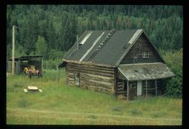
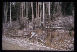
File consists of notes, clippings, and reproductions relating to the central interior rainforest and the Ancient Forest/Chun T'oh Whudujut Provincial Park and Protected Area.

Dunlevy Creek?
2012.13.1.50.138 · Pièce · 2006
Fait partie de J. Kent Sedgwick fonds

Image depicts the Dunlevy Creek area somewhere near Dawson Creek, B.C. The slide is simply labelled "Dunlevy irrigation" for uncertain reasons.

Shed
2012.13.1.6.273 · Pièce · [2006?]
Fait partie de J. Kent Sedgwick fonds

Image depicts a shed in an unknown location.

Soda Creek
2012.13.1.50.139 · Pièce · 2006
Fait partie de J. Kent Sedgwick fonds

Image depicts rail road tracks through a forest, as well as a river; located in Soda Creek, B.C.

Old Cabins
2012.13.1.6.271 · Pièce · [2006?]
Fait partie de J. Kent Sedgwick fonds

Image depicts several old log cabins, possibly at McLeod Lake.

Dunlevy Creek?
2012.13.1.50.137 · Pièce · 2006
Fait partie de J. Kent Sedgwick fonds

Image depicts the Dunlevy Creek area somewhere near Dawson Creek, B.C. The slide is simply labelled "Dunlevy irrigation" for uncertain reasons.

Hansard Bridge
2012.13.1.89.182 · Pièce · 2004
Fait partie de J. Kent Sedgwick fonds

Image depicts the new Hansard Bridge. Map coordinates 54°04'57.9"N 121°51'10.1"W

Hansard Bridge
2012.13.1.89.183 · Pièce · 2004
Fait partie de J. Kent Sedgwick fonds

Image depicts the new Hansard Bridge. Map coordinates 54°04'57.9"N 121°51'10.1"W

Origin of Yellowhead Highway
2012.13.1.85.49 · Pièce · Oct. 2004
Fait partie de J. Kent Sedgwick fonds

Image depicts an old road through the trees near Yellowhead Pass. The slide labels it as the origin of the Yellowhead highway.

Mellos House
2012.13.1.88.51 · Pièce · 2004
Fait partie de J. Kent Sedgwick fonds

Image depicts a house with torn-up siding. The slide is labelled: "Mellos house relocated from Penny." The location is uncertain.

A Ferry?
2012.13.1.89.180 · Pièce · 2004
Fait partie de J. Kent Sedgwick fonds

Image depicts what appears to be a ferry crossing a river at an uncertain location.

Two People and a Mobile Home
2012.13.1.89.181 · Pièce · 2004
Fait partie de J. Kent Sedgwick fonds

Image depicts two unidentified individuals speaking to each other in the doorway of what appears to be a mobile home. The location is uncertain.

Hansard Rail Bridge
2012.13.1.89.184 · Pièce · 2004
Fait partie de J. Kent Sedgwick fonds

Image depicts the Hansard railroad bridge taken from the new Hansard vehicle bridge. Map coordinates 54°04'58.1"N 121°50'58.0"W

Dairies in Prince George
2012.13.2.07.03 · Dossier · 2004-2006
Fait partie de J. Kent Sedgwick fonds

File consists of notes, clippings, and reproductions relating to dairying and dairy farming in Prince George. Includes material on Harry Moffat; cattle in Mud River; Mr. Hewlett and Centralia Dairy (established in 1923); Interior Creamery, located at the corner of Brunswick and First Avenue; and pasteurization.

Volkssport trail, Prince George
2012.13.2.14.19 · Dossier · 2004-2006
Fait partie de J. Kent Sedgwick fonds

File consists of notes, clippings, and reproductions relating to the Volksport trail in Prince George. The trail starts at the Prince George Railway and Forestry Museum and follows the Heritage River Trail through parks along the Fraser and Nechako Rivers with some residential walking. Includes: "Prince George Railway & Forestry Museum 11 km trail for Volkssporting members" typed document (2004) and "Presentation for Railway and Forestry Museum Directors Meeting" typed document by Audrey L'Heureux (Jan. 2004).

Upper Fraser research project
2012.13.2.17.03.1 · Pièce · 01-July-2003
Fait partie de J. Kent Sedgwick fonds

The item is a CD-R containing Kent Sedgewick's files regarding the Upper Fraser Valley history. Files include literature summaries, oral history transcripts and various other documents referring to the Upper Fraser Valley. Annotations on CD-R state, "Jun 7 '04 Kent - UF files to start."

Discovery Passage
2012.13.1.048 · Sous-série organique · 2003
Fait partie de J. Kent Sedgwick fonds

File contains slides depicting areas around the Discovery Passage.

Grade?
2012.13.1.41.05 · Pièce · 2002
Fait partie de J. Kent Sedgwick fonds

Image depicts a clearing through the woods, possibly an abandoned grade for the BCR. It is possibly located on Iron Road South, near Woodpecker B.C.

Iron Road North
2012.13.1.41.08 · Pièce · 2002
Fait partie de J. Kent Sedgwick fonds

Image depicts Iron Road North, and a creek surrounded by trees. Located north of Woodpecker, B.C.

Forest
2012.13.1.41.15 · Pièce · 2002
Fait partie de J. Kent Sedgwick fonds

Image depicts a forest, possibly somewhere near Woodpecker, B.C.

View South - Trees
2012.13.1.41.23 · Pièce · 2002
Fait partie de J. Kent Sedgwick fonds

Image depicts a view south, possibly of an abandoned grade for the BCR; possibly somewhere near Woodpecker, B.C.

Mud River
2012.13.1.049 · Sous-série organique · 2002
Fait partie de J. Kent Sedgwick fonds

File contains slides depicting Mud River.

Creek
2012.13.1.41.10 · Pièce · 2002
Fait partie de J. Kent Sedgwick fonds

Image depicts a creek near Iron Road North, north of Woodpecker, B.C.

Dogs in a Forest
2012.13.1.41.14 · Pièce · 2002
Fait partie de J. Kent Sedgwick fonds

Image depicts a pair of dogs in a forest, possibly somewhere near Woodpecker, B.C.

Forest
2012.13.1.41.18 · Pièce · 2002
Fait partie de J. Kent Sedgwick fonds

Image depicts a forest, possibly somewhere near Woodpecker, B.C.

Creek
2012.13.1.41.09 · Pièce · 2002
Fait partie de J. Kent Sedgwick fonds

Image depicts a creek near Iron Road North, north of Woodpecker, B.C.

Dogs in a Forest
2012.13.1.41.16 · Pièce · 2002
Fait partie de J. Kent Sedgwick fonds

Image depicts a pair of dogs in a forest, possibly somewhere near Woodpecker, B.C.